Intermountain Region
| Recreational Business Opportunities | |
| FOIA | |
| Partnerships | |
| Wilderness Areas | |
|
|
| Employee Search | |
| Campsite Reservations | |
| Public Lands Info | |
| National Fire Center | |
| Rocky Mountain Research Station |
US Forest Service (801) 625-5306 |
|
|
|


About Us
![[Photograph]: Man and Woman looking at seeds in mans hand.](https://webarchive.library.unt.edu/eot2008/20080920093519im_/http://www.fs.fed.us/global-websites/images/stock/i_pic11.jpg) The Intermountain Region of the Forest Service encompasses nearly 34-million acres of National Forest System land. The region consists of 13 National Forests and one National Grassland, administered by Forest Supervisors in Utah, Nevada, southern Idaho and western Wyoming.
The Intermountain Region of the Forest Service encompasses nearly 34-million acres of National Forest System land. The region consists of 13 National Forests and one National Grassland, administered by Forest Supervisors in Utah, Nevada, southern Idaho and western Wyoming.
Four major geographic provinces come together to form the Intermountain West. They include the Great Basin, Colorado Plateau, Middle Rocky Mountains and the Northern Rocky Mountains. These provinces are the reason for the tremendous diversity of landscapes and ecosystems within the Intermountain Region.
Find out more and "Meet the Forest Service."
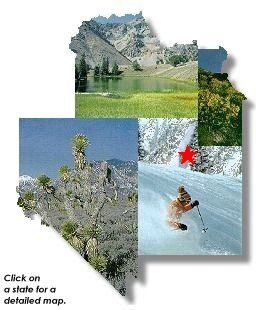
Where is the Intermountain Region?The Intermountain Region covers Utah, western Wyoming, southern Idaho, Nevada and a small portion of California.
|
Organizational Overview The Intermountain Region covers 13 National Forests
and one National Grassland within Utah, eastern Wyoming,
southern Idaho, Nevada, and a small portion of California. History The first forest reserves were created in 1891 and by 1905 they were placed under the Department of Agriculture and renamed the US Forest Service. Three years later in 1908, the Forest Service was divided into 6 administrative and geographic regions. |
US Forest Service - Intermountain Region
Last Modified: Monday, 10 March 2008 at 16:30:40 EDT