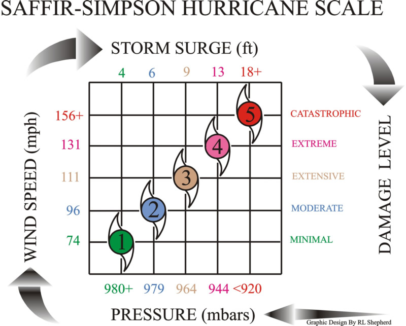
| Saffir-Simpson Scale
|
| Cat. |
Pressure
(mb) |
Winds
(mph) |
Surge
(ft) |
| TD |
-- |
< 39 |
-- |
| TS |
-- |
39-73 |
-- |
| 1 |
> 980 |
74-95 |
4-5 |
| 2 |
965-980 |
96-110 |
6-8 |
| 3 |
945-965 |
111-130 |
9-12 |
| 4 |
920-945 |
131-155 |
13-18 |
| 5 |
< 920 |
> 155 |
>18 |
|
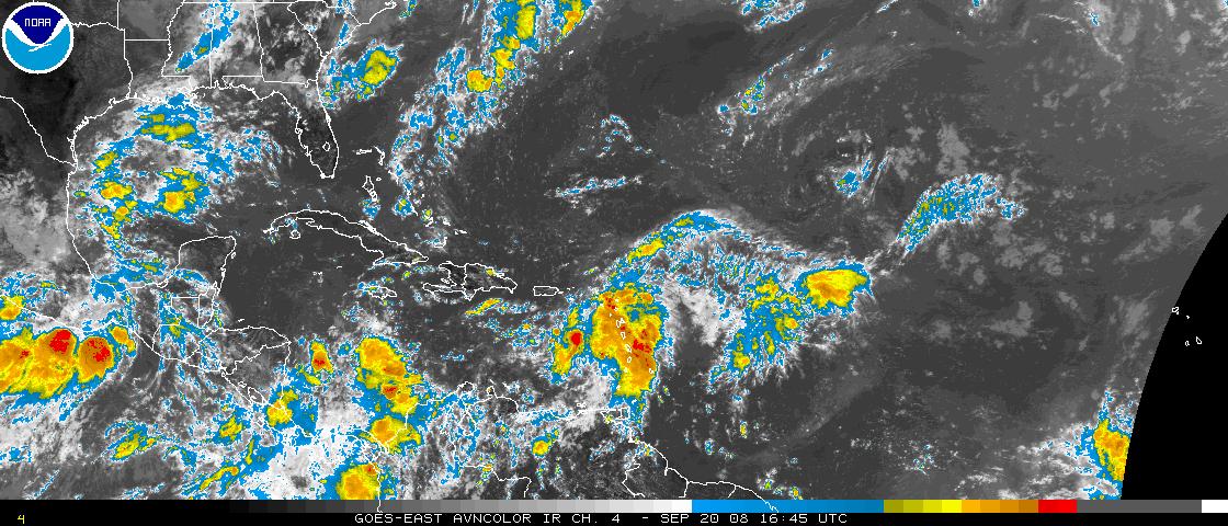
This is a GOES or
METEOSAT infrared satellite picture of a portion of the tropical
Atlantic basin. If tropical systems develop, we will display a sector
that focuses on the storm in either the Gulf of Mexico, the Caribbean
Sea and western Atlantic, the northwestern Atlantic, or the eastern
Atlantic.
Click on the image for a larger view. |

 National Weather Service Forecast Office