 |
| Storm Reports |
| Are you interested in what happened during a recent event? Check out the
report below. |
|
|
 |
Severe Weather/Heavy Rain on May 2, 2008 (Pg1) |
 |
| |
|
Severe thunderstorms developed in the Plains during the
evening of May 1st. Storms continued into the early morning hours of the
2nd, and shifted into Arkansas as dawn approached. |
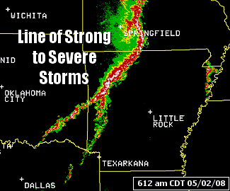
| In the
picture: The WSR-88D (Doppler Weather Radar) showed a line of strong to
severe thunderstorms building across northern and western Arkansas at
612 am CDT on 05/02/2008. |
| A line of strong to severe storms pushed into northern
and western sections of the state, with trees down at Harrison (Boone
County), Jasper (Newton County) and near Summit (Marion County). |
| Ahead of the line, scattered supercells (storms with
rotating updrafts) popped up, with tornadoes spawned. |
|
| In the
picture: The WSR-88D (Doppler Weather Radar) indicated strong rotation,
with a tornado spawned in portions of Conway and Van Buren Counties
during the morning of 05/02/2008. |
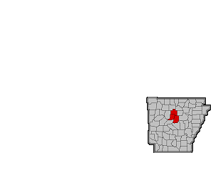
| One tornado affected areas from around Birdtown
(Conway County) to Damascus (Van Buren County) and Greers Ferry
(Cleburne County). The tornado caused extensive structural damage, with
Highway 65 closed for a time due to debris in the
road. |

|
Another tornado affected areas south of
Wrightsville near Hensley and Woodson (all in Pulaski County), with damage to
houses and numerous trees downed. |
| In the
picture: The WSR-88D (Doppler Weather Radar) showed a hook echo, with
another tornado in southern Pulaski County during the morning of
05/02/2008. |
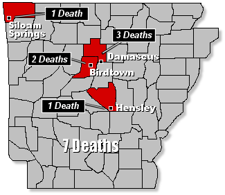
| Together, the tornadoes claimed the lives of six people. A
seventh death was reported in the Siloam Springs (Benton County) area
due to storms that moved through during the predawn hours. |
|
| In the
picture: Storms claimed the lives of at least seven people in Arkansas on
05/02/2008. |
| Other tornadoes were spawned at Carlisle (Lonoke
County) and south of Sheridan (Grant County) near the Cross Roads
community. At Carlisle (Lonoke County), trucks were overturned...with
Interstate 40 shut down temporarily. |
|
| There is more concerning severe weather and heavy rain on
May 2nd. To check out the rest of the story, click
here. |
|
|