Campgrounds
View a map of the Forest with the
location of each campground designated by a number.
The key to the maps has
information in tabular format about each campground: location,
elevation, number and kinds of sites, miles to services, etc. Refer to our campgrounds-status
list for information about whether they are open or closed,
cost, and available services. Campground Reservations Two of our campgrounds have campsites reservable for families:
McPhee
and House Creek
Campgrounds, both on the Dolores Ranger District. Four campgrounds offer reservable group sites: the Florida
Campground Group Area and Chris
Park Group Campground
(on the Columbine RD) and the McPhee
Campground Group Area, and House
Creek Campground Group Area, on the Dolores RD. To reserve sites at these locations, call ReserveAmerica
toll free at (877) 444-6777; TDD, (877) 833-6777; fax (518)
884-7424; or go to www.reserveamerica.com. This popular area in the Weminuche Wilderness contains three
"14'ers" but has restrictions on camping and campfires.
Seventeen miles west of Pagosa Springs, this ancient pueblo
is open May 15—September 30, with four guided tours
daily. Motor vehicle access with tours only.
For $3 for one year or $12 for five years, this card covers
costs incurred by search-and-rescue teams helping those caught
in emergency situations in the backcountry. It is available
from us by mail order at (970) 247-4874 and from stores throughout
Colorado.
A current Colorado hunting or fishing license, or boat, snowmobile,
or ATV registration, covers the same costs.
The Recreation Facilities Analysis Proposed Plan of Work for the San Juan National Forest is now available.
Weed-Free Forage
Useful information whether or not you visit this particular area |
Don't
Invite a Bear to Dinner: Bear Safety Regulations
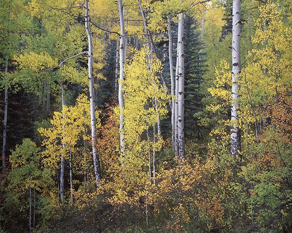
on the San Juan NF [PDF file, 2 pages, 32 KB] Fall Colors
The Fall color report for the San Juan National Forest will be posted here weekly.
Rocky Mountain Region Fall Color Report
Hunting Three documents that hunters will find useful:
- General Hunting Information
2008[PDF, 10 pages, 286 KB]: location and dates staffed
of local hunting-information booth, deer/elk season dates,
game-processing businesses, hunter safety classes, horse
use, weed-free-hay sources and new regulations, Leave No
Trace tips, and more.
- Hunting Public Land
2008 [PDF, 2 pages, 186 KB]: camping, fires
and wood, sanitation, outfitter-guides, Colorado Hiking
Certificate, OHV use, firearms regulations, maps, important
phone numbers, etc.
- The Ins and Outs of ATV Use
on the San Juan Public Lands, or How to Read the San
Juan National Forest Visitor Map. And how to operate your
ATV legally.
Jersey Jim
Fire Lookout Tower Rental
The Jersey Jim Lookout Tower [PDF, 6 pages, 830 KB] can be rented for one- or two-night stays from late May to mid October, weather permitting. The current rental rate is $40 per night. Rental fees are used to maintain the facility. Additional contributions are welcomed. Reservations can be made by calling (970) 533-7060 between 1 – 5 p.m. Mountain Standard Time, starting the first business day of each March (callers are advised to be aggressive in their dialing - the entire season is often booked in a couple of days that week).
1938 Lookout cookbook [PDF, 49 pages, 84 KB]
We have several kinds of maps with information on attractions,
facilities, services, trails, etc. Our brochures cover local
recreation, wildlife, fire safety, and other information.
Call (970) 247-4874 for details.
CDOW Habitat Stamp
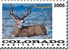
The Colorado Division of Wildlife requires individuals to possess a habitat stamp to use Colorado State Wildlife Areas. Some of these areas share property boundaries with the San Juan National Forest. Areas affected are: Perins Peak, Williams Creek Reservoir, Joe Moore Reservoir, Haviland Lake, and Andrews Lake. For more information go to the CDOW website (You will be leaving the San Juan NF website.) |
![[design image slice] U.S. Department of Agriculture Forest Service on faded trees in medium light green background](https://webarchive.library.unt.edu/eot2008/20081010121611im_/http://www.fs.fed.us/r2/sanjuan/local-resources/images/rmt-trees-left-usfs.gif)