A catalog of NASA images and animations of our home planet
Skip Navigation (key s)
.
Home
Terms of Use
Frequently Asked Questions
Browse By:
Satellite
Sensor
Collections
Country
U.S. State
GCMD Topic
All Categories
»
GCMD Topics
»
Land Surface
»
Topography
»
Terrain Elevation
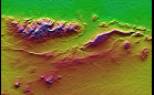
Radar Image with Color as Height: …
Perspective View with Radar Image …
Perspective View with Radar Image …
Mount St. Helens Flyover
SRTM Perspective View with Landsat …
SRTM Perspective View with Landsat …
SRTM Stereo Pair: Bhuj, India, Two …
Hardangerfjord, Norway
Topography: Haro and Kas Hills, …
Cucharas Canyon & Spanish …
Elevation Data of Las Bayas, …
Piñon Canyon Region, Colorado
Sort By: Data Date
↑
↓
Visualization Date
↑
↓
ID
↑
↓
« ‹ 1 › »
Subcategories