
|
Oregon and Hanford
|
|||
The Hanford Site is located in a large tract of arid land (approximately 586 square
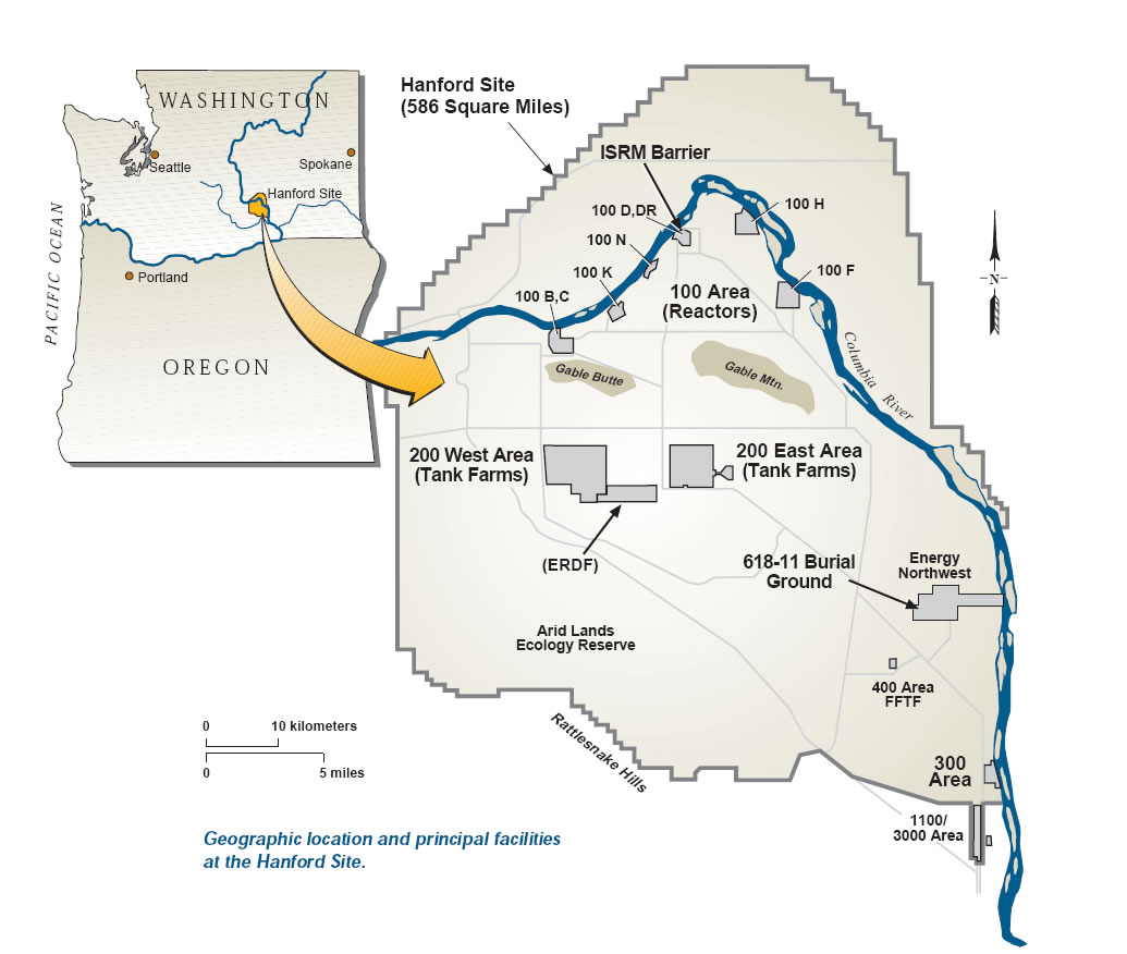
miles) in southeastern Washington. The Columbia River flows through the site, and eventually to the Pacific Ocean. The principal features and facilities of the Hanford Site are shown in the figure to the left. The arid climate and isolated character of the region made it a particularly attractive site for World War II plutonium production activities, which subsequently continued throughout the Cold War. These activities left a legacy of large volumes of wastes, including toxic chemicals and radioactive substances. Some of these wastes were intentionally (or otherwise)introduced to the vadose zone (the soil above the groundwater), the groundwater, and the Columbia River. The Hanford Site is now committed to an ambitious environmental cleanup mission. |
|||
|
Nuclear Safety & Energy Facility Siting
|
|
What's New
|
|