A catalog of NASA images and animations of our home planet
Skip Navigation (key s)
.
Home
Terms of Use
Frequently Asked Questions
Browse By:
Satellite
Sensor
Collections
Country
U.S. State
GCMD Topic
All Categories
»
GCMD Topics
»
Land Surface
»
Topography
»
Surface Roughness
Color Image of Death Valley, …
Space Radar Image of Altona, …
Space Radar Image of Mt. Etna, Italy
Space Radar Image of Central Java, …
Space Radar Image of Craters of …
Space radar image of Mauna Loa, …
Space Radar Image of Raco, Michigan
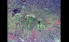
SRTM Radar - Landsat Image …
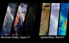
Hurricane Debby and the …
Landsat 7: Tagish Lake, Canada
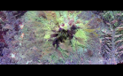
AIRSAR: Upolu Island, Western Samoa
AIRSAR: Upolu Island, Western Samoa
Sort By: Data Date
↑
↓
Visualization Date
↑
↓
ID
↑
↓
« ‹ 1 › »
Subcategories