

Mt. Pleasant, Mississippi
Power Supply Upgrade
Update: September 2006
TVA has evaluated a network of seven alternative line segments for the transmission line to serve the new Coldwater Substation using the same environmental, land-use, engineering, and cost considerations for each alternative. The reviews were based on available data, aerial photography, limited onsite reviews, public review and comment, and property owners’ input.
Based on these evaluations, TVA’s preferred route is an alternative that uses existing right-of-way for the majority of the route. The preferred Route 1 consists of segments 7, 5, 4, 2, and 1 (see maps). This route is about 5.5 miles long and is expected to have the least overall project impact of the alternatives.
Holly Springs Utility Department’s Coldwater Substation site is located east of Highway 311 about 1.5 miles south of Highway 72. The line will extend from new switches in TVA’s existing Holly Springs-Miller transmission line, which is located west of the substation site.
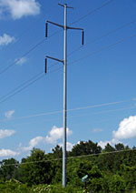
The line will be on steel poles on a 75-foot right-of-way. This is narrower than originally planned, and will reduce the impact of the project on property in the area. A short section of right-of-way near the substation will require a 100-foot right-of-way.
TVA is in the process of contacting property owners along the preferred transmission line route.
Background
In order to maintain reliability while meeting the growing power demand in the Mt. Pleasant area, TVA and Holly Springs Utilities Department have proposed to build new power system facilities.
The area is currently served from Holly Springs Utility Department’s Slayden 46-kV Substation, supplied by a 15-mile line from TVA’s Holly Springs 161-kV Substation. According to growth projections, the electrical load in the area will exceed the Slayden Substation’s ability to reliably serve the area during the summer of 2008.
Therefore, to provide a continued electrical supply for the growing suburban area of Mt. Pleasant, Holly Springs UD is planning a new 161-kV Coldwater Substation. It will be located east of Hwy. 311, approximately 1.5 miles south of the intersection with U.S. Hwy. 72.
TVA will supply the new substation through a new transmission line tapped from its existing Holly Springs-Miller 161-kV line. This line is the closest suitable power source to supply the new substation. Three alternative tap locations and a network of seven alternative route segments have been identified. Alternative routes being studied for the new line to serve the substation vary in length from about 4.5 to 5.6 miles long.
 The new line would be built using steel pole structures on a 100-foot right-of-way. A distribution circuit will share the transmission line easement from Highway 311 to Taska Road, approximately 1.1 miles. The project is scheduled to be in service in June 2008.
Two possible tap points are about five miles west southwest of the substation site. About two-thirds of the routes from these tap points could use the existing 75-foot distribution right-of-way. But it would have to be expanded to a 100-foot right-of-way, and the existing distribution line would have to be rebuilt below TVA’s transmission lines.
The third tap point is about four miles south of the substation site. This route would use about one-half mile of the existing right-of-way. It runs through a more populated area.
By continuing to provide affordable, reliable power, TVA and Holly Springs UD will help ensure the continued economic health of the area as well as residential and commercial growth.
Public involvement
TVA’s process for siting new transmission projects is designed to afford public input at all stages. TVA is committed to working with area stakeholders to address concerns during the course of the project.
TVA held an open house on the proposed transmission line project on July 27, 2006. A 30-day comment period followed.
Map
The map is a PDF file requiring Adobe Acrobat Reader. Use the zoom tool to view details of the section maps and allow time for them to reload. If you have questions or need help understanding the map, please contact TVA.
Alternative Routes Map (PDF, 409 kb)
Area under consideration and the alternative routes TVA is considering for the proposed transmission linePreferred Route Map (PDF, 404 kb)
Preferred route for the proposed transmission line.
Environmental Reviews
TVA attempts to minimize any land requirements, private property impacts, and environmental impacts associated with transmission line projects. It has conducted a National Environmental Policy Act review of the Mt. Pleasant project to assess the impacts. Read the environmental assessment.
Project schedule
Open house: July 27, 2006
Comments accepted: Through August 31, 2006
Determine preferred route for field surveys: Fall 2006
Begin contacting property owners for permission to survey: Fall 2006
Begin field surveys and environmental reviews: Late fall/winter 2006
Complete environmental review: Winter 2007
Begin right-of-way acquisitions: Winter 2007
Line in service: June 2008
Related information
Frequently asked questions about TVA right-of-way
Electric and magnetic fields and their effects
Benefits of planting native shrubs and grasses in utility rights-of-way.
- Landscaping with native shrubs (PDF file, 879 kb)
- Landscaping with native grasses (PDF file, 644 kb)