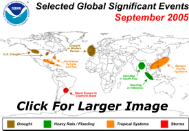
Major Highlights
SEPTEMBER, WARMER AND DRIER THAN AVERAGE ACROSS U.S.,
WARMEST SEPTEMBER GLOBALLY SINCE BEGINNING OF RELIABLE
INSTRUMENTS
The United States experienced its fourth warmest September on record, while global land surface temperatures were the warmest on record for the month, according to scientists at NOAA's National Climatic Data Center in Asheville, N.C. Also, three East Coast states had their driest September on record, while the month was the eleventh driest for the nation overall.
US Temperature:
NOAA reported the average temperature for the United States for September (based on preliminary data) was 2.6°F (1.4°C) above the mean for 1895-2004. This was the fourth warmest September on record, with only the West Coast and parts of the Rockies remaining near average. Louisiana had its warmest September in 111 years of national records and an additional 27 states ranked much above average. Some cities also set new records for warmest average September temperatures including: Houston-Galveston, Texas; London, Ky.; Shreveport, La.; and Raleigh-Durham, N.C. A record daily maximum of 107 degrees was also recorded in San Angelo, Texas, September 25, equaling the old September record set in 1952.
July-September average temperatures were also fourth warmest on record, indicative of an unusually warm late summer and early fall across the country. All 48 contiguous states ranked above average for the last three months, with six states (Florida, New York, New Jersey, Massachusetts, Rhode Island and Vermont) setting new statewide average temperature records for July-September. Overall, the Northeast region had its warmest July-September period in at least 111 years.
Temperatures across Alaska were also above average during July-September, with respective statewide temperatures of 2.3°F (1.3°C) and 2.2°F (1.2°C) above the 1971-2000 mean, ranking 12th for September and second warmest for July-September since 1918.
US Precipitation:
U.S. Precipitation was below average during September, with unusually dry conditions for much of the East Coast and parts of the Plains and Northwest. Georgia, South Carolina and Maryland had their driest September on record. Some selected cities that received record low September precipitation included: Washington, D.C.; Macon, Ga.; Columbia, S.C.; College Station, Texas; and Tampa, Fla. Serious drought continued across the Northwest and parts of the western Plains and Rockies. Areas west of Lake Michigan, namely northern Illinois, were also experiencing severe drought.
At the end of September, moderate-to-extreme drought (as defined by a widely-used measure of drought � the Palmer Drought Index) affected 18 percent of U.S., an increase of almost 6 percent from August 2005. The U.S. wildfire season through September 30 is approximately double the 10-year average acreage burned. More than 8 million acres have burned so far in 2005, approaching the record annual acreage burned, which occurred in 2000.
So far, tropical cyclone activity for the 2005 Atlantic season has been well above average with 20 named storms, 11 of which became hurricanes and five were classified as major. The hurricane season officially ends on November 30. There has been only other season with 20 or more named tropical systems � 1933 (21).
Globe:
The average global temperature anomaly for combined land and ocean surfaces for September (based on preliminary data) was 1.13°F (0.63°C) above the 1880-2004 long-term mean. This was the warmest September since 1880, the beginning of reliable instrumental records. The second warmest September was in 2003 with an anomaly of 1.02°F (0.57°C) above the mean. Land surface temperatures were highest on record for September with temperatures more than 5°F (2.8°C) above normal across large parts of Asia and North America. Ocean temperatures were third highest on record. El Ni�o Southern Oscillation conditions remained neutral in the tropical Pacific Ocean at month's end.
|


 Climate Monitoring / Climate of 2005 / September / Help
 Top of Page