
Bering Sea
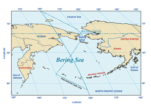
The Bering Sea covers over 2 million square km of the northernmost region of the Pacific Ocean. Its borders are defined to the north by Alaska, the Bering Strait, and northeastern Siberia, and to the south by the arc of the Alaska Peninsula, Aleutian Islands, and Commander Islands. The sea's largest embayments are the Gulf of Anadyr, Norton Sound, and Bristol Bay. The Anadyr River enters the sea from the west and the Yukon River from the east. The warm Japan Current has little influence on the Bering Sea, which has much ice; it can usually be traversed by ship only from June to October. The sea has many islands, notably Nunivak, St. Lawrence, Hall, St. Matthew, and the Pribilof Islands (all owned by the United States) and the Komandorski Islands (Russia).
Area: 884,900 sq. mi. or 2,291,900 sq. km
Average depth: 5,075
ft. or 1,547 m
Greatest known depth: 15,659 ft. or 4,773
m
Place of greatest known depth: Off Buldir Island
The Bering Sea is named after Danish explorer, Vitus Bering.
Bering Sea | Bathymetry | Currents | Habitats | Islands | Seas
More information:
Reference: Infoplease.com