


Welcome to the USGS Nevada Water Science Center!

The U.S. Geological Survey’s (USGS) mission is to provide reliable scientific information about the Nation’s natural resources. An integral part of that mission is to provide consistent, long-term water-resources data to customers, cooperators, and the public. To accomplish our mission, we operate a widespread surface- and ground-water data collection network as well as research a wide range of scientific issues throughout Nevada. more ![]()
Highlights
Amargosa Desert Research Site (ADRS) Annual Spring Field Campaign
Scientists from across the country will be visiting the ADRS for two weeks of data collection at the end of April. The first week, scientists will collect VOC, tritium, O-18, and deuterium data from plants, air, shallow soil, and the deep unsaturated zone as well as soil-moisture and bulk-precipitation data. The second week, scientists will examine large exposure of sediments in a new trench at US Ecology, Inc.; sample naturally occurring perchlorate in plants and soil; service field-monitoring equipment; and measure ground-water levels. more ![]()
Nevada 2007 Water Data Report Now Available
The 2007 USGS Water Data Report is now available online and improves on the previous online reports with a new interactive feature designed to make site data retrieval easier and more convenient. Access the Water Data Report using a text or map interface.
Featured Project
- Upper Humboldt Water Resources

- This study will develop an improved understanding of the water resources within the upper Humboldt River Basin. Specific, long-term objectives are to (1) define the hydrogeologic framework of the area; (2) describe the occurrence and movement of ground water in and between the eight hydrographic areas that comprise the basin; (3) define interactions of ground water and streamflow; (4) refine water budgets; and (5) define surface-water and ground-water quality.
more
New Publications
- DS340
- Update to the Ground-Water Withdrawals Database for the Death Valley Regional Ground-Water Flow System, Nevada and California, 1913–2003
- SIR 2008-5044
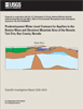
- Predevelopment Water-Level Contours for Aquifers in the Rainier Mesa and Shoshone Mountain area of the Nevada Test Site, Nye County, Nevada
