

Hydrologic Information and Data for Nevada
The USGS data collection network in Nevada began in 1889 when the first streamflow measurements were collected. Since then, the USGS Nevada Water Science Center (NWSC) has assisted customers, cooperators, and the public in understanding and managing Nevada’s water resources by
- maintaining a comprehensive network of streamgaging stations;
- monitoring stage in ponds, lakes, and reservoirs;
- measuring flow on rivers and streams periodically;
- collecting water-quality data for surface- and ground-water sites; and
- making periodic measurements at regionally representative well networks.
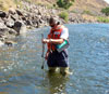
USGS currently operates hundreds of data collection sites in Nevada for acquiring information on surface-water, ground-water, water-quality, and precipitation. Surface-water data are collected from streamgaging stations in all the major river basins in Nevada. Near-real-time data are available for more than 120 stations; periodic and miscellaneous flow measurements are made at numerous sites, including springs. Water-quality data are collected at more than 100 sites, which vary from year to year. Precipitation data also are collected at more than 35 sites. Ground-water data are collected from regionally representative well networks; continuous well measurements are made at more than 15 wells throughout the State. Periodic well measurements are made at more than 800 wells but the number of wells can vary from year to year. Water-quality data are collected at more than 130 wells.
USGS water data are stored and managed in a national database (National Water Information System, NWIS) and are available to the public through the NWIS web site (NWISWeb). Because the data collected by the USGS are critical to managing Nevada’s water resources, much of the data are available on NWISWeb in near real-time or at periodic intervals. Data also are compiled and published annually in the Nevada water-data report (ADR).
Available Data
- Surface Water
-
Stream levels, streamflow (discharge), reservoir and lake levels, surface-water quality, and rainfall.
- Ground Water

-
Site inventory, ground-water level, and water-quality data for wells and springs.
- Water Quality

-
Physical and chemical characteristics of water.


