| site map |  | contact us |
| Education / Outreach |
| . |
| Hazardous Weather |
|
- Watches / Warnings - hazardous wx outlook - report severe weather ! - Nat'l Hazards Assessment - [ MORE... ] |
|
- select products... - current conditions - forecasts - maps - satellite images - NEXRAD radar - rainfall resources - [ MORE... ] |
| Aviation Weather |
|
- TAFs - METARS - [ MORE... ] |
| Climate / Records |
|
- daily & monthly - sunrise / sunset - storm stats - archived info |
| Lakes / Rivers |
| . |
| NOAA Weather Radio |
| . |
| Fire Weather |
| . |
| Tropical Weather |
| . |
| Preparedness Info |
| . |
| Education / Outreach |
| . |
| About Us |
| . |
| FAQs & Misc. |
| . |
| Additional Links |
| . |
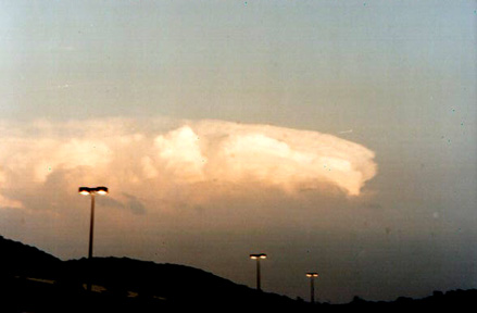
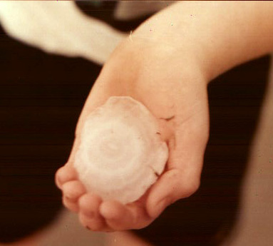
These pictures were taken in southern Whitfield and northern Gordon Counties Ga. This was one of the many super cells that hammered the southeast USA that day. This storm produced tennis ball size hail.
Courtesy NORTH GA STORM CHASERS
 |  |
 |
National Weather Service Forecast Office, Peachtree City, GA
by T. Murphy
 Back to home page