|
|
|
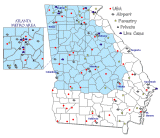
Latest Weather Observations Across Georgia
Get additional weather conditions:
CURRENT |||
PREVIOUS
| Station |
Sky/Wx |
Temp
(°F/°C) |
Dewp
(°F/°C) |
RelH (%) |
Wind (MPH) |
Pressure |
| Albany Prev | Cloudy | 72 / 22 | 61 / 16 | 68 | NE6 | 30.14S |
| Alma* Prev | Fair | 71 / 22 | 63 / 17 | 75 | E7 | 30.12S |
| Athens Prev | Fair | 63 / 17 | 57 / 14 | 81 | NE8 | 30.23R |
| Atlanta Prev | Mostly Cloudy | 68 / 20 | 55 / 13 | 63 | E12G21 | 30.21R |
| Augusta AGS Prev | Fair | 65 / 18 | 57 / 14 | 75 | NE7 | 30.19F |
| Augusta DNL Prev | Fair | 68 / 20 | 57 / 14 | 68 | NE10 | 30.21S |
| Bainbridge* Prev | Fair | 70 / 21 | 55 / 13 | 60 | E7 | 30.10F |
| Brunswick Prev | Cloudy | 77 / 25 | 68 / 20 | 73 | NE13G23 | 30.10F |
| Canton* Prev | Fair | 64 / 18 | 54 / 12 | 68 | E3 | 30.23S |
| Cartersville Prev | Fair | 68 / 20 | 57 / 14 | 68 | E5 | 30.21R |
| Chamblee Prev | Fair | 68 / 20 | 56 / 13 | 65 | E6 | 30.22R |
| Columbus Prev | Fair | 70 / 21 | 56 / 13 | 61 | E10 | 30.14R |
| Dalton* Prev | Fair | 63 / 17 | 59 / 15 | 88 | Calm | 30.21S |
| Fort Stewart Prev | Cloudy | 71 / 22 | 63 / 17 | 74 | NE8 | 30.13S |
| Gainesville Prev | Fair | 63 / 17 | 55 / 13 | 75 | E13 | 30.25F |
| Hunter AFB Prev | Cloudy | 73 / 23 | 62 / 17 | 68 | NE7 | 30.12S |
| La Grange* Prev | Fair | 66 / 19 | 61 / 16 | 82 | Calm | 30.17R |
| Macon Prev | Fair | 69 / 21 | 59 / 15 | 70 | E7 | 30.18R |
| Marietta Prev | Fair | 68 / 20 | 56 / 13 | 67 | VRB5 | 30.22R |
| Milledgeville* Prev | Fair | 70 / 21 | 61 / 16 | 73 | NE6 | 30.19S |
| Moody AFB Prev | Fair | 70 / 21 | 65 / 18 | 85 | NE6 | 30.11S |
| Moultrie* Prev | Cloudy | 72 / 22 | 63 / 17 | 73 | Calm | 30.12S |
| Peachtree City Prev | Fair | 69 / 21 | 56 / 13 | 62 | VRB3 | 30.20S |
| Rome Prev | Fair | 62 / 17 | 55 / 13 | 77 | Calm | 30.20S |
| Saint Simons Prev | Cloudy | 77 / 25 | 67 / 19 | 71 | NE22G29 | 30.09F |
| Savannah Prev | Cloudy | 73 / 23 | 60 / 16 | 63 | NE10 | 30.15R |
| Sylvania* Prev | Fair | 66 / 19 | 59 / 15 | 77 | E7 | 30.17F |
| Valdosta Prev | Fair | 70 / 21 | 63 / 17 | 78 | NE5 | 30.10S |
| Vidalia* Prev | Fair | 72 / 22 | 61 / 16 | 68 | NE9 | 30.14S |
| Warner Robins Prev | Partly Cloudy | 69 / 21 | 60 / 16 | 75 | Calm | 30.17R |
| Waycross* Prev | Fair | 70 / 21 | 66 / 19 | 88 | NE7 | 30.11S |
| West Atlanta Prev | Fair | 70 / 21 | 56 / 13 | 61 | E5 | 30.21R |
| Winder* Prev | Fair | 63 / 17 | 59 / 15 | 88 | E6 | 30.25F |
| " - " means data temporarily missing. | " * " use with caution. Not NWS data. |
| NOTE: Above data normally updated around 10 minutes after the hour. |
|

|


 Back to home page