 |
||||
|
|
|||


Home > Research by Programs > PEP
Physical Environment Prediction
Task Leader: David Schwab
Highlights
Distributed Large Basin Runoff Model
GLERL has developed an integrated, spatially distributed, physically-based water quality model to evaluate both agricultural non-point source loading from soil erosion, fertilizers, animal manure, and pesticides, and point source loadings at the watershed level.
+ Read more
NOAA COMPLETES FORECAST SYSTEM FOR GREAT LAKES System Aids
Navigation, Boating, Search and Rescue, and Emergency Response
The pioneering research for the Great Lakes forecast system was constructed
in collaboration between the NOAA Great Lakes Environmental Research
Laboratory and The Ohio State University.
+ Read
NOAA magazine article
+ View
Great Lakes Operational Forecast System
International Field Years on Lake Erie (IFYLE)
NOAA GLERL is leading a large scale collaborative research
effort on Lake Erie
+ Read more
![]() New Bathymetry of the Great Lakes
New Bathymetry of the Great Lakes
This has been a decade-long project at GLERL to fully utilize the existing
sounding data held by both the National Geophysical Data Center (NGDC
web site) and the Canadian Hydrographic Service (CHS web site) to produce high quality original
bathymetric maps and data products covering the Laurentian Great Lakes.
Poster bathymetry maps and CD Data ROMs have been published for Lakes
Michigan, Erie, and Ontario.
+ Read more
+ published
maps, CD-ROMs (National Geophysical Data Center web site)
Current Featured Projects
(Full List of GLERL Physical Environment Prediction Program Projects)
Coupling Quantitative Precipitation Estimate and Great Lakes
Hydrologic Models
 The
National Severe Storms Laboratory (NSSL) and the Great Lakes Environmental
Research Laboratory (GLERL) are involved in a joint project on Great Lakes
Runoff Ecosystem Coupling. (The coupling of High Resolution, Multiple
Sensor Quantitative Precipitation Estimations with Great Lakes Hydrologic
Models).
The
National Severe Storms Laboratory (NSSL) and the Great Lakes Environmental
Research Laboratory (GLERL) are involved in a joint project on Great Lakes
Runoff Ecosystem Coupling. (The coupling of High Resolution, Multiple
Sensor Quantitative Precipitation Estimations with Great Lakes Hydrologic
Models).
+ Read More
Great Lakes Hydrometeorological Database
![]() This
collaborative project was sponsored by the Great Lakes Hydraulics and
Hydrology Branch of the U.S. Army Corps of Engineers, and the directory
was compiled by NOAA's Great Lakes Environmental Research Laboratory (NOAA-GLERL).
The database was created by and is maintained at the Great Lakes Information
Network (GLIN web site).
This directory features some 20,000 listings of station characteristics
for over 11,000 hydrological and meteorological stations located throughout
the Great Lakes region. It is intended as a resource for determining period
of record, types of data collected and data availability. The mapping
tool provides a geographic orientation and allows the database to be searched
both by station characteristics and by location.
This
collaborative project was sponsored by the Great Lakes Hydraulics and
Hydrology Branch of the U.S. Army Corps of Engineers, and the directory
was compiled by NOAA's Great Lakes Environmental Research Laboratory (NOAA-GLERL).
The database was created by and is maintained at the Great Lakes Information
Network (GLIN web site).
This directory features some 20,000 listings of station characteristics
for over 11,000 hydrological and meteorological stations located throughout
the Great Lakes region. It is intended as a resource for determining period
of record, types of data collected and data availability. The mapping
tool provides a geographic orientation and allows the database to be searched
both by station characteristics and by location.
+ Read more (GLIN: Great Lakes Hydrometeorological Station Directory web site)
Data products
Real-time Meteorological Observation Network
 GLERL
established and maintains a network of real-time meteorological stations
at exposed coastal sites around southern Lake Michigan (Chicago, Milwaukee,
Kenosha, South Haven and Michigan City) for the purposes of analyzing
the impact of the meteorological data obtained by this network on nowcasts
and forecasts of waves and circulation in the Great Lakes Coastal Forecasting
System.
GLERL
established and maintains a network of real-time meteorological stations
at exposed coastal sites around southern Lake Michigan (Chicago, Milwaukee,
Kenosha, South Haven and Michigan City) for the purposes of analyzing
the impact of the meteorological data obtained by this network on nowcasts
and forecasts of waves and circulation in the Great Lakes Coastal Forecasting
System.
+ Read more
+ View Data
Water Level Plots
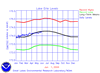 Great
Lakes daily water level plots compared with last years levels; monthly
Min, Max, and Mean levels. Great Lakes water levels constitute one of
the longest high quality hydrometeorological data sets in North America
with reference gage records beginning about 1860 with sporadic records
back to the early 1800's. These levels are collected and archived by NOAA's
National Ocean Service.
Great
Lakes daily water level plots compared with last years levels; monthly
Min, Max, and Mean levels. Great Lakes water levels constitute one of
the longest high quality hydrometeorological data sets in North America
with reference gage records beginning about 1860 with sporadic records
back to the early 1800's. These levels are collected and archived by NOAA's
National Ocean Service.
+ Read more
Great Lakes Advanced Hydrologic Prediction System (AHPS) Products (Experimental)
 (Based on choosing scenarios from 1948-1999) On this page are links to
plots for monthly values of inflow, outflow, total supply, mean lake level
and other hydrology and meteorology variables for each of the Great Lakes
and Lake St. Clair. Products include 18-month hindcast simulations and
9-month outlooks. Simply click on a lake in an ImageMap to access the
products. These products are updated daily.
(Based on choosing scenarios from 1948-1999) On this page are links to
plots for monthly values of inflow, outflow, total supply, mean lake level
and other hydrology and meteorology variables for each of the Great Lakes
and Lake St. Clair. Products include 18-month hindcast simulations and
9-month outlooks. Simply click on a lake in an ImageMap to access the
products. These products are updated daily.
+ Read more
Complete Listing of GLERL Data Products
Selected Software products
Derivative Outlook Weights Software
A special-purpose GUI, for using probabilistic meteorology outlooks to
make derivative outlooks. Accompanied by complete updated documentation
in a self-installing file.
+ Download Page
Large Basin Runoff Model Software
A fast, accurate model of weekly or monthly runoff volumes (with a daily
internal computation interval) with relatively simple data requirements.
+ Read More
+ Download Page
Complete Listing of GLERL Software Products
![]()

Program Background
This program supports research on physical processes in large lakes and the coastal ocean and their relationship to the biology, chemistry, and geochemistry of the ecosystem. This research is used to develop models to identify, forecast, and assist in managing and/or mitigating water quality and natural resource problems. Wind, waves, and thermal structure are primary determinants of water movements, mixing, and circulation in large lakes and (along with tides) in coastal ocean areas. Additionally GLERL conducts studies to identify and improve our understanding of the impacts of climate change and variability on socio-economic frameworks and ecosystem structure and function, including those through intermediate effects such as changes in the water supply of the Great Lakes Basin.
Recent Publications
ASSEL, R. A. Detroit River - Western Lake Erie Basin Indicator Project.
Indicator: Lake Erie Ice Cover. U.S. EPA Web Site (2006).
http://www.epa.gov/med/grosseile_site/indicators/index.html
CROLEY, T.E. II and C.F.M. Lewis. Warmer and drier climates that make terminal Great Lakes. Journal of Great Lakes Research 32:852-869 (2006).
+ download article [pdf]
CROLEY, T.E. II. Modified Great Lakes hydrology modeling system for
considering simple extreme climates. NOAA Technical Memorandum GLERL-137.
Great Lakes Environmental Research Laboratory, Ann Arbor, MI 27 pp.
(2006).
+
download article [pdf]
CROLEY, T. E., II. Using climate predictions in Great Lakes hydrologic
forecasts. In Climate Variations, Climate Change, and Water Resources
Engineering. Garbrecht, J., and T. Piechota (Eds.). American Society
of Civil Engineers, Arlington, VA, 164-187 (2006).
+
download article [pdf]
LIEBIG, J.R., H.A. VANDERPLOEG, and S.A. RUBERG. Factors affecting
the performance of the optical plankton counter in large lakes: Insights
from Lake Michigan and laboratory studies. Journal of Geophysical Research
111:C05S02, 10 pp. (2006).
+
download article [pdf]
LIU, P.C., and K.R. MacHutchon. Are there different kinds of rogue waves? Proceedings, 25th International Conference of Offshore Mechanics and Arctic Engineering. Hamburg, Germany, June 4-9, 2006. ASME, 6 pp. (2006).
+ download article [pdf]
LOFGREN, B.M. Land surface roughness effects on lake effect precipitation. Journal of Great Lakes Research. 32:839-851 (2006).
+ download article [pdf]
Plattner, S., D.M. MASON, G.A. LESHKEVICH, D.J. SCHWAB, and E.S. Rutherford.
Classifying and forecasting coastal upwellings in Lake Michigan using
satellite derived temperature images and buoy data. Journal of Great
Lakes Research 32:63-76 (2006).
+ download article [pdf]
Rao, Y.R., and N. HAWLEY. Inter-basin exchange flows in Lake Erie. Proceedings, Sixth International Symposium on Stratified Flows. The University of Western Australia, Perth, Australia, December11-14, 2006, pp. 245-250 (2006).
+ download article [pdf]
SCHWAB, D.J., B.J. EADIE, R.A. ASSEL, and P.J. Roebber. Climatology
of large sediment resuspension events in southern Lake Michigan. Journal
of Great Lakes Research 32:50-62 (2006).
+
download article [pdf]
Selected Brochures
NOAA CoastWatch Program in the Great Lakes [pdf]
Great Lakes Ice Cover - Winter 2003 compared with GLERL's 30-Winter Ice Cover Climatology [pdf] [html]
Meteorological Stations and Web Cams [pdf]
Real-Time Environmental Coastal Observation Network (RECON) [pdf]
Water Levels in the Great Lakes [pdf]