Forecasting Tornadoes
Can tornadoes be forecast or predicted?
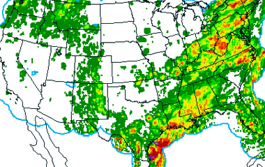
FORECAST MODELS
Forecasters often rely on massive computer programs called numerical weather prediction models to help them decide if atmospheric conditions will be right to support an environment in which tornadic storms might form. The models start with current weather observations and attempt to predict future weather using physics and dynamics to describe mathematically the atmosphere's behavior.
WATCHES AND WARNINGS
Forecasters at the National Weather Service Storm Prediction Center (SPC) issue daily forecasts, or convective outlooks, for organized severe thunderstorms over the U.S. based on current weather observations and forecast models. They also closely monitor areas they think are at a higher risk for tornadoes.
If conditions develop that are favorable for tornadoes, SPC forecasters issue a severe thunderstorm or tornado watch that typically lasts four to six hours. Local forecast offices, emergency managers, storm spotters and the general public are alerted to the possibility of severe weather.
Tornado warnings are issued by the local National Weather Service Forecast Office when a tornado has been sighted or indicated by weather radar. People in the warning area should seek appropriate shelter immediately.
HOW DOES NSSL CONTRIBUTE?
NSSL is actively involved in refining and building new conceptual models of severe storms, supercells structures and mesoscale convective complexes and systems. These conceptual models have improved our understanding of environments that are favorable for the formation of thunderstorms and tornadoes.
NSSL works with mesoscale models that help determine whether tornadic storms may or may not develop. They then test to see if these models are actually helpful in an operational forecasting situation.
NSSL scientists are studying the technique of "ensemble forecasting." Ensemble forecasting involves running a large number of forecasts with different initial conditions or a large number of different models together. This appears to provide more accurate forecasts than a single model by itself. NSSL scientists have also experimented with using direct forecaster input to identify regions and conditions that seem to be at a higher risk of severe weather. This way the forecaster could use his judgment and experience and input it into the model before the computer begins its computations.
NSSL actively works with the Storm Prediction Center each spring to evaluate the usefulness of new developments in computer models in daily forecasting.
Hazardous Weather Testbed
Inspired by the mutual interests of SPC forecasters and NSSL researchers,
the Hazardous Weather Testbed encompasses projects of many shapes, sizes
and composition. Interactions range from daily map discussions involving
imminent severe weather to loosely related research projects involving
2-3 collaborators to annual intensive collaboration periods such as the
SPC/NSSL Spring Program. This relationship provides forecasting support
for field research, helps evaluate operational and experimental numerical
models and other emerging operational forecast tools, and transitions promising
new meteorological insights and technologies into advances in forecasting
hazardous mesoscale weather.