|
Nature Watching/Exploration
- Identify birds and ducks, amphibians, butterflies, and other insects
- Explore wetlands and find wildlife
- Take a geologic tour of a National Park
|

|
Boating
- Real-time flows of streams and river levels to help determine safe conditions
- Maps for identifying and accessing boating areas
- Information on water quality trends in your area
- Geologic descriptions of surrounding areas
|

|
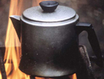
Camping
- Create and view maps online and locate access points for your camping destinations
- Browse a database of nearly 2 million physical and geographical features that you might encounter while camping
- Contact a local map dealer near you to purchase your favorite topographic or other map product
|

|
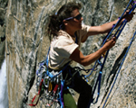
Climbing
- Locate maps on line to show elevation, calculate slope, and determine access points for climbing. Limited print-on-demand capability at scales suitable for field use
- View areal photographs of your climbing destination
- Add value to your climb with geologic maps to show the rock types you will encounter and the area’s geologic history, and atlas maps to help you understand relationships between nature and people
- Headed for a volcano? Get updates of activity, hazards, accessibility information, photos, and eruption and geographic history for volcanoes throughout the world
|

|
Fishing
- Real-time flows of streams and river levels to help determine safe and suitable angling conditions
- Real-time stream temperatures for select locations
- Maps for identifying and accessing fishing
areas
- Information on water quality trends in your
area
|

|
Health
- Check on the latest health issues affecting your recreational activities
- Information on USGS human health related activities
|

|
Hiking/Biking
- Create and view maps online and locate access
points for
your hiking/biking destinations
- Contact a local map dealer near you to
purchase your favorite
topographic or other map product
|

|
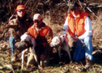
Hunting
- Identify the ducks of interest to hunters
- Using maps and a compass to navigate your way
in the wilderness
- How to obtain and read the most current maps
|

|
Environmental Laws and Regulations
- Air Quality, water quality, and water resource related acts and executive orders
- Cultural and historic resources, prime and unique farmlands, public land resources, and solid and hazardous substances
- Endangered species, and fish and wildlife conservation
- List of statutes by section, organizing federal laws and regulations, and miscellaneous acts
|

|
Contact Us |


