USGS Recreation
|
|
|
|
|
|
|
|
|
|
|
|
|
|
|
|
|
|
|
|
|
|
|
|
|
|
|
|
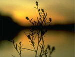 |
Nature Watching/Exploration |
| Current News and Developing Issues Concerning Recreational Issures from the USGS News Service | Current news and developing issues concerning recreation issues. |
| A Field Guide to the Reptiles and Amphibians of Coastal Southern California | A well-illustrated field guide to help train students, researchers, reserve managers, regulators, and others to identify the local herpetofauna, with emphasis on sensitive species. |
| Aerial Photographs and Satellite Images | Photographs and other images of the Earth taken from the air and from space show a great deal about the planet's landforms, vegetation, and resources. |
| Affects of Hurricane Katrina Slide Show | USGS Hurricane Katrina Slide Show - the show will advance frame by frame through 95 slides |
| Affects of Hurricane Rita Video | USGS Hurricane Rita Storm Surge Project September 20th - October 2005 |
| Alaska Bureau of Land Management | Outdoor Recreation |
| Alaska Biological Science Center | Is responsible for research trust lands and waters (including those of the National Park Service, Fish and Wildlife Service, Bureau of Land Management, and Minerals Management Service) and DOI trust species (including migratory birds, marine mammals, and anadromous fish) in Alaska. Provides scientific information essential for resource management decisions. |
| Alien Plants in Sequoia-Kings Canyon and Yosemite National Parks | A recent report published by the U.S. Geological Survey documents nonnative plants in Sequoia-Kings Canyon and Yosemite national parks, and provides a useful template for ranking alien species problems for management actions in these and other national parks and reserves. |
| America's National Scenic Byways Online | This site is sponsored by the Federal Highway Administration and is managed by the National Scenic Byways Online project at Utah State University and Multimedia Data Services Corporation. . |
| America's National Wildlife Refuge System (USFWS) | The mission of the National Wildlife Refuge System is to administer a national network of lands and waters for the conservation, management and where appropriate, restoration of the fish, wildlife and plant resources and their habitats within the United States for the benefit of present and future generations of Americans. |
| America's National Wildlife Refuge Education System (USFWS) | Education, Childrens Corner, Coloring Book, Q & A, Threatened and Endangered Species, Kids Portal, Distance Learning, Earth Stewards, Hawaiian Island Education Project, Hands on the land, Shorebird Sister Schools Project. |
| American Trails | Interest in enhancing and protecting America's network of interconnected trails. Supports local, regional, and long-distance trails and greenways, whether in backcountry, rural or urban areas. Promoting cooperation among all trail interests. |
| Amphibians and Reptiles | Research topics and links on amphibians and reptiles from the Patuxent Wildlife Research Center. |
| Arizona Bureau of Land Managment | Outdoor Recreation. |
| Attracting Wildlife to Your Back Yard: | A Guide to Increasing Wildlife Diversity and Aesthetic Value Around Your Home. |
| Audubon Society | Audubon is dedicated to protecting birds and other wildlife and the habitat that supports them. There is a national network of community-based Audubon nature centers and chapters, environmental education programs, and advocacy on behalf of areas sustaining important bird populations in order to engage millions of people of all ages and backgrounds in positive conservation experiences. |
| Bald Eagles Annual Winter Survey Set to Go | The bald eagle is a symbol in the United States of strength and freedom, but what is its strength in terms of population? The 2004 National Midwinter Bald Eagle Survey, sponsored by the U.S. Geological Survey (USGS), provides important information in addressing this question. |
| Bald Eagle Counts Continue to Climb Slowly | Winter counts of bald eagles increased nearly 2 percent annually from 1986-2000 in the contiguous United States. |
| Beyond the National Parks: A Recreational Guide to Public Lands in the West | Published by the Smithsonian Institution Press - For those of us who like to venture off the beaten path, this book is a must-have. It’s filled with the best-kept secrets about 175 unique public land sites throughout the West, with several eastern sites included for good measure ... take a peek. |
| Bird Banding Laboratory | Wild birds are captured and marked with a uniquely numbered band or ring placed on the leg. The bander records where and when each bird is banded, how old it is, what sex it is, and any other information and sends those data to the Bird Banding Laboratory. Information from bands subsequently found and reported to the Bird Banding Laboratory provides data on the distribution and movements of species, their relative numbers, annual production, life-span and causes of death. |
| Birder | Find out about birds and watching them in your area. |
| Birds, Birds, Birds (USFWS) | Find out about birds in your recreation area. |
| Bird Checklist of the United States | Offers bird checklists developed to indicate the seasonal occurrence of birds in state, federal, and private management areas, nature preserves, and other areas of special interest in the United States. |
| Butterflies of North America | Distribution maps showing the counties in which occurrence of a particular species has been verified. Photos of the adult and caterpillar (when available). Species accounts containing information on size, identifying characteristics, life history, flight, caterpillar hosts, adult food, habitat, species range, conservation status, and management needs. Species checklists for each county in the U. S. and northern Mexico. |
| Calculate Magnetic Declination On-line | Use numerical models of the earth's magnetic field derived from measurements taken by the USGS, the British Geological Survey and other world and government organizations to calculate your magnetic declination. |
| California Bureau of Land Management | Outdoor recreation information including bird watching, camping, fishing, hunting, off-highway vehicle riding, river recreation, scenic drives, and more. |
| Chesapeake Bay Activities | The mission of USGS Chesapeake Bay studies is to provide integrated science to support effective ecosystem conservation and restoration. |
| Chesapeake Meteorite: Message from the Past | The meteorite, moving nearly 60 times faster than a fired bullet, caused an impact more powerful than the combined explosion of every nuclear bomb on earth and blasted a crater in the crust of the earth thousands of feet deep and over 53 miles in diameter. |
| Chinese Tallow: Invading the Southeastern Coastal Plain | Chinese tallow is an ornmental tree with colorful autumn foliage that can survive full sunlight and shade. |
| Coastal and Marine Geology Program | Marine science and management for ocean and coastal environments. |
| Coastal and Marine Geology Topics | USGS research programs addressing a range of geologic issues from beaches, corals reefs, ecosystems, and submarine mapping to coastal hazards, disasters, and public safety. |
| Collecting Rocks | How to identify basic rock types, equipment and tips for rock collectors. |
| Colorado Bureau of Land Management | Outdoor recreation, activities and areas. |
| Convert Plus - Online Units Conversion | Perform online conversions for many different (areas, capacities, volumes, circular measurements, computer storage, currency, distances, lengths, energy, work, fuel, power, pressure, speed, temperature, time, torque, weight and mass) measurement systems - to and from units of measure, including a few exotic units of measure. |
| Dragonflies and Damselflies of the United States | Distribution maps and county checklists of Dragonflies and Damselflies (Odonata) in the United States. |
| Ducks at a Distance | This guide will help you recognize birds on the wing - it emphasizes their fall and winter plumage patterns as well as size, shape, and flight characteristics. It does not include local names. Recognizing the species of ducks and geese can be rewarding to bird watchers and hunters. |
| Duck Identification Guide for Hunters | This pictorial aid is designed to assist in recognizing ducks in the hand after they have been bagged. The shape of the bill, wing markings, color of feet or head crest are some of the typical characteristics used to identify ducks. |
| Earth As Art | See and purchase images of our earth taken from more than 400 miles high by the Landsat 7 satellite. |
| EarthNow! Landsat Image Viewer | Watch real-time Landsat imagery along the Earths orbital path. |
| Endangered Species Program | Disseminates conservation information on our Nation’s threatened and endangered fish, wildlife, and plants. |
| Environmental Directory | An Environmental Search Engine |
| Everglades to Alaska Science to Restore the Nation’s Ecosystems | Hydrologists, biologists, geologists and geographers from the U. S. Geological Survey (USGS) will discuss their science at the First National Conference on Ecosystem Restoration (NCER) Dec. 6-10 at the Wyndham Palace in Orlando, Fla. |
| Federal Aid in Wildlife Restoration | The Federal Aid in Wildlife Restoration Act, Federal Aid -Restoring America's Wildlife, Programs, and Contact Consultants |
| Field Manual of Wildlife Diseases | Field Manual of Wildlife Diseases: General Field Procedures and Diseases of Birds is completed. This field manual is a revision and expansion of our 1988 Volume 1, Field Guide to Wildlife Diseases and is funded by the U.S. Fish and Wildlife Service, Division of Federal Aid, Administrative Grant No. AP95-017. (Downloadable) |
| Forest and Rangeland Ecosystem Science Center | Provides scientific understanding and technology to support management and conservation of our nation's natural resources, with emphasis on western ecosystems. |
| Fossils, Rocks & Time | Fossils help scientists put events in order when studying the Earth’s vast history. Fossils can tell the knowledgeable observer what happened long ago and when it happened. |
| Friends of the Rappahannock | To promote the conservation, protection, and enjoyment of the natural, cultural, recreational, scenic and historical values of the Rappahannock River and its tributaries |
| Gemstones | A guidebook of general information on a variety of gemstones and the places they are found in the U.S. |
|
Our National Parks are the showcases of our nation’s rich geological heritage. This presentation is structured to inform and entice virtual and future park visitors with a non-technical approach to geology. We present the first page of any topic, including field trip stops, at the most basic level. You will find more detail as you work your way through each site. We have organized our pages into two categories: general geology topics and individual parks, and have included a link to the National Park Service Park Geology Tour site. |
| Geology of National Parks: | The 3-D tours feature National Parks, Seashores, Preserves and National Monuments. |
| Grand Canyon Monitoring and Research Center | Measures effects of Glen Canyon Dam operations on the resources along the Colorado River from Glen Canyon Dam to Lake Mead. |
| Great Lakes Science Center, Ann Arbor, Michigan | Advancing scientific knowledge and providing scientific information for restoring, enhancing managing, and protecting the living resources and their habitats in the Great Lakes basin ecosystem. |
| Historic Maps from the Library of Congress Archives | In the Geography and Map Division Reading Room of the Library of Congress, researchers can find the largest and most comprehensive cartographic collection in the world. There are more than 4.5 million maps and 60,000 atlases, as well as a large number of cartographic materials in other formats. |
| Idaho Bureau of Land Management | Keeping you informed about recreation options within Idaho's public lands. |
| Leave No Trace, Inc. | Leave No Trace, Inc. is a national non-profit organization dedicated to promoting and inspiring outdoor recreation through education, research, partnerships, awareness, appreciation and respect for our wildlands. |
| Leetown Science Center, West Virginia | Research, restore, maintain, enhance, and protect aquatic and terrestrial organisms and their supporting ecosystems. |
| Lewis and Clark Publications and Additional Web Sites | Welcome to Lewis and Clark200.gov. This website is a partnership among 32 federal agencies and organizations aimed at providing a single, easy-to-use web portal with information about various Lewis and Clark historical places. |
| Lewis and Clark and the U.S. Geological Survey in North Dakota | This web site gives a picture of the Missouri River and its tributaries during the early 1800's, via excerpts from the journals of Lewis and Clark, and a picture of the present-day river system, via aerial photographs along with U.S. Geological Survey data. |
| Lewis and Clark Expedition and the USGS | The Lewis and Clark Expedition was the first of many government surveys of natural resources in the American West. In 1879, four such surveys were combined into a new agency called the U.S. Geological Survey (USGS). |
| Linkexchangeoutsourcing directory | Directory of recreational web sites. Linkexchangeoutsourcing is a directory or collection of popular Web sites available in the web world covering several helpful categories and resources. |
| Malformed Frogs In Minnesota: An Update | Malformed frogs have been reported throughout Minnesota and elsewhere in the United States and Canada. |
| Map-A-Planet | The USGS Astrogeology Research Program accesses global imagery of the planets and satellites from a variety of missions in an easy to use web interface. Customize and download your own image maps of the Moon, Mars, Venus, and other planets and moons. |
| Mayflies of the United States | Consisting of information on the known distribution of Mayflies in the United States. Distribution maps and county checklists were created by extracting information on Mayfly distribution from publications listed |
| Microbes to Mammals - Invasive Species | A threat to America's Biological Heritage |
| Migratory Bird Information | Photographs, songs, videos, identification tips, maps, research programs and life history information for North American birds. |
| Montana, North and South Dakota Bureau of Land Management | U.S. Department of the Interior Bureau of Land Management Recreation Web site associated with the state of Montana and the Dakotas. |
| Moths of North America | Distribution maps showing the counties in which occurrence of a particular species has been verified, along with photographs, species account, and checklists. |
| National Council for Science and the Environment | Is dedicated to improving the scientific basis for environmental decisionmaking. They envision a society where environmental decisions by everyone are based on an accurate understanding of the underlying science, its meaning and limitations, and the potential consequences of their action or inaction. |
| National Forests - Find a National Forest or Grassland | USDA Forest Service |
| National Forests - Find a Special or Wilderness Areas | USDA Forest Service |
| National Map | The Nation's Topographic Map for the 21st Century. |
| National Wildlife Federation | Explore nature in your neighborhood, enjoy wildlife activities, learn about fun facts, and discover ways to help wildlife. |
| National Geologic Map Database | Locate maps showing the types of rocks in an area, their ages and structure, and a description of the geologic history from USGS, State geological surveys, professional societies, universities and other sources. |
| National Interagency Fire Center | A cooperative effort among several State and Federal partners including the USDA, Forest Service, Department of the Interior, and the National Association of State Foresters to manage the impacts of wildland fires in our Nation's communities. |
| National Park Foundation | National Park Foundation is a National Charitabel Partner of America's National Parks. |
| National Park Service - LearnNPS - Students and Teachers - TeacherZone - GoZone - RangerZone |
Curriculum Based Educational Programs with listings and contacts of National Park sites. Obtain information about pre-visit, on-site, and post-visit curriculum-based education programs. Select a park from the alphabetical list below, use the drop-down menu to search by state, or select a state from the map. |
| National Park Service - Parks and Recreation | Experience your America - Visit Your Parks. View history, cultures and places - Links to the Past. Nature and science in the parks - Nature and Science. For teachers and learners - Interpretation and Education. |
| National Register of Historic Places (NPS) | Teaching with Historic Places uses properties listed in the National Park Service's National Register of Historic Places to enliven history, social studies, geography, civics, and other subjects. There are a variety of products and activities that help teachers bring historic places into the classroom. |
| National Scenic Byways Program | National Scenic Byways Online provides travelers with current, detailed information about byways throughout the United States. Sponsored by the Federal Highway Administration (FHWA). |
| National Wild Horse and Burro Program | Wild horses and burros on the public rangelands are managed in a manner consistent with BLM's multiple use mission which takes into consideration natural resources such as wildlife and vegetation and other users such as livestock & recreationists. |
| National Wildlife Federation | Uniting individuals, organizations, businesses and government to protect wildlife, wild places, and the environment. |
| NatureWatch | NatureWatch is a partnership program of the U.S. Forest Service that provides nature viewing opportunities and encourages safe and sound viewing ethics contributing to local economies and opportunities for enjoying nature on a national forest near you. |
| Nevada Bureau of Land Management | Recreation. |
| New Hampshire and Vermont Recreation Project | The USGS has put together recreational information for the states of New Hampshire and Vermont (Beta Pilot Study) covering the themes in the USGS Recreation Web site. |
| New Mexico Bureau of Land Management | Outdoor recreation |
| Nonindigenous Aquatic Species | This site has been established as a central repository for accurate and spatially referenced biogeographic accounts of nonindigenous aquatic species. |
| North Dakota - Natural Areas | The following special guide is a combined effort of the North Dakota OUTDOORS editorial staff with assistance from the North Dakota Parks and Recreation Department, and is meant to provide you with a reference to North Dakota's natural areas. Additional support provided by The Nature Conservancy and the North Dakota Chapter of the Wildlife Society. |
| Northern Praire Wildlife Research Center | Research information on the quantitative ecological requirements for sustainable wildlife populations. |
| Northern Rocky Mountain Science Center | Panoramic photographs of Glacier National Park and the surrounding area. |
| Outdoors Writers Association of America | OWAA is an international, professional association of outdoor communicators, outdoor companies and outdoor industry service providers. |
| Paleontology and the U.S. Geological Survey | Includes photographs of fossil groups, and describes the different types of fossils, how fossilized flora and fauna lived, and how they are used to answer important questions about the world we inhabit. |
| Peterson Field Guildes Online | Informative and practical field guides. |
| Planetary Geology | Browse the solar system for facts about the planets and view a striking collection of spacecraft imagery of the planets and their moons on the NASA Photojournal. |
| Prospecting for Gold | Anyone who pans for gold hopes to be rewarded by the glitter of colors in the fine material collected in the bottom of the pan. Although the exercise and outdoor activity experienced in prospecting are rewarding, there are few thrills comparable to finding gold. The would-be prospector hoping for financial gain, however, should carefully consider all the pertinent facts before deciding on a prospecting venture. |
| Recreation.gov | The Recreation One-Stop initiative is intended to enhance customer satisfaction with recreational experiences on public lands. It will improve access to recreation-related information generated by the Federal government, streamline the systems used to manage that information, and increase the sharing of recreation-related information among government and non-government organizations. |
| Recreation News | Online magazine covering feature cover destinations and activities within a day or weekend drive of Baltimore or Washington, D.C. Focus is on Maryland, Virginia, West Virginia, Delaware, Pennsylvania and North Carolina. |
| Sabino Canyon | This website introduces the hydrology of Sabino Creek – where the stream originates, how it changes with weather and season, and where it goes. |
| Science In Your Watershed | Find scientific information organized on a watershed basis. This information, coupled with observations and measurements made by watershed groups, provides a powerful foundation for characterizing, assessing, analyzing, and maintaining the status and health of a watershed. |
| Snakehead in your inbox? Welcome to the Nonindigenous Aquatic Species Alert System | Want to know how many new species have been found in your state in the past six months, or where the latest sighting of snakeheads occurred? You can find the answers to both these questions at the USGS Nonindigenous Aquatic Species (NAS) Alert System. |
| South Florida Information Access | Access to natural hazards including flooding from storm runoff and hurricanes tides, destruction by hurricane winds, and foundation problems arising from unstable rock conditions in South Florida. |
| Southwest Biological Science Center | Research and information on water use and the effects of livestock grazing, wildland fires, invasive species, environmental contaminants, declining populations of native species and urban development on the Southwest region of the U.S. |
| Spotted Owl Groups Defined with Genetics | New U.S. Geological Survey (USGS) science reaffirms, with strong genetic evidence, that the northern spotted owl is a separate subspecies from California and Mexican spotted owls. |
| State Parks, Wildlife Departments and Recreational Facilities in Your Area | Pick the State of your choice for ideal nature watching and recreation facilities |
| Status and Trends of Reptiles | Access to biological information for reptiles |
| Stoneflies of the United States | Everything you wanted to know about the Stonefly. |
| The Wilderness Society | Helps protect America's Wilderness through science, advocacy and education. Ensures that wild places, their values, maintain biological diversity. |
| Tiger Beetles of the United States | Everything you wanted to know about the Tiger Beetle. |
| Tread lightly - Leaving A Good Impression | Through education, restoration and research, Tread Lightly! empowers generations to enjoy the outdoors responsibly. If we increase public awareness and encourage responsible outdoor practices, the great outdoors will be accessible, open and well preserved for years to come. |
| USDA Forest Service | Information on National Forests and Grasslands, a diversity of outdoor opportunities, historic trails, scenic rivers, land areas and other National favorites. It's an adventure in America's Great Outdoors. |
| US Fish and Wildlife Service | Southwest Region 2 - Conserving Wildlife and Habitats. |
| Volcano Hazards Program | Observations and the latest information on volcanoes. |
| Water Cycle | The USGS site offers the most comprehensive discussion of the water cycle anywhere on the Web. It features a superb diagram by a USGS graphic artist; the diagram is available in 36 languages. There is an in-depth Web page for each of the 15 topics on the diagram, along with a single-page summary of the water cycle. |
| WaterWatch - Current water resource conditions. | See and track real-time streamflow and water conditions in your neighborhood. |
| Wetland Losses of the United States | Undisturbed marshes, swamps, and overflow lands have many inherent values and a variety of uses. This report is confined to the use of these natural wetlands by wildlife. Millions of Americans rely on wild animals to furnish them with healthful outdoor recreation. |
| Wilderness.net | Wilderness.net is an Internet-based tool connecting the natural resource workforce, scientists, educators, and the public to their wilderness heritage through ready access to wilderness information. Through Wilderness.net and its partners, you'll find access to general information about wilderness, stewardship and educational resources, scientific information, agency policies, relevant legislation, communication tools to connect you with others in the wilderness community and more.. |
| Wildfire Science Applications and Support | Use different Wildfire map viewers, see related links, learn about the ecological effects of fire retardant chemicals, and examine post-wildfire runoff event data from the science center. |
| Wyoming Bureau of Land Management | Recreation Opportunities. |

![]()
![]() U.S. Department of the Interior
U.S. Department of the Interior
U.S. Geological Survey
URL: http://recreation.usgs.gov/nature_watching.html
Page Contact Information: Webmaster
Page Last Modified: Wednesday, 01-Oct-2008 11:30:26 EDT
