
National Hydrography
Home
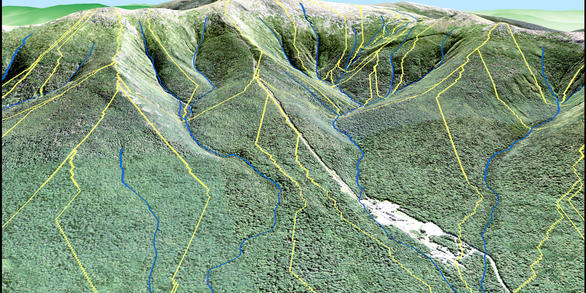
The USGS National Geospatial Program manages the National Hydrography Dataset (NHD), Watershed Boundary Dataset (WBD), and NHDPlus High Resolution (NHDPlus HR). These geospatial datasets represent the surface water of the United States for mapping and modeling applications.
Update National Hydrograpy with the Markup App

Have a correction or update for the NHD, WBD, or NHDPlus High Resolution? Visit the Markup App!
Go ThereNHDPlus HR - the Next Generation of National Hydrography
Check out the NHDPlus High Resolution (NHDPlus HR) factsheet
Read More!Access the NHD Newsletter to keep up with the latest Hydrography info

Subscribe to and access the National Hydrography Dataset newsletters for updates, information, and the hydro quiz!
NewslettersHydrography for the Nation
The USGS manages surface water and hydrologic unit mapping for the Nation as geospatial datasets. These include the National Hydrography Dataset (NHD), Watershed Boundary Dataset (WBD), and NHDPlus High Resolution (NHDPlus HR). Hydrography data are integral to a myriad of mission critical activities undertaken and managed by government entities (Federal, state, regional, county, local, Tribal), nonprofit organizations, and private companies. Hydrography data make it possible for these groups to, for example:
- Manage water such as stream flow and stormwater
- Monitor, manage, and report water quality
- Assess water availability and water rights
- Model and map flood risk
- Conserve terrestrial and aquatic habitats
- Manage fisheries, rangeland, timberlands, and agricultural lands
- Assess coastal hazards
- Plan for future land development activities and infrastructure development
- Manage riverine and coastal navigation and safety
- Provide recreational opportunities for citizens
Please see the About National Hydrography Products link for more detailed information on national hydrography products.
Accessing Hydrography Products
Direct download links and web-based map service information are available from the Access National Hydrography Products page. Downloads via interactive map are available from The National Map Download viewer, and all web-based map services are listed at The National Map Service Endpoints page.
Resources and Tools
Many resources and tools exist to support the National Hydrography Datasets. Tools include the Markup Application to suggest edits, or “markups”, to the NHD, WBD, and NHDPlus HR, as well as the Hydrologic Event Management (HEM) Tool to create, manage, and refresh of event data that is referenced to hydrography data. Tools are also available to stewards to edit and manage NHD and WBD data.
A series of training videos on hydrography and other USGS geospatial data and products are also available.
Stewardship
National Hydrography Datasets are updated and maintained through a strong community of stewards and users who have local knowledge about the streams where they live and work. Edits and updates to the NHD and WBD are made by stewards and processed and made available in the national dataset distribution by the USGS. For more information, please visit the Stewardship and Community link.
Governance
The NHD and WBD are managed by the USGS under OMB Circular A-16 and as a part of the FGDC National Geospatial Data Asset (NGDA) Water-Inland Theme, with collaboration, support, and cost-sharing with many other Federal, state, and local entities. The National Hydrography Infrastructure Working Group (NHI WG) is a forum for Federal agencies with direct involvement in the National Hydrography Infrastructure to provide input and collaborate on the direction, development, priorities, management, technologies, use, and resources of the National Hydrography Infrastructure.
Join Our Community!
We communicate monthly through the NHD Newsletters and Hydrography Advisory Calls, and hold special seminars and workshops as well. Please visit the National Hydrography Dataset Playlist on the USGS YouTube Channel for recorded Advisory Calls and the News tab on the left for more detailed information. For questions, please email nhd@usgs.gov.
News

Announcing NEW National Hydrography Dataset Newsletter Delivery
There's a new National Hydrography Dataset Listserv and fresh Newsletter look and feel!

National Hydrography Meetings and Trainings
Meetings and Trainings Through December 2020

NHD, WBD, and NHDPlus HR Status Updates
NHDPlus High Resolution Beta Production Status
Publications

The Open Water Data Initiative: Water information for a thirsty nation
Initial efforts of the Open Water Data Initiative have focused on three use cases covering flooding, drought, and contaminant spill response, with a goal of identifying critical water data resources and making them more accessible. Significant progress has been made in the past year, although much remains to be done.
Rea, Alan; Clark, Edward; Adams, Angela; Samuels, William B.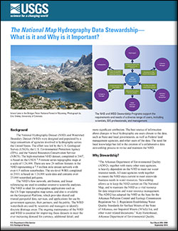
The National Map hydrography data stewardship: what is it and why is it important?
The National Hydrography Dataset (NHD) and Watershed Boundary Dataset (WBD) were designed and populated by a large consortium of agencies involved in hydrography across the United States. The effort was led by the U.S. Geological Survey (USGS), the U.S. Environmental Protection Agency (EPA), and the Natural Resources Conservation Service (NRCS)....
Arnold, Dave