
Unified Interior Regions
Salton Sea
The Salton Sea is facing many challenges as inflows and water levels decline. USGS science helps identify problems and evaluate possible solutions.
Read moreRegion 8: Lower Colorado Basin
Regions L2 Landing Page Tabs
The Lower Colorad Basin includes Arizona, southern Nevada, and souther California. The Regional Office, headquartered in Sacramento, provides Center oversight and support, facilitates internal and external collaborations, and works to further USGS strategic science directions. Our scientists do a broad array of research and technical assistance throughout the U.S. and across the globe.
News

Earth MRI Funds Critical Minerals Projects in Arizona
A total of $133,016 will fund new research and preserve important data across the Grand Canyon State.

USGS Science to Keep Us Safe: Floods and Drought
The scarcity or overabundance of water presents some of the most dangerous, damaging and costly threats to human life, ecosystems and property in the form of drought, floods and debris flows.

RAMPS Newsletter - Summer 2020 Edition
This season's edition of the Restoration Assessment and Monitoring Program for the Southwest Newsletter contains recent program highlights including research updates, new projects, field updates and more.
To subscribe to our newsletter, please visit: ...
")
The Nonindigenous Aquatic Species Alert Risk Mapper (ARM)
The Nonindigenous Aquatic Species (NAS) program has developed a new tool, the NAS Alert Risk Mapper (ARM), to characterize waterbodies in the conterminous U.S. and Hawaii at potential risk of invasion from a new nonindigenous species sighting.
")
Defining Native Ranges of U.S. Inland Fishes
Understanding the native versus non-native range of a species can provide useful information about dispersal, population distribution patterns, and human mediated movement across hydrologic barriers. The USGS Nonindigenous Aquatic Species (NAS) Program is working with partners to define native ranges of inland fishes in the United States to help identify which species should be included in the...

The Nonindigenous Aquatic Species Flood and Storm Tracker (FaST)
Storm-related flooding can lead to the potential spread of nonindigenous (or non-native) aquatic species into waterways they have not been seen in before. The USGS Nonindigenous Aquatic Species program has developed an innovative mapping tool to help natural resource managers with post-storm nonindigenous aquatic species detection and assessment efforts.

Nonindigenous Aquatic Species (NAS) Program
Welcome to the Nonindigenous Aquatic Species (NAS) information resource for the United States Geological Survey. Located at Gainesville, Florida, this site has been established as a central repository for spatially referenced biogeographic accounts of introduced aquatic species. The program provides scientific reports, online/realtime queries, spatial data sets, distribution maps, and general...
Dragonfly Mercury Project specimen collection in Glacier NP
Researchers instruct volunteers on how to collect dragonfly larvae in Glacier NP as a part of the Dragonfly Mercury Project.
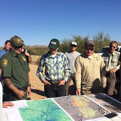
Managing Fire on the US Mexico Borderlands
RAMPS met with DOI Office of Wildland Fire, US Customs and Border Patrol, and US Fish & Wildlife Service staff at Buenos Aires National Wildlife Refuge in southern AZ last November. The group is developing tools to reduce wildfire risk, conserve wildlife habitat and natural resources, and increase safety and security of border operations.
...
Juniper Skeletons
Thinning rangelands by removing trees such as juniper is a common mangement action done across the intermountain west. The goals of this type of vegetation treatment typically are to increase forage and habitat for grazing animals, improve soil conditions, and/or reduce risks of catastrophic fire. In this photo, skeletons leftover from a chaining treatment dot a range in
...
A single species stand of nonnative tamarisk
Single species stand of nonnative tamarisk on the Lower Colorado River at Cibola National Wildlife Refuge, California

A total of $133,016 will fund new research and preserve important data across the Grand Canyon State.
The scarcity or overabundance of water presents some of the most dangerous, damaging and costly threats to human life, ecosystems and property in the form of drought, floods and debris flows.
This season's edition of the Restoration Assessment and Monitoring Program for the Southwest Newsletter contains recent program highlights including research updates, new projects, field updates and more.
To subscribe to our newsletter, please visit: https://listserv.usgs.gov/mailman/listinfo/ramps
Read more about how the network or RAMPS is enhancing restoration in drylands.

RestoreNet is a networked ecological experiment testing restoration treatments across the arid Southwest. Seven experimental sites were installed in the Summer of 2018 on the rangelands of Northern Arizona. The experiments tested seed mixes with various treatments to increase revegetation success (see photos above). These are the results after the first year.
Read more about RestoreNet here.
This season's edition of the Restoration Assessment and Monitoring Program for the Southwest Newsletter contains recent program highlights including research updates from our RestoreNet experiment, recently awarded funding, field updates and more.
To subscribe to our newsletter, please visit: https://listserv.usgs.gov/mailman/listinfo/ramps
Get the latest updates from RAMPS here.
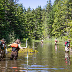
U.S. Geological Survey field crews are measuring flooding across the country as spring weather is in full swing. Warming temperatures, increased precipitation and snowmelt have caused moderate to major flooding in the upper Midwest, East Coast, Central Plains and the Southeast portions of the country.

Budget Focuses on Bringing Science, Facilities, and Infrastructure into the 21st Century
Contacts
Locations

Region 8: Lower Colorado Basin
Phone: 916-278-9551