
Core Science Systems
Home
CSS leads USGS’s mission as the civilian mapping agency for the Nation. We conduct detailed surveys and develop high quality, highly accurate topographic, geologic, hydrographic, and biogeographic maps and data. Our maps allow precise planning for critical mineral assessments; energy development; infrastructure projects; urban planning; flood prediction; emergency response; and hazard mitigation.
National Geospatial Program

The National Geospatial Program is the Federal civilian mapping agency and provides the digital geospatial foundation for the Nation. It engages partners and communities of use to collaboratively produce consistent and accurate topographic map data.
Learn MoreScience Analytics and Synthesis (SAS)

The USGS Science Data Catalog, supported by SAS, provides seamless access to USGS research and monitoring data from across the nation. Users have the ability to search, browse, or use a map-based interface to discover data.
Learn MoreNews

Upcoming Reprocessing of Recently Acquired Landsat 8 Data
Since November 2020, NASA and USGS calibration and validation engineers have observed a slow reduction in radiometric response from Landsat 8's Thermal Infrared Sensor (TIRS). The current impact is that TIRS's image products are 1 to 3 percent colder than expected.

TNMCorps Mapping Challenge Summary Results for City / Town Halls in NE & WY
Summary statistics are now available for this challenge. Thanks again to everyone who contributed!

Atlas displays beauty, variety, and value of Landsat water images
Landsat satellites exist to provide information—millions of images’ worth of information—about the Earth’s surface.
Publications
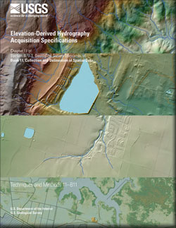
Elevation-derived hydrography acquisition specifications
Hydrographic features derived from U.S. Geological Survey (USGS) 3D Elevation Program data, and collected for use by the USGS, must meet the specifications described in this document. The specifications described herein pertain to the final product delivered to the USGS, not to methods used to derive the hydrographic features. The specifications...
Terziotti, Silvia; Archuleta, Christy-Ann
Elevation-derived hydrography—Representation, extraction, attribution, and delineation rules
With the increasing availability of 3D Elevation Program (3DEP) quality high resolution elevation data across the United States and the pressing need for better integrated elevation and hydrography data, the U.S. Geological Survey is developing guidance to improve the horizontal and vertical alignment of these datasets. The U.S. Geological Survey...
Archuleta, Christy-Ann; Terziotti, Silvia
Global islands
A new map of global islands at a high spatial resolution (30 m) has been produced from a semi-automated interpretation of 2014 satellite imagery. The data are available in the public domain. The islands were classified by size into continental mainlands (5), big islands > 1 km2 (21,818), and small islands ≤ 1...
Martin, Madeline Thomas; Sayre, Roger; Van Graafeiland, Keith; McDermott-Long, Osgur; Weatherdon, Lauren; Will, David; Spatz, Dena R.; Holmes, Nicholas