
New York Water Science Center
Home
Our New York Water Science Center priority is to continue the important work of the Department of the Interior and the USGS, while also maintaining the health and safety of our employees and community. Based on guidance from the White House, the CDC, and state and local authorities, we are shifting our operations to a virtual mode and have minimal staffing within our offices.


NY WSC Quick Links
Explore some of our most popular science topics, data, and tools
USGS National Water Dashboard (NWD)
Coastal conditions in Southeastern New York
LaboratoryNews

Field Photo Friday Winner for January 2021
Physical scientist Ariel Reed digging a hole thru the ice to check on passive loggers at USGS 04273996 W BR AUSABLE R TRIB 1 ABV ST HW 86 NR LK PLACID NY in Ausable Tributary, Lake Placid, NY. (Credit: Kaitlyn Jozokos, USGS NY WSC. Public domain.)

New Wells in Long Island Sustainability Well Network
Drilling Updates

USGS Unveils Mobile Flood Tool for the Nation
The U.S. Geological Survey announced Friday the completion of a new mobile tool that provides real-time information on water levels, weather and flood forecasts all in one place on a computer, smartphone or other mobile device.
Publications

Procedures and best practices for trigonometric leveling in the U.S. Geological Survey
With the advent of highly precise total stations and modern surveying instrumentation, trigonometric leveling has become a compelling alternative to conventional leveling methods for establishing vertical-control networks and for perpetuating a datum to field sites. Previous studies of trigonometric-leveling measurement uncertainty proclaim that...
Noll, Michael L.; Rydlund, Jr., Paul H.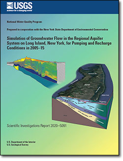
Simulation of groundwater flow in the regional aquifer system on Long Island, New York, for pumping and recharge conditions in 2005–15
A three-dimensional groundwater-flow model was developed for the aquifer system of Long Island, New York, to evaluate (1) responses of the hydrologic system to changes in natural and anthropogenic hydraulic stresses, (2) the subsurface distribution of groundwater age, and (3) the regional-scale distribution of groundwater travel times and the...
Walter, Donald A.; Masterson, John P.; Finkelstein, Jason S.; Monti, Jr., Jack; Misut, Paul E.; Fienen, Michael N.
Compilation of mercury data and associated risk to human and ecosystem health, Bad River Band of Lake Superior Chippewa, Wisconsin
Mercury is an environmentally ubiquitous neurotoxin, and its methylated form presents health risks to humans and other biota, primarily through dietary intake. Because methylmercury bioaccumulates and biomagnifies in living tissue, concentrations progressively increase at higher trophic positions in ecosystem food webs. Therefore, the greatest...
Burns, Douglas A.