
California Water Science Center
Home
The California Water Science Center has adjusted activities in response to guidance concerning the global COVID-19 pandemic. We will carry on the work of the USGS, while also maintaining the health and safety of our employees and community. Based on direction from the White House, the CDC, and state and local authorities, we are shifting to a virtual mode.
For assistance, please contact us through our Connect page.
Water Research Projects
Over 100 research projects addressing California's key water issues including: long-term water supply and availability, water quality, droughts and floods, climate change, aquatic ecology, the Delta, management of watersheds and groundwater.
Explore ProjectsPartnering with Us
The USGS partners with local, state, and other federal agencies to provide scientific information needed by water-resources managers across the Nation.
Find out howCalifornia Water Data
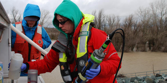
Basic hydrologic data collection, processing, analysis, dissemination, and archiving are major parts of the California Water Science Center program.
National Water Information System Mapper
Current California Streamflow Conditions
California Post-Fire Debris-Flow Maps
California Water-Quality Mapper
Get CA Water DataNews

Ecosystem Engineering Impacts of Water Primrose in the Sacramento-San Joaquin Delta
Many non-native fish, invertebrates, and plants have colonized the Delta over the past century. Included among these species is the water primrose (Ludwigia grandiflora ssp. hexapetala and Ludwigia peploides), an aggressive floating aquatic plant native to South and Central America and parts of the US, but invasive in California.

Scientists Study Selenium Hazard in the Salton Sea Environment
In the past decade, Salton Sea water elevation has declined due to drought, lining of canals, and changes to management of the Colorado River. This has resulted in the creation of new wetlands caused by drains and rivers no longer reaching the Salton Sea.

USGS Unveils Mobile Flood Tool for the Nation
The U.S. Geological Survey announced Friday the completion of a new mobile tool that provides real-time information on water levels, weather and flood forecasts all in one place on a computer, smartphone or other mobile device.
Publications

DGMETA (version 1)—Dissolved gas modeling and environmental tracer analysis computer program
DGMETA (Dissolved Gas Modeling and Environmental Tracer Analysis) is a Microsoft Excel-based computer program that is used for modeling air-water equilibrium conditions from measurements of dissolved gases and for computing concentrations of environmental tracers that rely on air-water equilibrium model results. DGMETA can solve for the...
Jurgens, Bryant C.; Böhlke, J.K.; Haase, Karl; Busenberg, Eurybiades; Hunt, Andrew G.; Hansen, Jeffrey A.
Mapping the global threat of land subsidence
Subsidence, the lowering of Earth's land surface, is a potentially destructive hazard that can be caused by a wide range of natural or anthropogenic triggers but mainly results from solid or fluid mobilization underground. Subsidence due to groundwater depletion (1) is a slow and gradual process that develops on large time scales (months to years...
Herrera, Gerardo; Ezquerro, Pablo; Tomás, Roberto; Béjar-Pizarro, Marta; López-Vinielles, Juan; Rossi, Mauro; Mateos, Rosa M.; Carreón-Freyre, Dora; Lambert, John; Teatini, Pietro; Cabral-Cano, Enrique; Erkens, Gilles; Galloway, Devin; Hung, Wei-Chia; Kakar, Najeebullah; Sneed, Michelle; Tosi, Luigi; Wang, Hanmei; Ye, Shujun Trends in nitrogen, phosphorus, and sediment concentrations and loads in streams draining to Lake Tahoe, California, Nevada, USA
Lake Tahoe, a large freshwater lake of the eastern Sierra Nevada in California and Nevada, has 63 tributaries that are sources of nutrients and sediment to the lake. The Tahoe watershed is relatively small, and the surface area of the lake occupies about 38% of the watershed area (1313 km2). Only about 6% of the watershed is urbanized or...
Domagalski, Joseph L.; Morway, Eric D.; Alvarez, Nancy L.; Hutchins, Juliet; Rosen, Michael R.; Coats, Robert