
Utah Water Science Center
Home
The Utah Water Science Center priority is to continue the important work of the Department of the Interior and the USGS, while also maintaining the health and safety of our employees and community. Based on guidance from the White House, the CDC, and state and local authorities, we are shifting our operations to a virtual mode and have minimal staffing within our offices.
National Water Dashboard
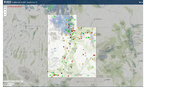
Use this interactive map to access water information and weather conditions. Legend available in the top right corner of map.
Go to Dashboard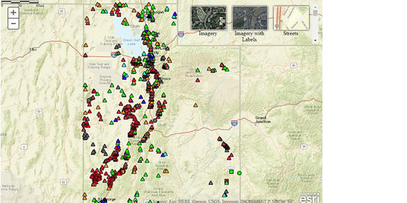
News

USGS Unveils Mobile Flood Tool for the Nation
The U.S. Geological Survey announced Friday the completion of a new mobile tool that provides real-time information on water levels, weather and flood forecasts all in one place on a computer, smartphone or other mobile device.

Groundwater in Moab Area Less than Previously Reported
A new assessment of groundwater resources in the Spanish Valley watershed in southern Utah shows an amount that is about 30–40% lower than previously reported, according to a U.S. Geological Survey report.

Salinity Cycles in Lower Colorado River Caused by Precipitation Patterns in Upper Basin
A new study shows that mysterious cycles in salinity in the lower Colorado River are a result of precipitation patterns in the headwaters of the upper basin more than a thousand river miles away. The salinity levels generally repeat about every 10 years.
Publications

The firn meltwater Retention Model Intercomparison Project (RetMIP): Evaluation of nine firn models at four weather station sites on the Greenland ice sheet
Perennial snow, or firn, covers 80 % of the Greenland ice sheet and has the capacity to retain surface meltwater, influencing the ice sheet mass balance and contribution to sea-level rise. Multilayer firn models are traditionally used to simulate firn processes and estimate meltwater retention. We present, intercompare and evaluate outputs from...
Vandecrux, Baptiste; Mottram, Ruth; Langen, Peter; Fausto, Robert; Olesen, Martin; Stevens, C. Max; Verjans, Vincent; Leeson, Amber; Ligtenberg, Stefan; Kuipers Munneke, Peter; Marchenko, Sergey S.; van Pelt, Ward; Meyer, Colin R.; Simonsen, Sebastian B.; Heilig, Achim; Samimi, Samira; Marshall, Shawn J.; Machguth, Horst; MacFerrin, Michael J.; Niwano, Masashi; Miller, Olivia L.; Voss, Clifford I.; Box, Jason E.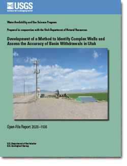
Development of a method to identify complex wells and assess the accuracy of basin withdrawals in Utah
Power consumption coefficients (PCCs) and dedicated flowmeter records for irrigation wells in three Utah groundwater basins were analyzed to develop a method to better characterize the accuracy of annual groundwater withdrawal estimates. The PCC method has been used by the U.S. Geological Survey in Utah since 1963 as a way to estimate groundwater...
Gold, Brittany L.; Angeroth, Cory E.; Marston, Thomas M. Rethinking a groundwater flow system using a multiple-tracer geochemical approach: A case study in Moab-Spanish Valley, Utah
The Glen Canyon Group Aquifer (GCGA) is the sole source of public water supply for the city of Moab, Utah, a domestic and international tourist destination. Population and tourism growth are likely to target the GCGA for future water resources, but our analysis indicates that additional withdrawals would likely be sourced from groundwater storage...
Gardner, Philip M.; Nelson, Nora C.; Heilweil, Victor M.; Solder, John E.; Solomon, Douglas K.