Data and Tools
RTD- Remote Sensing
Remote Sensing and Landsat
The USGS, in coordination with NASA, operates and distributes data from Landsat satellites, and provides access to the longest continually acquired archive of space-based land remote sensing data. Information derived from Landsat data support government, commercial, industrial, civilian, military, and educational communities throughout the world.
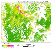
Near-Real-Time Cheatgrass Monitoring
The USGS Earth Resources Observation and Science (EROS) Center produces near-real-time estimates of annual herbaceous land cover for the Great Basin, Snake River Plain, Wyoming, and contiguous areas in the United States. Estimates are based on enhanced Moderate Resolution Imaging Spectroradiometer (eMODIS) Normalized Difference Vegetation Index (NDVI) data at 250-meter resolution.
Famine Early Warning Systems Network (FEWS NET)
The USGS FEWS NET Data Portal provides access to geo-spatial data, satellite image products, and derived data products in support of FEWS NET drought monitoring efforts throughout the world. This portal is provided by the USGS FEWS NET Project, part of the Early Warning Focus Area at the USGS Earth Resources Observation and Science (EROS) Center.
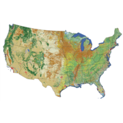
National Land Cover Database (NLCD)
The National Land Cover Database (NLCD) provides nation-wide data on land cover and land cover change at the Landsat Thematic Mapper (TM) 30-meter resolution. NLCD provides spatial reference and descriptive data for characteristics of the land surface such as thematic class (e.g., urban, agriculture, and forest), percent impervious surface, and percent tree canopy cover.
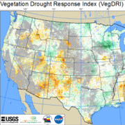
Vegetation Drought Response Index (VegDRI)
The VegDRI and QuickDRI are complementary drought monitoring tools that show drought patterns at relatively high spatial detail compared to traditional drought indicators.
Find and Access Data at EROS
The EROS data archive contains a vast array of satellite imagery, aerial photos, digitized maps, elevation and land cover products, and much more. Most are easily downloadable via the internet.


