
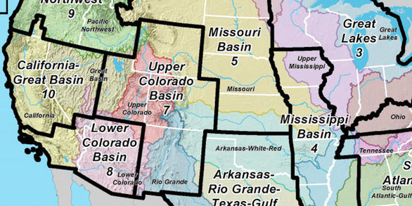
Unified Interior Regions
Region 7: Upper Colorado Basin
Map of Region 7 Upper Colorado River Basin
Map Showing USGS/DOI Unified Region 7 and parts of adjoining Regions
Key USGS Region 7 Upper Colorado Basin Contacts
Regional Director (Acting)-Peter Griffiths
Associate Regional Director, Operations-Peter Griffiths
USGS Region 7 Upper Colorado Basin Offices and Science Centers
Regions L2 Landing Page Tabs
The DOI Unified Region 7 - Upper Colorado Basin includes Wyoming, Utah, Colorado, and New Mexico. The data, information, analyses, and tools developed by the USGS support land managers in making decisions on the landscape. USGS Science Centers in the Region conduct multi- and interdisciplinary research and monitoring related to natural resources, ecology, and natural hazards.
News

Invasive Brown Treesnake Present on Cocos Island, Agencies Working to Prevent Further Spread
For the first time, an invasive brown treesnake population has been found on Cocos Island, an 83.1 acre atoll located 1.5 miles off the southwest coast of Guam.

Now Trending…Earthquakes
The earth isn’t the only thing shaking after an earthquake.

USGS Estimates Undiscovered Oil and Gas Resources in the Austin Chalk Formation of the U.S. Gulf Coast
The Austin Chalk and Tokio and Eutaw Formations of the Gulf Coast Basin contain a mean of 6.9 billion barrels of oil and 41.5 trillion cubic feet of natural gas according to a new assessment by the U.S. Geological Survey. In comparison, the U.S. Energy Information Administration estimates that the United States used 7.5 billion barrels of petroleum products in 2019.
Publications

Quantifying model structural uncertainty using airborne electromagnetic data
The ability to quantify structural uncertainty in geological models that incorporate geophysical data is affected by two primary sources of uncertainty: geophysical parameter uncertainty and uncertainty in the relationship between geophysical parameters and geological properties of interest. Here, we introduce an open-source, trans-dimensional...
Minsley, Burke J.; Foks, N. Leon; Bedrosian, Paul A.
Structure contour and isopach maps of the Wolfcamp shale and Bone Spring Formation of the Delaware Basin, Permian Basin Province, New Mexico and Texas
A series of structure contour and isopach maps for the Wolfcamp shale and the Bone Spring Formation of the Delaware Basin, Permian Basin Province, were generated in support of the U.S. Geological Survey 2018 assessment of undiscovered continuous oil and gas resources. The interpreted formation tops used to generate the maps are from the IHS Markit...
Gaswirth, Stephanie B.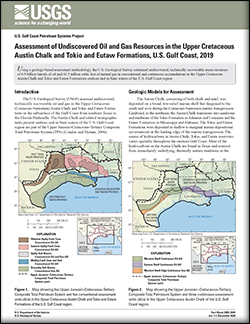
Assessment of undiscovered oil and gas resources in the Upper Cretaceous Austin Chalk and Tokio and Eutaw Formations, U.S. Gulf Coast, 2019
Using a geology-based assessment methodology, the U.S. Geological Survey estimated undiscovered, technically recoverable mean resources of 6.9 billion barrels of oil and 41.5 trillion cubic feet of natural gas in conventional and continuous accumulations in the Upper Cretaceous Austin Chalk and Tokio and Eutaw Formations onshore and in State...
Pitman, Janet K.; Paxton, Stanley T.; Kinney, Scott A.; Whidden, Katherine J.; Haines, Seth S.; Varela, Brian A.; Mercier, Tracey J.; Woodall, Cheryl A.; Schenk, Christopher J.; Leathers-Miller, Heidi M.; Pearson, Ofori N.; Burke, Lauri A.; Le, Phuong A.; Birdwell, Justin E.; Gianoutsos, Nicholas J.; French, Katherine L.; Drake, Ronald M.; Finn, Thomas M.; Ellis, Geoffrey S.; Gaswirth, Stephanie B.; Marra, Kristen R.; Tennyson, Marilyn E.; Shorten, Chilisa M.USGS Science Centers in Region 7-Upper Colorado Basin conduct a large number of cooperative and collaborative projects with other agencies and partners. A sampling of those projects are shown below on this web page.

USMIN Mineral Deposit Database
Our objective is to develop a national-scale, geospatial database that is the authoritative source of the most important mines, mineral deposits, and mineral districts of the United States.

Isotope and Chemical Methods for Mineral and Geoenvironmental Assessments and Support of USGS Science Strategy
This Project integrates several geochemical tools—stable isotope geochemistry, noble gas geochemistry, active gas geochemistry, single fluid inclusion chemistry, and fluid inclusion solute chemistry—in studies of the processes that form mineral deposits and the processes that disrupt them during mining or natural weathering. Research is directed toward fundamental scientific questions or, in...

National Geochemical Database
The National Geochemical Database project assembles, reformats, corrects, and archives historical data obtained from the geochemical analysis of millions of geologic samples collected for USGS studies. These data, representing hundreds of millions of dollars' worth of USGS research, are provided to USGS researchers; other Federal agencies; State Geological Surveys and Environmental Protection...

Spectroscopy and Hyperspectral Imaging of Critical Mineral Resources
Our project will characterize the primary critical minerals (minerals that contain critical elements in their base structure) that are not yet in the USGS Spectral Library. We propose to increase understanding of the spectral indicators of critical minerals using lab-based studies of hand specimens and drill core, hyperspectral field...

Non-Traditional Stable Isotopes
Understanding the genesis of ore deposits and their behavior in the environment is a subject of great importance to the Nation. A relatively new tool to aid in these efforts to investigate the origin and environmental effects of ore deposits is the use of "heavy" metal stable isotopes. Our research objectives are to utilize various isotopic systems to advance our understanding of ore genesis...

Metal Transport in Mineralized Mountain Watersheds
The central objective of this project is to develop a greater understanding of deep bedrock groundwater circulation and its contribution to surface water metal loads in mineralized mountain blocks composed of sedimentary rocks. This work is being performed in cooperation with Lawrence Berkeley National Laboratory as part of a broader research program aimed at understanding processes...

Integrated Hyperspectral, Geophysical and Geochemical Studies of Yellowstone National Park Hydrothermal Systems
We are researching the subsurface groundwater flow systems in Yellowstone and the relation of these systems to understanding the regional movement of water in a volcanic center. New geophysical data will be integrated with existing data sets from hyperspectral data from Yellowstone's thermal areas and thermal water geochemistry to help define regionally extensive mineral assemblages, the...

Quantitative Disease Ecology
Researchers at the USGS are working on developing new quantitative methods to study disease dynamics in wildlife systems as well as systems at the wildlife-domestic-human interface. Much of our work focuses on how host population structure affects disease invasion, persistence and control in wildlife disease systems. We tackle these issues with a combination of simulation and statistical...

Critical Elements in Carbonatites: From Exploration Targets to Element Distribution
Critical elements are essential to the modern economy and have potential supply chain disruptions, but compared to most base and precious metals, little work has been done in understanding ore-grade enrichments. Carbonatites are the primary source of the worlds light rare earth elements and niobium, and a potential source for heavy rare earths, scandium, tantalum, and thorium. Project...

Microbial Source Tracking and Escherichia coli Monitoring in the Rio Grande in the South Valley, Albuquerque, New Mexico
The Rio Grande, in southern Albuquerque, is an impaired reach for bacteria. Escherichia coli (E. coli) bacteria are elevated in this reach of the Rio Grande even without stormwater present, during what is referred to as “dry season”. Samples will be collected over a range of flows including during the dry season (November 1st-June30th). Water samples will be analyzed for E. coli and microbial...

Denali National Park Geohazards Geologic Mapping
Denali National Park (DENA) is a major draw for tourism and recreation and a major economic engine for central Alaska. However, the geologic forces that created the steep landscape of DENA also make it prone to geologic hazards (geohazards) like landslides, debris flows, and earthquakes. DENA has only one major road, called the ‘Park Road’, that serves nearly all of its infrastructure.
...

A Shallow to Deep View Inside the Hydrothermally Altered and Mineralized Silverton Caldera Complex: New Geologic Insights Gained From Modern Geophysical Interpretations
The Silverton caldera complex in southwest Colorado hosts base and precious metals that have been mined since the late 1800s. Extensive mine workings, excellent bedrock exposures, and deeply incised drainages make this area a natural laboratory ideally suited for furthering our understanding of the mineral systems in a volcanic environment. In addition, state-of-the-art geophysical...
USGS Science Centers in Region 7-Upper Colorado Basin collect a wide variety of natural resource data types including spatial, geologic, hydrologic, and biologic data. Data included in USGS-series publications that are not publically available in USGS databases are published in Data Releases. Tools are USGS products that can be used to analyze those types of data.
 - Black (TM)")
Bayesian modeling of NURE airborne radiometric data for the conterminous United States: predictions and grids
This data release includes estimates of potassium (K), equivalent uranium (eU), and equivalent thorium (eTh) for the conterminous United States derived from the U.S. Geological Survey's (USGS) national airborne radiometric data compilation (Duval and others, 2005). Airborne gamma ray spectrometry (AGRS) measures the gamma-rays that are emitted from naturally occurr
Influence of wildfire and beetle-caused canopy mortality on water temperature regimes in cutthroat trout streams, Rocky Mountain National Park, CO.
This dataset was collected to build on past and ongoing monitoring and research efforts within Colorado’s Rocky Mountain National Park (RMNP). Specifically, the data were collected to test the hypothesis that reductions in canopy cover due to natural disturbances (i.e. wildfire and beetle kill) result in increases in water temperature, or the longitudinal thermal gradient of a
Landscape inputs and simulation output for the LANDIS-II model in the Greater Yellowstone Ecosystem
This data release provides inputs needed to run the LANDIS-II landscape change model, NECN and Base Fire extensions for the Greater Yellowstone Ecosystem (GYE), USA, and simulation results that underlie figures and analysis in the accompanying publication. We ran LANDIS-II simulations for 112 years, from 1988-2100, using interpolated weather station data for 1988-2015 and downscale
Hydrologic and geophysical data from high-elevation boreholes in Redwell Basin near Crested Butte, Colorado: Hydraulic test data
Boreholes were drilled in 2017 and 2018 in Redwell Basin, a headwater catchment underlain by mineralized and hydrothermally altered sedimentary rock in the Elk Mountains near the town of Crested Butte, Colorado. Site locations and well construction are documented under the main page of this data release. Hydraulic data were acquired during drilling and on core samples to estimate the hydrauli...
Data release for: Spatially explicit reconstruction of post-megafire forest recovery through landscape modeling
This data release provides inputs needed to run the LANDIS PRO forest landscape model and the LINKAGES 3.0 ecosystem process model for the area burned by the Black Dragon Fire in northeast China in 1987, and simulation results that underlie figures and analysis in the accompanying publication. The data release includes the fire perimeter of Great Dragon Fire; input data for LINKAGES including...
Data release for Accounting for Land in the United States: Integrating Physical Land Cover, Land Use, and Monetary Valuation
Land plays a critical role in both economic and environmental accounting. As an asset, it occupies a unique position at the intersection of the System of National Accounts (SNA), the System of Environmental-Economic Accounting Central Framework (SEEA-CF), and (as a spatial unit) SEEA Experimental Ecosystem Accounting (SEEA-EEA), making land a natural starting point for dev
Data release for tracking rates of post-fire conifer regeneration distinct from deciduous vegetation recovery across the western U.S.
Post-fire shifts in vegetation composition will have broad ecological impacts. However, information characterizing post-fire recovery patterns and their drivers are lacking over large spatial extents. In this analysis we used Landsat imagery collected when snow cover (SCS) was present, in combination with growing season (GS) imagery, to distinguish evergreen vegetation from deciduou
Elevation of top of Precambrian rocks from previous USGS studies of the Colorado Plateau
For use as part of a regional petroleum assessment, the USGS in the early 1990’s developed a dataset reporting elevation on the surface of the Precambrian basement of the central and southern Colorado Plateau and vicinity (Butler, 1991). This dataset was released as paper report that included a table of basement elevations at more than 3,700 control points, including outcrop d
Data release for Integrating physical and economic data into experimental water accounts for the United States: lessons and opportunities
Water provides society with economic benefits that increasingly involve tradeoffs, making accounting for water quality, quantity, and their corresponding economic productivity more relevant in our interconnected world. In the past, physical and economic data about water have been fragmented, but integration is becoming more widely adopted internationally through application of the Syste
Environmental tracer data from surface water and groundwater samples collected in Redwell Basin near Crested Butte, Colorado, 2017-2019
This dataset contains environmental tracer data from surface water and groundwater samples collected by the U.S. Geological Survey in Redwell Basin, an alpine watershed in the Elk Mountains near the town of Crested Butte, Colorado. The basin is underlain by interbedded shale and sandstone that have been variably hydrothermally altered and silicified by local magmatic intrusions. Samples were...
Geochemical data for alkaline igneous rock units in the Cripple Creek district, Colorado USA: 1989-2016
This data release includes new major and trace element geochemical data acquired by the U.S. Geological Survey (USGS) for igneous rocks in the Cripple Creek district in Colorado. Cripple Creek is among the largest epithermal districts in the world, with more than 800 metric tons (t) Au (>26.4 Moz). The ores are associated spatially, temporally, and genetically with ~34 to 28
Optically Stimulated Luminescence (OSL) data and ages for selected Native American Sacred Ceremonial Stone Landscape features--Final Project Report Submitted to the Narragansett Tribal Historic Preservation Trust
Stone rows, enclosures, structures and chambers can be found in the landscapes of Massachusetts and Rhode Island. Structures similar to those shown in the cover photo are documented elsewhere. The age, cultural affiliation, and purpose of these stone structures--which are found in a variety of forms, such as piles arranged in spatial configurations across landscapes, shapes suggesting
This Maps web page contains descriptions of and links to USGS topographic maps, the National Map, and other types of maps that are not official USGS publication series, including online interactive maps related to Region 7-Upper Colorado Basin. To access USGS publications series maps related to Region 7, please visit the Publications page of this web site.

This map shows the provinces assessed by the USGS for undiscovered oil and gas resources.

The USGS monitors current streamflow and water-quality conditions at various sites in the Animas and San Juan River Basins in Colorado, New Mexico, and Utah, including areas below the Gold King Mine release area. These streamgages provide continuous data on streamflow and select water-quality constituents including specific conductance, water temperature, pH, and turbidity.

The areal and vertical location of the major aquifers is fundamental to the determination of groundwater availability for the Nation. The map, which is derived from the Ground Water Atlas of the United States, indicates the areal extent of the uppermost principal aquifers on a national scale.

StreamStats version 4 is a Web application that provides access to an assortment of Geographic Information Systems (GIS) analytical tools that are useful for water-resources planning and management, and for engineering and design purposes.

These geospatial data are provided to the public to aid in the understanding of the geologic resources of New Mexico.

The National Map is a collaborative effort among the USGS and other Federal, State, and local partners to improve and deliver topographic information for the Nation. It has many uses ranging from recreation to scientific analysis to emergency response. The National Map is easily accessible for display on the Web, as products and services, and as downloadable data.
Topographic maps are a signature product of the USGS. They were essential for integrating and analyzing place-based information, and were widely used by receationalists. After 125-year legacy of topographic mapping (1884-2009), the USGS embarked on an innovative future of integrating historical maps with computer-generated maps from a national geographical information system (GIS) database.

Digital map of aquifer boundary for the High Plains aquifer in parts of Colorado, Kansas, Nebraska, New Mexico, Oklahoma, South Dakota, Texas, and Wyoming - This digital data set represents the extent of the High Plains aquifer in the central United States

The map-based user interface can be used to delineate drainage areas, get basin characteristics and estimates of flow statistics, and more.
Funding partners: Colorado Department of Transportation and Colorado Water Conservation Board

The 3DEP products and services available through The National Map consist of standard digital elevation models (DEMs) at various horizontal resolutions, elevation source and associated datasets, an elevation point query service and bulk point query service. All 3DEP products are available, free of charge and without use restrictions.

The location of the 188 streamgages used to develop the peak-streamflow equations, of which 44 streamgages have paleoflood or non-exceedance bound data.

An easy-to-use, Web-based geodatabase of historical flood and paleoflood information which includes links to sources of flood data. The interface makes this collection of information useful to water-resource managers to better understand the historic events for improved flood-frequency estimates of the largest floods in Colorado.
USGS Science Centers in Region 7-Upper Colorado Basin produce hundreds of USGS-series publications, journal papers, and books each year that are subject to rigorous review by USGS specialists. The publications shown below on this page are related to study areas and staff members of USGS Science Centers in Region 7 compiled from the USGS Publications Warehouse.
Quantifying model structural uncertainty using airborne electromagnetic data
The ability to quantify structural uncertainty in geological models that incorporate geophysical data is affected by two primary sources of uncertainty: geophysical parameter uncertainty and uncertainty in the relationship between geophysical parameters and geological properties of interest. Here, we introduce an open-source, trans-dimensional...
Minsley, Burke J.; Foks, N. Leon; Bedrosian, Paul A. Structure contour and isopach maps of the Wolfcamp shale and Bone Spring Formation of the Delaware Basin, Permian Basin Province, New Mexico and Texas
A series of structure contour and isopach maps for the Wolfcamp shale and the Bone Spring Formation of the Delaware Basin, Permian Basin Province, were generated in support of the U.S. Geological Survey 2018 assessment of undiscovered continuous oil and gas resources. The interpreted formation tops used to generate the maps are from the IHS Markit...
Gaswirth, Stephanie B. Assessment of undiscovered oil and gas resources in the Upper Cretaceous Austin Chalk and Tokio and Eutaw Formations, U.S. Gulf Coast, 2019
Using a geology-based assessment methodology, the U.S. Geological Survey estimated undiscovered, technically recoverable mean resources of 6.9 billion barrels of oil and 41.5 trillion cubic feet of natural gas in conventional and continuous accumulations in the Upper Cretaceous Austin Chalk and Tokio and Eutaw Formations onshore and in State...
Pitman, Janet K.; Paxton, Stanley T.; Kinney, Scott A.; Whidden, Katherine J.; Haines, Seth S.; Varela, Brian A.; Mercier, Tracey J.; Woodall, Cheryl A.; Schenk, Christopher J.; Leathers-Miller, Heidi M.; Pearson, Ofori N.; Burke, Lauri A.; Le, Phuong A.; Birdwell, Justin E.; Gianoutsos, Nicholas J.; French, Katherine L.; Drake, Ronald M.; Finn, Thomas M.; Ellis, Geoffrey S.; Gaswirth, Stephanie B.; Marra, Kristen R.; Tennyson, Marilyn E.; Shorten, Chilisa M.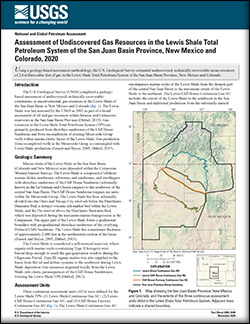
Assessment of undiscovered gas resources in the Lewis Shale Total Petroleum System of the San Juan Basin Province, New Mexico and Colorado, 2020
Using a geology-based assessment methodology, the U.S. Geological Survey estimated undiscovered, technically recoverable mean resources of 2.6 trillion cubic feet of gas in the Lewis Shale Total Petroleum System of the San Juan Basin Province, New Mexico and Colorado.
Marra, Kristen R.; Schenk, Christopher J.; Mercier, Tracey J.; Leathers-Miller, Heidi M.; Tennyson, Marilyn E.; Finn, Thomas M.; Woodall, Cheryl A.; Brownfield, Michael E.; Le, Phuong A.; Drake, Ronald M.
Assessment of undiscovered gas resources of the Fruitland Total Petroleum System, San Juan Basin Province, New Mexico and Colorado, 2020
Using a geology-based assessment methodology, the U.S. Geological Survey estimated undiscovered, technically recoverable mean resources of 39 trillion cubic feet of gas within continuous and conventional reservoirs of the Fruitland Total Petroleum System in the San Juan Basin Province, New Mexico and Colorado.
Marra, Kristen R.; Schenk, Christopher J.; Mercier, Tracey J.; Leathers-Miller, Heidi M.; Tennyson, Marilyn E.; Finn, Thomas M.; Woodall, Cheryl A.; Brownfield, Michael E.; Le, Phuong A.; Drake, Ronald M.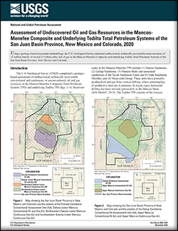
Assessment of undiscovered oil and gas resources in the Mancos-Menefee composite and underlying Todilto Total Petroleum Systems of the San Juan Basin Province, New Mexico and Colorado, 2020
Using a geology-based assessment methodology, the U.S. Geological Survey estimated undiscovered, technically recoverable mean resources of 12 million barrels of oil and 27 trillion cubic feet of gas in the Mancos-Menefee Composite and underlying Todilto Total Petroleum Systems of the San Juan Basin Province, New Mexico and Colorado.
Marra, Kristen R.; Schenk, Christopher J.; Mercier, Tracey J.; Leathers-Miller, Heidi M.; Tennyson, Marilyn E.; Finn, Thomas M.; Woodall, Cheryl A.; Brownfield, Michael E.; Le, Phuong A.; Drake, Ronald M.
Optimization assessment of a groundwater-level observation network in the Middle Rio Grande Basin, New Mexico
The U.S. Geological Survey, in cooperation with the Albuquerque Bernalillo County Water Utility Authority (ABCWUA), measures groundwater levels continuously (hourly) and discretely (semiannually and annually) at a network of wells and piezometers (hereafter called the observation network) within the Middle Rio Grande Basin in central New Mexico....
Ritchie, Andre B.; Pepin, Jeff D. Geochemistry and age of groundwater in the Williston Basin, USA: Assessing potential effects of shale-oil production on groundwater quality
Thirty water wells were sampled in 2018 to understand the geochemistry and age of groundwater in the Williston Basin and assess potential effects of shale-oil production from the Three Forks-Bakken petroleum system (TBPS) on groundwater quality. Two geochemical groups are identified using hierarchical cluster analysis. Group 1 represents the...
McMahon, Peter B.; Galloway, Joel M.; Hunt, Andrew; Belitz, Kenneth; Jurgens, Bryant; Johnson, Tyler D.
Assessment of undiscovered conventional oil and gas resources of Southeast Asia, 2020
Using a geology-based assessment methodology, the U.S. Geological Survey estimated undiscovered, technically recoverable mean resources of 10.5 billion barrels of oil and 271.5 trillion cubic feet of gas within 33 geologic provinces of Southeast Asia.
Schenk, Christopher J.; Mercier, Tracey J.; Woodall, Cheryl A.; Finn, Thomas M.; Le, Phuong A.; Marra, Kristen R.; Leathers-Miller, Heidi M.; Drake, Ronald M. Increased burning in a warming climate reduces carbon uptake in the Greater Yellowstone Ecosystem despite productivity gains
1. The effects of changing climate and disturbance on mountain forest carbon stocks vary with tree species distributions and over elevational gradients. Warming can increase carbon uptake by stimulating productivity at high elevations but also enhance carbon release by increasing respiration and the frequency, intensity, and size of wildfires.2....
Henne, Paul D.; Hawbaker, Todd J.; Scheller, Robert M.; Zhao, Feng S; He, Hong S; Xu, Wenru; Zhu, Zhiliang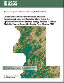
Landscape and climatic influences on actual evapotranspiration and available water using the Operational Simplified Surface Energy Balance (SSEBop) Model in eastern Bernalillo County, New Mexico, 2015
The U.S. Geological Survey, in cooperation with the Bernalillo County Public Works Division, conducted a 1-year study in 2015 to assess the spatial and temporal distribution of evapotranspiration (ET) and available water within the East Mountain area in Bernalillo County, New Mexico. ET and available water vary spatiotemporally because of complex...
Douglas-Mankin, Kyle R.; McCutcheon, Ryan J.; Mitchell, Aurelia C.; Senay, Gabriel B. Generalizing the inversion‐based PSHA source model for an interconnected fault system
This article represents a step toward generalizing and simplifying the procedure for constructing an inversion‐based seismic hazard source model for an interconnected fault system, including the specification of adjustable segmentation constraints. A very simple example is used to maximize understandability and to counter the notion that an...
Field, Edward H.; Milner, Kevin R.; Page, Morgan T.This web page has descriptions of and links to computer programs that may be downloaded online. To view USGS-series publications related to software, please visit the publications page of this website.
Various projects on the USGS's public GitHub.

The software and related documentation on these Web pages were developed by the U.S. Geological Survey (USGS) for use by the USGS in fulfilling its mission. The software can be used, copied, modified, and distributed without any fee or cost.
The is a useful tool designed to facilitate FGDC metadata creation for spatial and non-spatial data sets. It is a cross-platform desktop application built using an open-source Python architecture.

The transit-loss accounting program, which has been in continuous daily use in some form since April 1989, has provided water-rights administrators with a tool to effectively manage RRFs and administer water diversion priorities along Fountain Creek on a daily basis.
Smart River GIS allows simultaneous views of river hydraulics, species-specific habitat, and fish population simulations, for a better understanding of complex ecological interactions. We used existing data sets from the South Platte River in Colorado to develop a multi-layered geographic information system (GIS) that resource managers can use to improve their understanding of river ecosystems.
CloseTest is a Windows program for testing capture-recapture data
Photos and videos described and linked on this webpage come from a wide variety of USGS science activities and presentations performed by USGS Science Center staff members in the Region 7-Upper Colorado Basin.

Scientist holding brown treesnake
A USGS scientist holds an invasive brown treesnake.

Austin Chalk Core
Bedding features in the core from the USGS Gulf Coast #4 Bonham borehole, in the Eagle Ford Group mudstones from a depth of about 401 feet, Fannin County, Texas. The Eagle Ford Group lies underneath the Austin Chalk and serves as the source rock for much of the Austin Chalk's petroleum.

USGS Technicians Prepare to Take a Core of the Austin Chalk in Texas
USGS technicians at the USGS Gulf Coast #4 Bonham borehole in preparation for geophysical logging of the Austin Chalk Group and the Eagle Ford Group mudstones, Fannin County, Texas.

Yellowstone Volcano Observatory Monthly Update: January 2, 2020
Mike Poland, Scientist-in-Charge of the Yellowstone Volcano Observatory, gives an overview of activity at Yellowstone during 2019, with an emphasis on the month of December.

Map showing ice cover in the Yellowstone region
Map showing ice cover in the Yellowstone region. Light shaded areas bounded by black and red lines indicate areas covered during the Pinedale (about 20,000-15,000 years ago) and Bull Lake (about 150,000 years ago) glaciations, respectively. Blue lines are contours in thousands of feet on the maximum reconstructed Pinedale glacier surface. The circled numbers schematically
...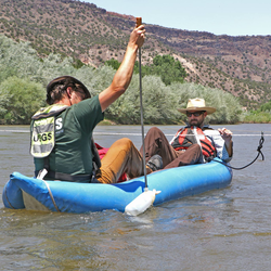
Sampling Suspended-sediment Concentration
Tyson Hatch and Fletcher Brinkerhoff sampling suspended-sediment concentration upstream of the Buckman Diversion for the city of Santa Fe on the Rio Grande (08313150 Rio Grande above Buckman Diversion, near White Rock, NM)

Collaborating on Climate Adaptation
RAMPS expands drought adaptation project with national parks in the 4-Corners area. National parks across the desert Southwest are experiencing ecological impacts due to climate change. Since late 2018, USGS RAMPS scientists have been working with Southeast Utah Group of national parks to better understand climate change impacts and build a suite of science-driven
...
Yellowstone Volcano Observatory Monthly Update: December 2, 2019
Mike Poland, Scientist-in-Charge of the Yellowstone Volcano Observatory, describes activity at Yellowstone during the month of November 2019.

Photomicrographs from a Great-Horned Owl
Photomicrographs from a Great-Horned Owl showing (A) moderate acute hemorrhage in the right atrial epicardium extending into the myocardium and (B) a focally extensive area of coagulative necrosis of the epidermis and dermis (arrow) consistent with an electrical burn.
Managing Fire on the US Mexico Borderlands
RAMPS met with DOI Office of Wildland Fire, US Customs and Border Patrol, and US Fish & Wildlife Service staff at Buenos Aires National Wildlife Refuge in southern AZ last November. The group is developing tools to reduce wildfire risk, conserve wildlife habitat and natural resources, and increase safety and security of border operations.
...
Yellowstone Volcano Observatory Monthly Update: November 1, 2019
Mike Poland, Scientist-in-Charge of the Yellowstone Volcano Observatory, describes activity at Yellowstone during the month of October 2019

Earth as Art 6
The Earth As Art project began in the early 2000s, and its original intent remains the same: to produce images that do not look like satellite images at first glance. Earth As Art shows not only what satellites capture in the visible wavelengths of light you and I can see, but also what’s hiding in the invisible wavelengths that Landsat sensors can detect in the infrared
News items shown on this page are highlights of selected studies conducted and publications produced by USGS Science Center staff members in Region 7-Upper Colorado Basin.
For the first time, an invasive brown treesnake population has been found on Cocos Island, an 83.1 acre atoll located 1.5 miles off the southwest coast of Guam.
The earth isn’t the only thing shaking after an earthquake.
The Austin Chalk and Tokio and Eutaw Formations of the Gulf Coast Basin contain a mean of 6.9 billion barrels of oil and 41.5 trillion cubic feet of natural gas according to a new assessment by the U.S. Geological Survey. In comparison, the U.S. Energy Information Administration estimates that the United States used 7.5 billion barrels of petroleum products in 2019.

A total of $171,555 will fund new research and preserve important data across the Centennial State
A total of $133,000 will fund new research and preserve important data across the Land of Enchantment

The scarcity or overabundance of water presents some of the most dangerous, damaging and costly threats to human life, ecosystems and property in the form of drought, floods and debris flows.

This season's edition of the Restoration Assessment and Monitoring Program for the Southwest Newsletter contains recent program highlights including research updates, new projects, field updates and more.
To subscribe to our newsletter, please visit: https://listserv.usgs.gov/mailman/listinfo/ramps
Read more about how the network or RAMPS is enhancing restoration in drylands.

Washington – Today, the U.S. Geological Survey (USGS), U.S. National Park Service (NPS), U.S. Fish and Wildlife Service (FWS) and Conservancy of Southwest Florida announced they have teamed up to radio-track Burmese pythons in Big Cypress National Preserve, Crocodile Lake National Wildlife Refuge and other areas of Southwest Florida.

USGS Mineral Resources Program Highlights for the Summer 2020 Edition of the USGS Energy Quarterly Newsletter

A magnitude 7.4 earthquake struck offshore Oaxaca, Mexico, on June 23, 2020, at 11:30 a.m. ET. Seismic instruments indicate the earthquake originated at a depth of 16 miles (26 km).

Weighing costs relative to outcomes: woody and invasive plant removal followed by seeding in shrublands and woodlands.
New study by RAMPS researchers examines how the costs of vegetation treatments related to outcomes.
Find out more about how RAMPS supports land management decisions here.
This season's edition of the Restoration Assessment and Monitoring Program for the Southwest Newsletter contains recent program highlights including research updates from our RestoreNet experiment, recently awarded funding, field updates and more.
To subscribe to our newsletter, please visit: https://listserv.usgs.gov/mailman/listinfo/ramps
Get the latest updates from RAMPS here.
This page includes links to Social Media accounts (top of page), Science Centers (middle of page), and Regional Office staff members (bottom of page) of the USGS Region 7--Upper Colorado Basin.
Contacts
Locations

Region 7 - Upper Colorado Basin
rgonzales-schreiner@usgs.gov
Phone: 703-648-7200

NSF Ice Core Facility
Phone: 303-202-4830

New Mexico Water Science Center
Phone: (505) 830-7900
Fax: (505) 830-7998

Geosciences and Environmental Change Science Center
Phone: 303-236-5345

Utah Water Science Center
angeroth@usgs.gov
Phone: (801) 908-5000
Fax: (801) 908-5001

Colorado Water Science Center - Main Office
gs-w-codist_webmaster@usgs.gov
Phone: 303-236-6900
Fax: 303-236-4912

Wyoming-Montana Water Science Center - Cheyenne Office
Phone: (307) 778-2931
Fax: (307) 778-2764

National Geospatial Technical Operations Center - Denver, CO

Geology, Geophysics, and Geochemistry Science Center
Phone: 303-236-1800
Fax: 303-236-3200

Geologic Hazards Science Center
Phone: 303-273-8500
North Central Climate Adaptation Science Center

Fort Collins Science Center
Phone: 970-226-9100
Fax: 970-226-9230

Colorado Water Science Center - Southeast Colorado Office: Pueblo, CO
gs-w-codist_webmaster@usgs.gov
Phone: 719-562-2840
Fax: 719-544-2463

Colorado Water Science Center - Western Colorado Office: Grand Junction
gs-w-codist_webmaster@usgs.gov
Phone: 970-628-7150
Fax: 970-245-1026

National Earthquake Information Center
Phone: 303-273-8500

Yellowstone Volcano Observatory (YVO)
yvowebteam@usgs.gov
Phone: 360-993-8906

Spectroscopy Lab

Molecular Ecology Lab (MEL)
Phone: 970-226-9100
Fax: 970-226-9230

Denver Microbeam Laboratory

Albuquerque Seismological Laboratory

Moab Field Office
wilkowsk@usgs.gov
Phone: 435-259-4430
Fax: 435-259-5420
Salt Lake Field Office
sjgerner@usgs.gov
Phone: 801-908-5000
Fax: 801-908-5001

Wyoming-Montana Water Science Center - Casper Office
Phone: 307-261-5485
Fax: 307-261-5487

Wyoming-Montana Water Science Center - Riverton Office
Phone: 307-856-3771
Fax: 307-857-3165

Roswell Field Office
Phone: 575-627-0324
Fax: 575-646-7949

Southwest Biological Science Center - Moab, UT, Research Station
Phone: 435-259-3121

USGS Everglades Research Offices
Phone: 305-242-7834

Colorado Water Science Center - Durango Field Office
gs-w-codist_webmaster@usgs.gov
Phone: 970-247-4222
Fax: 970-247-4296

Jackson, Wyoming Field Research Station
Phone: 307-733-2314

Las Cruces Field Office
Phone: (575) 646-8129
Fax: (575) 646-7949

Cedar City Field Office
baslaugh@usgs.gov
Phone: 435-586-4543
Fax: 435-586-4557


USGS Denver Library
den_lib@usgs.gov
Phone: 303-236-1000
Fax: 303-236-1013

The Core Research Center
CRC@USGS.GOV
Phone: 303-202-4851
Fax: 303-202-4856
Social Media
USGS Science Centers in Region 7-Upper Colorado Basin conduct a large number of cooperative, co-funded science and monitoring projects with many other Federal, Tribal, State, and local agencies. Please scroll below to see the agencies with which those Science Centers currently have cooperative agreements.