
Requirements Capabilities & Analysis for Earth Observations
Home
The U.S. Geological Survey (USGS) National Land Imaging (NLI) Program is partnering with Federal agencies to document user requirements for Earth observation data and the benefits that these data provide to Federal programs.
RCA-EO was established to help the USGS and other agencies take fuller advantage of U.S. and international Earth observation capabilities, and develop requirements-driven, prioritized investment decisions for new EO systems, products, and services. What is and why do we need RCA-EO?

Requirements
Provide a comprehensive view of Federal science and operational needs for Earth observations
Capabilities
Provide a consolidated source of information about Earth observing capabilities and data
Analysis
Provide databases and tools to enable data-driven decision making by managers and practitioners
News

2019 Joint Agency Commercial Imagery Evaluation—Land remote sensing satellite compendium
The 2019 Joint Agency Commercial Imagery Evaluation— Land Remote Sensing Satellite Compendium, released June 17, 2019, is the sum of three years of data collection on the global status of Earth imaging satellite platforms.
Publications

Bundle adjustment using space based triangulation method for improving the Landsat global ground reference
There is an ever-increasing interest and need for accurate geo-registration of remotely sensed data products to a common global geometric reference. Although the geo-registration has improved significantly in the last decade, the lack of an accurate global ground reference dataset poses serious issues for data providers seeking to make...
Choate, Michael; Storey, James C.; Rengarajan, R.; Choate, Michael J.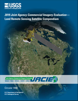
2019 Joint Agency Commercial Imagery Evaluation—Land remote sensing satellite compendium
The Joint Agency Commercial Imagery Evaluation (JACIE) is a collaboration between five Federal agencies that are major users and producers of satellite land remote sensing data. In recent years, the JACIE group has observed ever-increasing numbers of remote sensing satellites being launched. This rapidly growing wave of new systems creates a need...
Christopherson, Jon B.; Ramaseri Chandra, Shankar N.; Quanbeck, Joel Q.
National Land Imaging Requirements (NLIR) Pilot Project summary report: Summary of moderate resolution imaging user requirements
Under the National Land Imaging Requirements (NLIR) Project, the U.S. Geological Survey (USGS) is developing a functional capability to obtain, characterize, manage, maintain and prioritize all Earth observing (EO) land remote sensing user requirements. The goal is a better understanding of community needs that can be supported with land remote...
Vadnais, Carolyn; Stensaas, Gregory L.