
Earthquake Science Center
Home
The Earthquake Science Center in Menlo Park, California is the largest USGS research center in the West and houses extensive research laboratories, scientific infrastructure, and library facilities.
Our priority is to continue the important work of the Department of the Interior and the USGS, while also maintaining the health and safety of our employees and the community. Based on guidance from the White House, the CDC, and state and local authorities, we are shifting our operations to a virtual mode and have minimal staffing within our offices.
Earthquake Science Center Seminars

Seminars typically take place at 10:30 AM Wednesdays in the Rambo Auditorium (main USGS Conference Room). The USGS Campus is located at 345 Middlefield Road, Menlo Park, CA.
Browse SeminarsEarthquake Science Center Campus Video
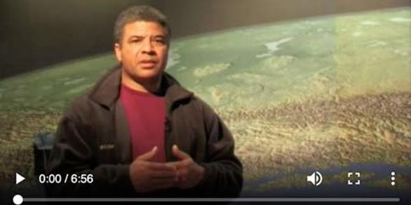
This short, 7-minute video gives an overview of the USGS Earthquake Science Center in Menlo Park, California. It briefly introduces you to the San Francisco Bay Area, shows the campus and facilities, and includes interviews with scientists.
View videoHandbooks to Help You Prepare for an Earthquake

USGS handbooks that describe the threat posed by earthquakes in the San Francisco Bay region and explain how you can prepare for, survive, and recover from these inevitable events.
View HandbooksNews

ShakeOut 2020: Staying Safe When the Ground Starts to Rumble
When the ground shakes, what do you do? ShakeOut 2020: Drop, Cover, and Hold On!

From Volcanoes to Vineyards - New Geologic Map Reveals Portland's Deep History
A new digital geologic map of the greater Portland-Vancouver-Hillsboro metropolitan area of Oregon and Washington being released today will support emergency response, conservation, agriculture and recreation.

Publications

Earthquake early warning in Aotearoa New Zealand: A survey of public perspectives to guide warning system development
Earthquake early warning (EEW) can be used to detect earthquakes and provide advanced notification of strong shaking, allowing pre-emptive actions to be taken that not only benefit infrastructure but reduce injuries and fatalities. Currently Aotearoa New Zealand does not have a nationwide EEW system, so a survey of the public was undertaken to...
Becker, Julia S.; Potter, Sally H.; Vinnel, Lauren; Nakayachi, Kazuya; McBride, Sara; Johnston, David A. Evaluation of seismic hazard models with fragile geologic features
We provide an overview of a 2019 workshop on the use of fragile geologic features (FGFs) to evaluate seismic hazard models. FGFs have been scarcely utilized in the evaluation of seismic hazard models, despite nearly 30 yr having passed since the first recognition of their potential value. Recently, several studies have begun to focus on the...
Stirling, Mark W.; Oskin, Mike; Arrowsmith, J. Ramon; Rood, Anna H.; Goulet, Christine A.; Grant Ludwig, Lisa; King, Tamarah; Kottke, Albert; Lozos, Julian C.; Madugo, Chris L M; McPhillips, Devin; Rood, Dylan; Sleep, Norman; Wittich, Christine Injection‐induced earthquakes near Milan, Kansas, controlled by Karstic Networks
Induced earthquakes from waste disposal operations in otherwise tectonically stable regions significantly increases seismic hazard. It remains unclear why injections induce large earthquakes on non‐optimally oriented faults kilometers below the injection horizon, particularly since fluids are not injected under pressure, but rather poured, into...
Joubert, Charlene; Sohrabi, Reza; Rubinstein, Justin; Jansen, Gunnar; Miller, Stephen A