
Caribbean-Florida Water Science Center (CFWSC)
Home
The CFWSC has an active presence in support of hydrologic research and monitoring across the Florida, Puerto Rico, and the U.S. Virgin Islands region. We look forward to expanding our work with partner organizations throughout this region and identifying new projects of mutual interest relevant to our water-resources. For questions related to water resources, please feel free to:
Latest Highlights
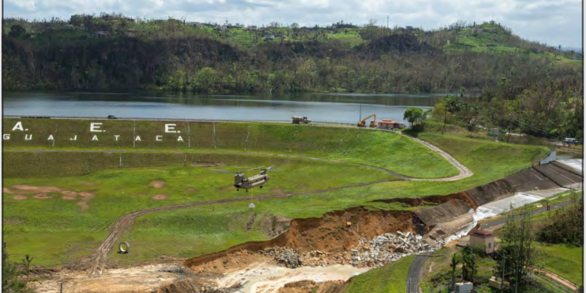
Publication: Monitoring Storm Tide, Flooding, and Precipitation From Hurricane Maria in Puerto Rico and the U.S. Virgin Islands, September 2017
Science HighlightsReal-Time/Historical Data

We provide current and historical surface-water, groundwater, water quality, water use, and ecological data in various formats.
Access DataNews

USGS Unveils Mobile Flood Tool for the Nation
The U.S. Geological Survey announced Friday the completion of a new mobile tool that provides real-time information on water levels, weather and flood forecasts all in one place on a computer, smartphone or other mobile device.

USGS Deploying Storm Tide Sensors Along Gulf Coast for Hurricane Delta
To learn more about USGS’s role in providing science to decision-makers before, during and after Hurricane Delta, visit the USGS Hurricane Delta page at www.usgs.gov/delta.

Bridging the Language Barrier During the Puerto Rico Earthquake
What happens when a 6.4 magnitude earthquake strikes Puerto Rico and the public needs critical information? How does a mostly English-speaking science agency reach a mostly Spanish-speaking public?
Publications

Measured and calculated nitrate and dissolved organic carbon concentrations and loads at the W.P. Franklin Lock and Dam, S-79, south Florida, 2014-17
The U.S. Geological Survey monitored dissolved nitrate plus nitrite as nitrogen (N) and dissolved organic carbon (DOC) concentrations and calculated loads of these constituents at the W.P. Franklin Lock and Dam (S-79) from April 2014 to December 2017. Flows from Lake Okeechobee controlled by S-77, S-78 and S-79 affect water quality in the...
Booth, Amanda
Pesticide mixtures show potential toxicity to aquatic life in U.S. streams, water years 2013-2017
During water years (WY) 2013–2017, the U.S. Geological Survey, National Water-Quality Assessment (NAWQA) Project, sampled the National Water Quality Network – Rivers and Streams (NWQN) year-round and reported on 221 pesticides at 72 sites across the United States in agricultural, developed, and mixed land use watersheds. The Pesticide Toxicity...
Covert, S. Alex.; Shoda, Megan E.; Stackpoole, Sarah M.; Stone, Wesley W.
The Everglades Depth Estimation Network (EDEN) surface-water interpolation model, version 3
The Everglades Depth Estimation Network (EDEN) is an integrated network of water-level gages, interpolation models that estimate daily water-level data at ungaged locations, and applications that generate derived hydrologic data across the freshwater part of the Greater Everglades landscape. Version 3 (V3) of the EDEN interpolation surface-...
Haider, Saira; Swain, Eric; Beerens, James; Petkewich, Matthew; McCloskey, Bryan; Henkel, Heather