National Land Imaging Program
Home
Our Nation’s economic security and environmental vitality rely on continuous monitoring of the Earth’s continents, islands, and coastal regions in order to record, study, and understand land change at local, regional, and global scales. The USGS National Land Imaging (NLI) Program helps meet this need.
Image of the Week
The western wall of Uzbekistan's Sardoba Reservoir breached on May 1st, 2020 after a week of heavy rain. Imagery from Landsat and Europe's Copernicus Sentinel-2 satellites tell the story of the impact.
Uzbekistan DamLandsat 9 Road to Launch
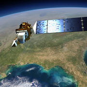
Launching in 2021, Landsat 9 is a partnership between NASA and the U.S. Geological Survey. Learn about the process of building Landsat 9 and how it will extend Landsat's unbroken record of our planet to over half a century.
Road to LaunchMore to Explore
Follow these links to learn more about our remote sensing research partnerships, how to access and download data, our image collections, news articles, and more.
News
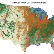
LCMAP Collection 1 Science Products Available for Download as Conterminous U.S. Mosaics
USGS Land Change Monitoring, Assessment and Projection (LCMAP) Collection 1 Science Products are now available as CONUS mosaics.
Landsat 9 Launch Delay Raises Questions about Science Data Acquisitions
The slipping of Landsat 9’s original launch readiness date from December 2020 to September 2021 brings with it uncertainty to the Landsat user community, but no real panic at this point.
USGS Supports the 2020 National Space Policy
In support of the President’s policy, USGS and NASA will leverage their full technological abilities to meet the nation’s growing environmental information needs.
Publications
Landsat Collection 2 geometric calibration updates
The U.S. Geological Survey (USGS) changed the management and delivery of Landsat products to the public in its archive through the implementation of Collections. The Collections process ensures consistent data quality through time and across all the Landsat sensors with a few modifications to the metadata. The consistent data products from...
Rengarajan, R.; Choate, Michael; Storey, James C.; Franks, Shannon; Micijevic, Esad2020 Joint Agency Commercial Imagery Evaluation—Remote sensing satellite compendium
The Joint Agency Commercial Imagery Evaluation (JACIE) is a collaboration between five Federal agencies that are major users and producers of satellite land remote sensing data. In recent years, the JACIE group has observed ever-increasing numbers of remote sensing satellites being launched. This rapidly growing wave of new systems creates a need...
Ramaseri Chandra, Shankar N.; Christopherson, Jon B.; Casey, Kimberly A.Economic valuation of landsat imagery
Landsat satellites have been operating since 1972, providing a continuous global record of the Earth’s land surface. The imagery is currently available at no cost through the U.S. Geological Survey (USGS). A previous USGS study estimated that Landsat imagery provided users an annual benefit of $2.19 billion in 2011, with U.S. users accounting for...
Straub, Crista L.; Koontz, Stephen R.; Loomis, John B.


