- Focus Area
- Tool Type
- Data Type
- Platform
Tools
Data alone is not enough. Use these tools to turn data into helpful information.

Data alone is not enough. Use these tools to turn data into helpful information.

Maps ecosystem services and their values for use in natural resource planning
Provides information on water quality, advisories, and closures for coastal and Great Lakes recreational waters

Access, view, and download beach nourishment data
Derives benthic terrain classifications from bathymetry

Serves as an interactive resource and database for ecosystem services valuation
View and explore coastal land cover and change data

Provides tools for emergency planning and response for a variety of all-hazard events—especially hazardous chemicals
Translates existing benthic habitat data sets to the Coastal and Marine Ecological Classification Standard (CMECS)

Provides statistics for the nation, all states and counties, and for cities and towns with a population of 5,000 or more

Submit and view water level reports, as well as map water levels regionally

Create a map of potential ecological, social, and economic impacts from rising seas and changing climate

Turn complex data into easy-to-understand stories, complete with charts and graphs

Maps people, places, and natural resources that are potentially exposed to coastal flooding

Create a map of potential ecological, social, and economic impacts from rising seas and changing climate
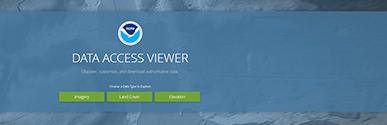
Find and download data hosted on the NOAA Office for Coastal Management website

Computes the rate of shoreline change using multiple historical shoreline positions

Helps users obtain and compare various ocean and Great Lakes economic data sets

Explore ecosystem goods and services with this interactive resource

Integrates static and real-time data in an easy-to-use map for environmental responders and decision-makers

Provides documents related to this program through text or map based queries

Display essential fish habitat boundaries and associated areas protected from fishing

View, retrieve, and analyze a wide range of estuarine data from multiple sources

View, analyze, and process lidar data sets

Provides hurricane and flood response data for significant events

Visualize, compare, and access spatial data that describes potential future environmental change

Interact with information relevant to Great Lakes coastal wetland conservation and management

Provides and visualizes Great Lakes water level data and forecasts across a variety of time scales
Climate and Resilience COP, EPA Gulf of Mexico Program, Gulf of Mexico Alliance, Northern Gulf of Mexico Sentinel Site Cooperative
Identify climate resilience tools that meet your needs

Analyze risk and potential losses from floods, hurricane winds, and earthquakes

View and analyze historical tropical cyclone data

Calculates the percentage of impervious surfaces for a selected geographic area

Streamlines the U.S. Fish and Wildlife Service’s environmental review process

Allows decision-makers to map and value goods and services from nature

Visualize potential lake level changes and impacts

Identifies suitable locations for planting native marsh grasses during coastal wetland restoration

Converts a collection of point features into a track line,

A collection of over 250 geoprocessing tools

Access offshore mineral resource data and information for the U.S. Outer Continental Shelf

Provides access to classification and spatial data for all marine protected areas

Supplies baseline ocean planning information

Supports conservation planning design and evaluation

Visualize county-level indicators and profiles for all 3,069 U.S. counties

Informs the environmental review process using geographically referenced data

Helps citizens increase their weather readiness as a part of NOAA's Weather-Ready Nation initiative

Provides real-time alerts and historical inundation information at select National Ocean Service tide stations

Features detailed information on U.S. nourishment projects at the national, state, and project levels

Identify and prioritize opportunities to protect and restore rare and threatened habitats in the Northeast

Helps assess proposed conservation projects by integrating conservation data with land use and resource management information

Constitutes a database of environmental and historic preservation statutes and other information on the protection of underwater cultural heritage on the outer continental shelf
Explore changes in marine species distributions

Visualize coastal and ocean information and generate custom reports for all U.S. waters

An interface for creating, viewing, printing, and downloading workforce-related maps, profiles, and underlying data

Measure potential runoff, nonpoint source pollution, and erosion

Explore the potential for coastal hazards from sea level rise, storms, and shoreline change along parts of California’s coastline

Access curated global data to analyze vulnerability and build climate resilience
Provides access to economic and demographic data for multiple coastal jurisdictions

Helps users properly install a rain garden at their home, office, or job site
Compare watershed indicators in a state-based Excel format, complete with maps, graphs, and tables

View riverine flood forecasts in a visual format
Explore Great Lakes science and monitoring activities

Simulates potential impacts on wetlands and shorelines from long-term sea level rise

Calculates predicted rates of sea level change

View potential impacts of sea level rise along the coast

Provides information on features and functions of multiple sea level rise visualization tools for California

View, query, and download volume and shoreline change data derived from comparing multiple lidar data sets

Create and analyze thematic maps of soil types and characteristics

Shows threats from sea level rise and storm surge for all coastal towns, cities, counties, and states in the contiguous U.S.

Provides interactive tsunami evacuation maps and information for Hawaii and Guam

Provides an inventory and information about the best available elevation data sets collected in the United States

Vertically transforms geospatial data between a variety of tidal, orthometric, and ellipsoidal datums

Estimates wave energy and its effects on ecosystem functions, as well as on developed coastal and inland-water areas

Explore and compare estuaries along the coastlines of Washington, Oregon, and California