- Home
- Programs and Services
- Aerial Photography
- ARC/PLC Program
- Commodity Operations
- Conservation Programs
- Cooperative Agreements
- Cotton Ginning Cost Share Program
- Dairy Margin Coverage Program
- Margin Protection Program for Dairy
- Disaster Assistance Programs
- Emergency Assistance for Livestock, Honey Bees, and Farm-raised Fish (ELAP)
- Emergency Forest Restoration Program (EFRP)
- Livestock Forage Program (LFP)
- Livestock Indemnity Program (LIP)
- Noninsured Crop Disaster Assistance Program (NAP)
- Tree Assistance Program (TAP)
- Loss Adjustment Standards Handbooks
- Disaster Designation Information
- 2017 Wildfires and Hurricanes Indemnity Program (WHIP)
- Economic and Policy Analysis
- Energy Programs
- Environmental and Cultural Resource Compliance
- Farm Bill Home
- Farm Loan Programs
- Financial Management Information
- Laws and Regulations
- Market Facilitation Program
- MIDAS
- Organic Certification Cost Share Program (OCCSP)
- Outreach and Education
- Payment Eligibility
- Price Support
- Initiatives
- About FSA
- Página Principal de FSA
- State Offices
- Alabama
- Alaska
- Arizona
- Arkansas
- California
- Colorado
- Connecticut
- Delaware
- Florida
- Georgia
- Hawaii & Pacific Basin
- Idaho
- Illinois
- Indiana
- Iowa
- Kansas
- Kentucky
- Louisiana
- Maine
- Maryland
- Massachusetts
- Michigan
- Minnesota
- Mississippi
- Missouri
- Montana
- Nebraska
- Nevada
- New Hampshire
- New Jersey
- New Mexico
- New York
- North Carolina
- North Dakota
- Ohio
- Oklahoma
- Oregon
- Pennsylvania
- Puerto Rico
- Rhode Island
- South Carolina
- South Dakota
- Tennessee
- Texas
- Virginia
- Virgin Islands
- Vermont
- Utah
- Washington
- West Virginia
- Wisconsin
- Wyoming
- Online Services
- Newsroom
- Home
- /Programs and Services
- /Aerial Photography
- /Imagery Products
Imagery Products
The Aerial Photography Field Office (APFO) has a vast amount of imagery of the United States and its territories from 1955 to the present. However, APFO does not maintain any shelf stock--all orders are produced upon request.
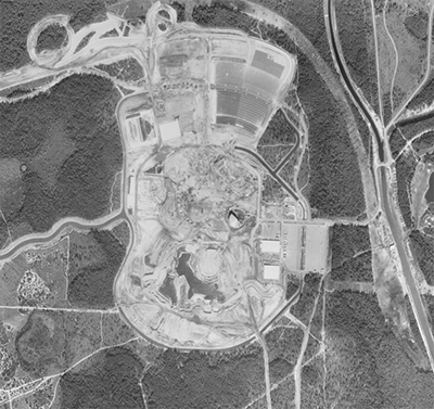
APFO offers 10"x10" scans of any image in our film library using state of the art photogrammetric scanners from Black and White, Color Infrared, and Natural Color film (see example below). Film scans are furnished in standard tagged image file (.tif) format. Standard scan resolution is 12.5 microns or 2136 dpi.
 |  |  |
| 1980 Black & White | 1998 Color Infrared | 2013 Natural Color |
Disney World & Epcot Center
PHOTO PRODUCTS
Photographs
Photographs can include custom line work such as roads or boundaries and are available in different types and scales ranging from 1" = 5,000' to 1" = 200'. Paper sizes range from 10"x10" to 30"x40". Metallic prints are also available which provide a silver luster to enhance colors and can be used to write on with dry erase marker only.
Indexes
Available as photo, line or spot indexes--most indexes are available in both print and digital format.
DIGITAL PRODUCTS
All digital aerial photographs are made from true digitally captured images or scanned from Color Positive (CP) or Color Infrared Positive (CIRP) film that include NAIP, NAPP, NHAP, and some Forest Service projects.
Compressed County Mosaics (CCM)
Countywide imagery coverage in various compressed ratios depending on the year. CCMs are used by the USDA Service Center Agencies for crop compliance farm programs and widely used by the public for base layer imagery. NAIP Compressed County Mosaics (CCM) may be obtained as free downloads from the USDA Geospatial Data Gateway. NAIP CCMs can also be purchased from the Aerial Photography Field Office if unable to download from the USDA Geospatial Data Gateway.
Quarter Quads (QQ)
Individual images (tile) covering one quarter of a standard 7.5' topographical quad map which are used to create the CCMs. These images are used for those who prefer working with an uncompressed format. Majority of NAIP imagery is available in 1m pixel resolution with some states and years prior to 2008 having 2m pixel resolution. As of 2013, 0.5m pixel resolution is available in limited states.
