- Home
- Programs and Services
- Aerial Photography
- ARC/PLC Program
- Commodity Operations
- Conservation Programs
- Cooperative Agreements
- Cotton Ginning Cost Share Program
- Dairy Margin Coverage Program
- Margin Protection Program for Dairy
- Disaster Assistance Programs
- Emergency Assistance for Livestock, Honey Bees, and Farm-raised Fish (ELAP)
- Emergency Forest Restoration Program (EFRP)
- Livestock Forage Program (LFP)
- Livestock Indemnity Program (LIP)
- Noninsured Crop Disaster Assistance Program (NAP)
- Tree Assistance Program (TAP)
- Loss Adjustment Standards Handbooks
- Disaster Designation Information
- 2017 Wildfires and Hurricanes Indemnity Program (WHIP)
- Economic and Policy Analysis
- Energy Programs
- Environmental and Cultural Resource Compliance
- Farm Bill Home
- Farm Loan Programs
- Financial Management Information
- Laws and Regulations
- Market Facilitation Program
- MIDAS
- Organic Certification Cost Share Program (OCCSP)
- Outreach and Education
- Payment Eligibility
- Price Support
- Initiatives
- About FSA
- Página Principal de FSA
- State Offices
- Alabama
- Alaska
- Arizona
- Arkansas
- California
- Colorado
- Connecticut
- Delaware
- Florida
- Georgia
- Hawaii & Pacific Basin
- Idaho
- Illinois
- Indiana
- Iowa
- Kansas
- Kentucky
- Louisiana
- Maine
- Maryland
- Massachusetts
- Michigan
- Minnesota
- Mississippi
- Missouri
- Montana
- Nebraska
- Nevada
- New Hampshire
- New Jersey
- New Mexico
- New York
- North Carolina
- North Dakota
- Ohio
- Oklahoma
- Oregon
- Pennsylvania
- Puerto Rico
- Rhode Island
- South Carolina
- South Dakota
- Tennessee
- Texas
- Virginia
- Virgin Islands
- Vermont
- Utah
- Washington
- West Virginia
- Wisconsin
- Wyoming
- Online Services
- Newsroom
- Home
- /Programs and Services
- /Aerial Photography
- /Status Maps
Status Maps
NAIP, NRI and Resource Information Maps
This web page contains current year data maps for the National Agriculture Imagery Program (NAIP), the National Resources Inventory (NRI), and the Resource flying programs.
Archived status maps are kept for the NAIP program only. To view these archived status maps, click here.
In the APFO Catalog Listing for NAIP, the second column (% COV) may state 100%, but coverage may in fact be less than complete.
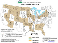
Use the Interactive NAIP 2002-2018 Coverage status map below for all NAIP years or Click here to download historical NAIP quarter quad or film photo center shape files for any given state. Look for NAIP QQ & Photocenter Shapefiles.

Please Note: Multi-layered PDF coverage map is readable from Acrobat 6.0 and above.
 Interactive NAIP 2002-2018” to “2002-2019 Coverage Map
Please Note: The National Resource Inventory (NRI) program acquires aerial photos of small 1/4 section sites nationwide. It is special purpose photography for government land-use studies and not available for reproduction or resale.
Resource Imagery Status
High resolution/large scale Resource Imagery is typically acquired for the U.S. Forest Service and other agencies for resource management, monitoring and inventory of land, minerals, vegetation, wildlife habitat, recreation, and travel etc. Imagery is typically collected in stereo for 3D viewing/analysis and often delivered in an orthorectified format as well.


