Physical Oceanography Division

Physical Oceanography

The Physical Oceanography Division is comprised of scientists, engineers, and technical support staff that aid NOAA’s mission by observing and studying ocean and climate dynamics, the physical drivers of ecosystem variability, and the impacts of natural and anthropogenic activities on marine resources. We study how ocean changes affect climate and marine ecosystems as well as coastal and inland communities. We also share and build on the current state of knowledge by maintaining valuable, long-term datasets of changes over time.

Visit the Physical Oceanography Division

Research Themes

Monitoring the Ocean Improves Hurricane Intensity Forecasts

Improvements in hurricane intensity forecasts for the Atlantic have lagged in comparison to hurricane track forecasts. Rapid hurricane intensification is often observed when tropical cyclones move over warm ocean features, given appropriate atmospheric conditions. AOML plays a key role in collecting and maintaining sustained ocean observations that monitor the thermal structure of these warm ocean features using drifters, Argo floats, XBTs, moorings, etc. Since 2014, sustained and targeted ocean observations have been gathered in support of hurricane intensity forecasts using underwater gliders.

Overturning Oceans & Societal Impacts

The overturning circulation is one of the primary ways that the oceans move heat, salt, carbon and nutrients throughout the global oceans. Achieving a more complete understanding of the behavior of the Atlantic Meridional (north/south) Overturning Circulation (AMOC) requires an observational network that spans the entire basin. Changes in the AMOC over time have a pronounced impact on a variety of socially important weather and climate phenomena, on the blue economy, and on commerce. AOML scientists have shown that these changes predict precipitation changes around the world.

Ocean Monitoring to Protect Marine Mammals and Manage Fisheries

Ship strikes are a major source of injury and death for critically endangered North Atlantic right whales. The Physical Oceanography Division has developed and currently hosts the Mandatory Ship Reporting System, which is operated by NOAA's National Marine Fisheries Service and the United States Coast Guard, to protect whales by reducing the number of ship strikes and improve overall maritime safety. AOML researchers also provide real-time ocean products that are used by NOAA's National Marine Fisheries Service to improve stock assessment and management of Atlantic bluefin tuna.

If You Like Your Weather Forecast, Thank an Oceanographer

AOML designs, implements, and maintains key components of the global ocean observing system. These ocean observations are a crucial component for weather and climate forecasts and outlooks. Variables that are typically observed are: temperature and heat content, ocean currents, eddies, and frontal regions, and salinity, surface pressure, and Meridional heat transport, and volume transport. Recent studies have shown that ocean in-situ observations in the Atlantic Ocean improve the forecast of Nor’easters more than any other observing platforms, including satellites. Without ocean observations, which provide initial and boundary conditions, weather forecasts would have large errors even at short 12-hours forecasts.

Oceanographers Help Improve Outlooks of U.S. Tornado Outbreaks

In 2013, AOML scientists found that the springtime El Niño-Southern Oscillation (ENSO) climate phenomenon generates large-scale atmospheric conditions that are conducive to intense tornado outbreaks in the United States. Since 2016, PHOD scientists have provided NOAA’s National Weather Service with a seasonal outlook for US regional tornado activity. This outlook is used as a forecast tool for the NOAA Climate Prediction Center’s experimental Seasonal Severe Weather Outlook.

Ocean Observations help Understand and Forecast extreme Weather Events

Scientist from the Physical Oceanography Division at NOAA/AOML designs, implements, and maintains key components of the global ocean observing system whose data are crucial for weather and climate forecasts. Without ocean observations, which provide initial and boundary conditions to forecast models, weather forecasts would have large errors. PHOD scientists are also working toward improving subseasonal to seasonal forecasts of extreme weather phenomena such as hurricanes, tornadoes and heat waves by using key ocean indicators and processes as the predictors.

Research Themes

Monitoring the Ocean Improves Hurricane Intensity Forecasts Hurricane Glider Project

Improvements in hurricane intensity forecasts for the Atlantic have lagged in comparison to hurricane track forecasts. Rapid hurricane intensification is often observed when tropical cyclones move over warm ocean features, given appropriate atmospheric conditions. AOML plays a key role in collecting and maintaining sustained ocean observations that monitor the thermal structure of these warm ocean features using drifters, Argo floats, XBTs, moorings, etc. Since 2014, sustained and targeted ocean observations have been gathered in support of hurricane intensity forecasts using underwater gliders.

Visit the Glider Project Page for more.

Overturning Oceans & Societal Impacts The Atlantic Meridional Overturning Circulation

The overturning circulation is one of the primary ways that the oceans move heat, salt, carbon and nutrients throughout the global oceans. Achieving a more complete understanding of the behavior of the Atlantic Meridional (north/south) Overturning Circulation (AMOC) requires an observational network that spans the entire basin. Changes in the AMOC over time have a pronounced impact on a variety of socially important weather and climate phenomena, on the blue economy, and on commerce. AOML scientists have shown that these changes predict precipitation changes around the world.

Ocean Monitoring To Protect Marine Mammals and Manage Fisheries

Ship strikes are a major source of injury and death for critically endangered North Atlantic right whales. The Physical Oceanography Division has developed and currently hosts the Mandatory Ship Reporting System, which is operated by NOAA’s National Marine Fisheries Service and the United States Coast Guard, to protect whales by reducing the number of ship strikes and improve overall maritime safety. AOML researchers also provide real-time ocean products that are used by NOAA’s National Marine Fisheries Service to improve stock assessment and management of Atlantic bluefin tuna.

Visit the Ocean Observations for a Sustainable Blue Economy Page

If You Like your Weather Forecast Thank an Oceanographer

AOML designs, implements, and maintains key components of the global ocean observing system. These ocean observations are a crucial component for weather and climate forecasts and outlooks. Variables that are typically observed are: temperature and heat content, ocean currents, eddies, and frontal regions, and salinity, surface pressure, and Meridional heat transport, and volume transport. Recent studies have shown that ocean in-situ observations in the Atlantic Ocean improve the forecast of Nor’easters more than any other observing platforms, including satellites. Without ocean observations, which provide initial and boundary conditions, weather forecasts would have large errors even at short 12-hours forecasts.

Oceanographers Help Improve Outlooks U.S. Tornado Outbreaks

In 2013, AOML scientists found that the springtime El Niño-Southern Oscillation (ENSO) climate phenomenon generates large-scale atmospheric conditions that are conducive to intense tornado outbreaks in the United States. Since 2016, PHOD scientists have provided NOAA’s National Weather Service with a seasonal outlook for US regional tornado activity. This outlook is used as a forecast tool for the NOAA Climate Prediction Center’s experimental Seasonal Severe Weather Outlook.

Featured Projects

Featured Projects

Physical Oceanography Data

Data from buoys, satellites, and instruments on the sea floor can be accessed on our Data page or by clicking the links below.

We are Strong because of our Community.

The Global Ocean Observing System.

AOML works with partners around the world to develop and maintain key components of these systems of observing technologies, known collectively as the Global Ocean Observing System. The resulting observations have been shown to improve weather forecasts and advance our knowledge of climate fluctuations. AOML scientists design and operate new observing technologies and systems, deploy them in the ocean around the world, coordinate deployments with partners to maximize efficiency, and manage several critical aspects of data flow to insure that the data are available and of the highest quality. Learn more about how AOML contributes to the Global Ocean Observing System.

Ocean Observations

Western Boundary Time Series Time Series Validates Ocean Models

This program has produced a critical nearly-continuous time series of ocean transport that is used in validating nearly all ocean models used for study of climate variability. The important long records collected by this program have also proven invaluable for determining time scales of variability for phenomenon such as the AMOC – the bulk of which is carried in the Florida Current and DWBC at these latitudes.

View PDF Flyer

Argo Profiling Floats Global Ocean Monitoring

Argo is an international program designed to deploy and maintain an array of 3,000 profiling floats to monitor the upper 2 km of the global ocean. It is designed to monitor quantitative changes in the state of the upper-ocean including patterns of ocean climate variability from months to decades using an array of more than 3,000 profiling floats. Argo data is used to initialize and assimilate into ocean-atmospheric forecast models, model testing and verification as well as direct quantitative estimates of oceanic heat and freshwater storage and transport.

View PDF Flyer

Global Drifter Program Observing Ocean Dynamics over Time

NOAA’s Global Drifter Program (GDP) is the principal component of the Global Surface Drifting Buoy Array, a branch of NOAA’s Global Ocean Observing System and a scientific project of the Data Buoy Cooperation Panel. Its objectives are to maintain a global  array of satellite-tracked surface drifting buoys and to provide a data processing system for scientific use.

View PDF Flyer

Project Highlight

Detecting Changes in Ocean and Atmosphere

Western Boundary Time Series

AOML detects changes in the ocean and atmosphere through its global ocean observing system. Working with international and commercial partners, AOML has been able to expand long-term climate monitoring efforts that reach far beyond South Florida with non-stationary instrumentation and cruise networks. One such cruise, the Western Boundary Time Series, is a long-term observing project aids in measuring the speed of the Florida Current. This current is directly related to the Meridional Overturning Circulation, and therefore to the global climate.

Science Seminars

The Physical Oceanography Division at AOML hosts seminars to share its latest work and strengthen collaborations for an Earth Systems approach to research. Watch seminars from previous years on Youtube.

Upcoming Seminars

There are no upcoming seminars at this time.

Recent News

NOAA’s hurricane gliders are returning home after a successful journey during the 2020 hurricane season. These gliders were deployed off the coasts of Puerto Rico, Dominican Republic, the U.S. Virgin Islands, the Gulf of Mexico, and the eastern U.S. to collect data for scientists to use to improve the accuracy of hurricane forecast models.

Featured Publication

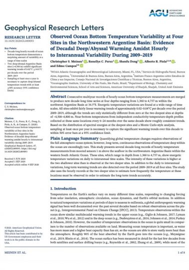
Observed Ocean Bottom Temperature Variability at Four Sites in the Northwestern Argentine Basin: Evidence of Decadal Deep/Abyssal Warming Amidst Hourly to Interannual Variability During 2009–2019

Meinen, C. S., Perez, R. C., Dong, S., Piola, A. R., & Campos, E. (2020). Observed ocean bottom temperature variability at four sites in the northwestern Argentine Basin: Evidence of decadal deep/abyssal warming amidst hourly to interannual variability during 2009‐2019. Geophysical Research Letters, e2020GL089093.

Consecutive multiyear records of hourly ocean bottom temperature measurements are merged to produce new decade‐long time series at four depths ranging from 1,360 to 4,757 m within the northwest Argentine Basin at 34.5°S. Energetic temperature variations are found at a wide range of time scales. All sites exhibit fairly linear warming trends of approximately 0.02–0.04°C per decade over the period 2009–2019, although the trends are only statistically different from zero at the two deepest sites at depths of ~4,500–4,800 m. Near‐bottom temperatures from independent conductivity‐temperature‐depth profiles collected at these same locations every 6–24 months over the same decade…

Read full paper

deep_sea_rising_temp_publication

Looking for scientific literature? Visit our Publication Database.

Driving Innovative Science

Project Report

This project report provides highlights of ongoing research projects that are either led by or involve AOML scientists together with essential science support personnel from NOAA, the University of Miami/Cooperative Institute for Marine and Atmospheric Studies (CIMAS), and our international partners.

Contact

| Gustavo Goni, Ph.D.

Director, Physical Oceanography Division

| Rick Lumpkin, Ph.D.

Deputy Director, Physical Oceanography Division

For current job opportunities click the button below to explore our career page

Let's Stay in Touch!

Get Updates, Hear About Events, and See Recent Articles.