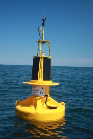
First Landing - FL
Geolocation is 36.9981, -76.0873
| Parameter | Group | Sort | Value | Unit | Date | Graphs |
|---|---|---|---|---|---|---|
| Current Direction | Currents | 4 | 133 | Deg. Mag. | 2020-06-26 10:00 EDT | 1 7 30 |
| Barometric Pressure | Meteorological | 1 | 30.1 | inches | 2020-06-26 10:50 EDT | 1 7 30 |
| Current Speed | Currents | 4 | 0.569 | kts | 2020-06-26 10:00 EDT | 1 7 30 |
| Latitude | Position | 5 | 36.99801 | Degrees | 2020-06-26 10:50 EDT | 1 7 30 |
| Longitude | Position | 5 | -76.08691 | Degrees | 2020-06-26 10:50 EDT | 1 7 30 |
| Wind Direction | Meteorological | 1 | 331 | Deg. Mag. | 2020-06-26 10:50 EDT | 1 7 30 |
| Wind Speed | Meteorological | 1 | 5.6 | kts | 2020-06-26 10:50 EDT | 1 7 30 |
| Wind Gust | Meteorological | 1 | 7.8 | kts | 2020-06-26 10:50 EDT | 1 7 30 |
| Wave Direction (From) | Waves | 3 | 63 | Deg. Mag. | 2020-06-26 10:00 EDT | 1 7 30 |
| Significant Wave Height | Waves | 3 | 1.05 | ft | 2020-06-26 10:00 EDT | 1 7 30 |
| Mean Wave Period | Waves | 3 | 2.9 | s | 2020-06-26 10:00 EDT | 1 7 30 |
| Water Salinity | WaterQuality | 2 | 19.8 | PSU | 2020-06-26 10:00 EDT | 1 7 30 |
| Water Temperature | WaterQuality | 2 | 75.5 | F | 2020-06-26 10:00 EDT | 1 7 30 |
| Turbidity | WaterQuality | 2 | 2 | NTU | 2020-06-26 10:00 EDT | 1 7 30 |
| Sea Nettle Probability | WaterQuality | 2 | 4 | % | 2020-06-26 10:00 EDT | 1 7 30 |
| Chlorophyll A | WaterQuality | 2 | 5.13 | ug/L | 2020-06-26 10:00 EDT | 1 7 30 |
| Dissolved Oxygen | WaterQuality | 2 | 8.44 | mg/L | 2020-06-26 10:00 EDT | 1 7 30 |
Captain John Smith passed the site of NOAA’s First Landing CBIBS buoy four times during his time in Virginia—the first on April 26, 1607, when he was aboard one of the Virginia Company’s ships as they entered the Chesapeake at dawn. The crew’s “first landing” was at what they named Cape Henry, the land at the south side of the Bay’s mouth.
A wide variety of people will be interested in observations from the First Landing buoy. The buoy is located near major shipping operations, as Bay pilots get on board tankers and cargo ships to guide them up the Bay to Norfolk, Baltimore, and other destinations. And fishermen—commercial and recreational—spend time near the First Landing buoy, as the mix of waters that occurs at the mouth of the Bay lures many a fish in.
Be sure to check the weather forecast before you head out.
A buoy deployed in April 2018 close to the First Landing buoy tracks surface water and atmospheric CO2 and surface water pH levels. This information will help researchers investigate how increasing concentrations of atmospheric carbon dioxide and increase ocean acidification affect the Bay and its valuable shellfish.
For more information on the history of the area surrounding the First Landing, please visit:
- First Landing State Park
- Fisherman Island National Wildlife Refuge
- Chesapeake Bay Bridge-Tunnel
- Virginia Beach Parks and Recreation/Marinas and Waterway Access
- Back Bay National Wildlife Refuge
- Chesapeake Bay Center
For more in depth analysis please visit data tools.