GOES-R Series Satellites
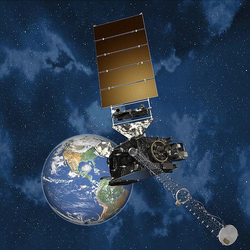
The Geostationary Operational Environmental Satellite-R Series (GOES-R), the latest generation of geostationary weather satellites, significantly improves the detection and observation of environmental phenomena, resulting in improved public safety, more accurate forecasts, better protection of property, and greater assurance on our nation’s economic health and prosperity.
GOES-16 replaced GOES-13 as the operational GOES-East Satellite on December 18, 2017, and GOES-17 became operational on February 12, 2019. GOES-15 will still be sending data a little while longer before it is decommissioned later in 2019. GOES-T and GOES-U are planned to be launched in the future and will extend the availability of the operational GOES satellite system through 2036.
See a brief history of GOES satellite program at the GOES-R Series Program Office website.
Data Access
Data access to GOES-R Series data and other information is available at NCEI, as well as at Comprehensive Large Array-Data Stewardship System (CLASS). For quick access to Space Weather Data please go to https://www.ngdc.noaa.gov/stp/satellite/goes-r.html. For products from the Advanced Baseline Images (ABI) and Geostationary Lightning Mapper (GLM) you can go to either CLASS or the Archive Information Request System (AIRS). Also, there are several cloud services providing GOES-R Series ABI Radiance and Cloud & Moisture Imagery products. Google Cloud is one such service with direct links to the files. See all access links in the tables below. We suggest you see the Glossary of Search Filters to help with searches on various ABI products, and the GOES-R Series Frequently Asked Questions (FAQ) for answers to common questions or problems.
For subscriptions to near real-time data please go to CLASS. If you are not registered with CLASS, please do so first, then contact the CLASS Help Desk with subject matter, “Subscription Service Request”. Other access issues should go to NCEI.sat.info@noaa.gov.
Advanced Baseline Imager
The GOES-R primary instrument for imaging Earth’s weather, oceans, and environment is the Advanced Baseline Imager (ABI), which is far superior to the last generation, GOES Imagers. ABI will view the Earth with 16 different spectral bands compared to five on the previous generation GOES satellites. The ABI includes two visible channels, four near-infrared channels, and ten infrared channels, providing three times more spectral information, four times greater spatial resolution, and more than five times temporal coverage. In less than 4 years, ABI data production will equal the total data production from 1975 through 2015 of all prior GOES Imager & Sounder data combined!
ABI Baseline Products
The following is a complete list of baseline products. Click on product to get product description and access.
- L1b Radiances
- Aerosol Detection
- Aerosol Optical Depth
- Clear Sky Masks
- Cloud and Moisture Imagery
- Cloud Optical Depth
- Cloud Particle Size Distribution
- Cloud Top Height
- Cloud Top Phase
- Cloud Top Pressure
- Cloud Top Temperature
- Derived Motion Winds
- Derived Stability Indices
- Downward Shortwave Radiation (Surface)
- Fire/Hot Spot Characterization
- Land Surface Temperature (Skin)
- Legacy Vertical Moisture Profile
- Legacy Vertical Temperature Profile
- Rainfall Rate/Quantitative Precipitation Estimation
- Reflected Shortwave Radiation
- Sea Surface Temperature (Skin)
- Snow Cover
- Total Precipitable Water
- Volcanic Ash (Detection & Height)
Geostationary Lightning Mapper
The GOES-R Geostationary Lightning Mapper (GLM) instrument is a single-channel, near-infrared optical transient detector that can detect the momentary changes in an optical scene, indicating the presence of lightning. GLM will measure total lightning (in-cloud, cloud-to-cloud, and cloud-to-ground) activity continuously over the Americas and adjacent ocean regions with near-uniform spatial resolution of approximately 10 km.
GLM Product
GOES-R ABI Baseline Product Information and Access Table
|
Product Name |
Description/Metadata |
Maturity Release |
Access/Order |
||

|
Level 1b data for 16 visible, near-infrared, and infrared spectral bands from .5km to 2km spatial resolution. Temporal frequency on average is 5 minutes. GOES-R products are generated using radiance data (See metadata). Please review GOES-17 ABI Performance due to cooling system issue. |
GOES-16 GOES-17 |
GOES-16 GOES-17 |
||
|
Cloud and Moisture Imagery Products (CMIP) 
|
The Cloud and Moisture Imagery products are derived from the Radiance data into reflectance values within the visible bands and brightness values and brightness temperatures for the infrared bands. These products are used to generate an array of products (See metadata). |
GOES-16 GOES-17 |
GOES-16 GOES-17 |
||
|
Aerosol Detection Product (ADP)  |
The Aerosol Detection product employs multiple spectral bands to detect presence of aerosols in the atmosphere. |
GOES-17 |
GOES-16 GOES-17 |
||

|
The Aerosol Optical Depth (AOD) product utilizes several spectral bands to measure the reflectance properties of cloud-free pixels at the top of the atmosphere (TOA). These reflectance properties at the TOA are then fed into aerosol models to compute the surface reflectance and aerosol properties at the surface. |
GOES-16 GOES-17 |
GOES-16 GOES-17 |
||
|
|
The Clear Sky Mask algorithm will take advantage of the high spatial and temporal resolution of the ABI visible, near-infrared, and infrared bands to automatically produce a cloud classification for each pixel: cloudy, probably cloudy, clear, or probably clear. This information will be used extensively by downstream level-2 product algorithms. |
GOES-16 GOES-17
|
GOES-16 GOES-17 |
||

|
Cloud Optical Depth uses both the visible and the near-infrared bands during the daytime and a combination of infrared bands for night-time detection. This product, together with the Cloud Particle Size Distribution product, will provide valuable information about the radiative properties of clouds. |
GOES-16 GOES-17 |
GOES-16 GOES-17 |
||
|
Cloud Particle Size Distribution (CPS) 
|
The Cloud Effective Particle Size will be computed using the same algorithm that estimates the Cloud Optical Depth. Using both the visible and near-infrared bands during the day and the infrared bands during the night, the Cloud Optical and Microphysical Properties algorithm will retrieve, simultaneously with COD, the Cloud Particle Size. |
GOES-16 GOES-17 Beta |
GOES-16 GOES-17
|
||

|
The Cloud Top Height algorithm will use ABI infrared bands to simultaneously retrieve Cloud Top Height, Cloud Top Temperature, and Cloud Top Pressure for each cloudy pixel. These cloud products are a prerequisite for generating other downstream products that include the Cloud Layer product, Cloud Optical/Microphysical products, and the Derived Motion Wind products. |
GOES-16 GOES-17 |
GOES-16 GOES-17 |
||

|
The Cloud Type algorithm will use four ABI infrared spectral bands to determine four different cloud phases: warm (>0C) liquid water, supercooled liquid water, mixed, and ice. The Cloud Phase product is a prerequisite for generating other downstream products that include Cloud Height, Cloud Optical Properties, Fog Detection/Depth, and Aircraft Icing. |
GOES-16 GOES-17 |
GOES-16 GOES-17 |
||

|
The Cloud Top Height algorithm will use ABI infrared bands to simultaneously retrieve Cloud Top Height, Cloud Top Temperature, and Cloud Top Pressure for each cloudy pixel. These cloud products are a prerequisite for generating other downstream products that include the Cloud Layer product, Cloud Optical/Microphysical products, and the Derived Motion Wind products. |
GOES-16 GOES-17 |
GOES-16 GOES-17 |
||

|
The Cloud Top Height algorithm will use ABI infrared bands to simultaneously retrieve Cloud Top Height, Cloud Top Temperature, and Cloud Top Pressure for each cloudy pixel. These cloud products are a prerequisite for generating other downstream products that include the Cloud Layer product, Cloud Optical/Microphysical products, and the Derived Motion Wind products |
GOES-16 GOES-17 |
GOES-16 GOES-17 |
||

|
The Derived Motion Winds product is derived from using a sequence of visible or IR spectral bands to track the motion of cloud features and water vapor gradients. The resulting estimates of atmospheric motion are assigned heights by using the Cloud Height product. |
GOES-16 GOES-17 |
GOES-16 GOES-17 |
||
|
Derived Stability Indices (DSI) 
|
The Derived Stability Indices such as Convective Available Potential Energy (CAPE), Lifted Index (LI), Totals Total (TT), Showalter Index (SI), and the K-Index (KI) will be computed from the retrieved atmospheric moisture and temperature profiles. |
GOES-16 GOES-17 |
GOES-16 GOES-17 |
||
|
Downward Shortwave Radiation: Surface (DSR) 
|
The Downward Shortwave Radiation (DSR) product is an estimate of the total amount of shortwave radiation (both direct and diffuse) that reaches the Earth’s surface. The product algorithm uses spectral channels in both the visible and the infrared in addition to data regarding albedo and atmospheric composition to compute the Downward Shortwave Radiation at the Earth’s surface. DSR has many applications both in the general and applied sciences. |
GOES-16 GOES-17 |
GOES-16 GOES-17 |
||
|
Fire/Hot Spot Characterization (FDC) 
|
The Fire/Hot Spot Characterization product will make use of both visible and IR spectral bands to locate fires and retrieve sub-pixel fire characteristics. |
GOES-16 GOES-17 |
GOES-16 GOES-17 |
||
|
Land Surface (Skin) Temperature (LST) 
|
The Land Surface Temperature (LST) product will be derived from ABI longwave infrared spectral channels and is expected to be used in a number of applications in hydrology, meteorology, and climatology. |
GOES-16 GOES_17 |
GOES-16 GOES-17 |
||
|
Legacy Vertical Moisture Profile (LVMP) 
|
The Legacy Vertical Moisture product will estimate levels of moisture throughout the troposphere, providing a vertical profile of moisture. |
GOES-16 GOES_17 |
GOES-16 GOES-17 |
||
|
Legacy Vertical Temperature Profile (LVTP) 
|
The Legacy Vertical Temperature Profile product will estimate levels of temperature throughout the troposphere. This product will be a continuation of the operational sounder product available on the current GOES satellites. |
GOES-16 GOES_17 |
GOES-16 GOES-17 |
||
|
Rainfall Rate Quantitative Precipitation Estimation (RRQPE) 
|
The ABI Rainfall Rate algorithm generates the baseline Rainfall Rate product from ABI IR brightness temperatures and is calibrated in real time against microwave-derived rain rates to enhance accuracy. The algorithm generates estimates of the instantaneous rainfall rate at each ABI IR pixel. |
GOES-16 GOES-17 |
GOES-16 GOES-17 |
||
|
Reflected Shortwave Radiation (RSR)
|
The Reflected Shortwave Radiation product will measure the total amount of shortwave radiation that exits the Earth through the top of the atmosphere. The algorithm will use several spectral channels in both the visible and infrared spectrum to measure the Reflected Shortwave Radiation. |
GOES-16 GOES-17 |
GOES-16 GOES-17 |
||

|
Sea Surface Temperature (SST) for each cloud-free pixel over water The SST algorithm employed on GOES-R will use hybrid physical-regression retrieval in order to produce a more accurate product. |
GOES-16 GOES-17 |
GOES-16 GOES-17 |
||

|
The fractional Snow Cover algorithm uses GOES-R ABI spectral information in the visible and near-visible portion of the energy spectrum to retrieve sub-pixel fractional Snow Cover and grain size estimates via computationally efficient spectral mixture modeling. |
N/A |
|
||
|
Total Precipitable Water (TPW)
|
The Total Precipitable Water (TPW) product is computed from the retrieved atmospheric moisture profiles and represents the total integrated moisture in the atmospheric column from the surface to the top of the atmosphere. (See Metadata) |
GOES-16 GOES-17
|
GOES-16 GOES-17 |
||
|
Volcanic Ash: Detection & Height 
|
The Volcanic Ash product algorithm utilizes five GOES-R ABI infrared channels to automatically determine the height and mass loading properties of any pixel found to contain volcanic ash. |
GOES-16 GOES-17 |
GOES-16 GOES-17 |


GOES-R GLM Product Information and Access Table
|
Product Name |
Description/Metadata |
Maturity Release |
Access/Order |
|
Geostationary Lightning Mapper (GLM) 
|
The GLM product contains cloud-to-ground and inter-cloud lightning data with a spatial resolution of 8 to 14 km and organized into a hierarchy of earth-located lightning radiant energy measures including events, groups, and flashes. Lightning events are detected by the instrument. Lightning groups are a collection of one or more lightning events that satisfy temporal and spatial coincidence thresholds. Similarly, lightning flashes are a collection of one or more lightning groups that satisfy temporal and spatial coincidence thresholds. The product includes the relationship among lightning events, groups, and flashes, and the area coverage of lightning groups and flashes (See metadata). |
GOES-16 |
GOES-16 GOES-17
|