Regional Climate Centers

The Regional Climate Center (RCC) Program provides climate services to six regions encompassing the United States. NOAA's National Centers for Environmental Information (NCEI) manages the RCC Program. The service provided by the RCCs has evolved through time to become an efficient, user-driven program that exemplifies many of the components that have been cited for effective regional climate services. As operational climate service providers, the RCCs fill three main niches:
- Provision and development of sector-specific and value-added data products and services
- Establishment of robust and efficient computer-based infrastructure for providing climate information
- Seamless integration and storage of non-NOAA climate data with traditional NOAA data sources
RCC Product Spotlight
An expanding suite of climate data products and tools define the RCC Program. Through these tools, decision makers from various sectors, climate-service partners, and the public are provided with timely and relevant climate information.
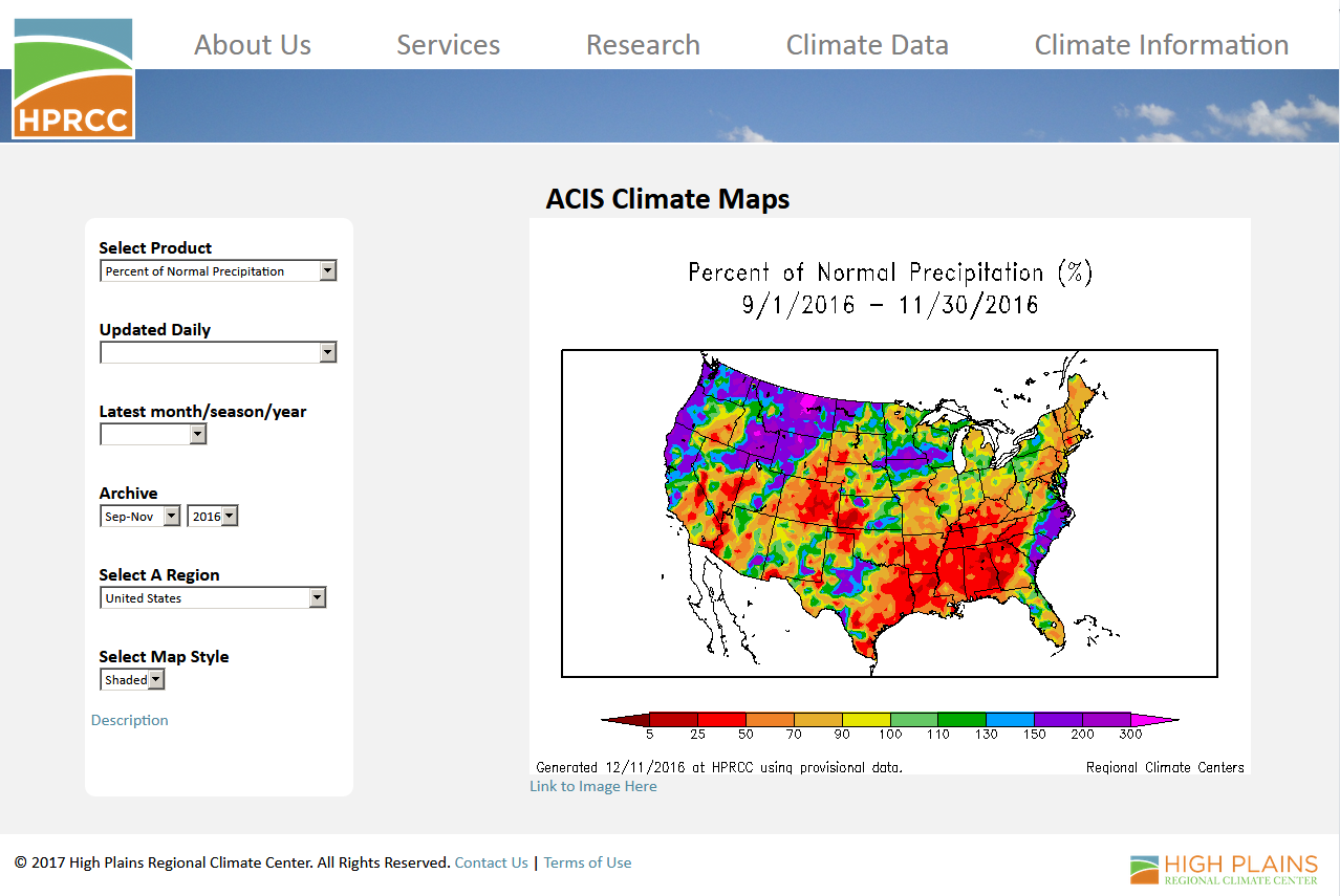
High Plains Regional Climate Center produces climate summary maps on a daily basis to give stakeholders perspective on the current and past climate conditions. These are invaluable to a wide variety of customers in order to assess the state of the climate. In particular, these maps help inform decisions on issues such as drought early warning, water management, and energy usage. This long-standing and popular product draws upon the Applied Climate Information System (ACIS) framework, a powerful system developed by the RCC Program. Users are able to choose from precipitation, temperature, heating and cooling degree days, and a standardized precipitation index over various time intervals and spatial scales.
 The Vegetation Impact Program (VIP) is an initiative led by the Midwestern Regional Climate Center to bring together real-time climate monitoring, forecasters, and citizen science participation for understanding the current susceptibility and climate-related impacts on vegetation. Products include frost/freeze monitoring tools as well as stress degree-days that monitor heat stress to corn and chilling hours that impact dormant season recovery of small fruits gridded data values.

Developed by the Northeast Regional Climate Center, scACIS allows climate service providers, like state climatologists, to access a wide range of daily and month climate data products. Products include tabular and graphical data summaries as well as a number of map-based products using both station and gridded data values.

 The mission of the Southern Regional Climate Center (SRCC) is to increase the use and availability of climate information in the Southern region. SRCC personnel work closely with scientists from other regional and Federal climate centers to enhance climate services and programs that provide a regional structure for climate applications.The long-term objectives of the SRCC are to collect, enhance, and deliver climate data and products to the citizens and industries in its region; provide personalized service and outreach; and conduct applied climate research and development to enhance data quality, product utility, and promote a better understanding of the interaction between climate information and societal needs.
 The western United States consists of complex terrain, where local precipitation and temperature can vary dramatically across short distances, which in turn impacts local drought conditions. The Western Regional Climate Center West Wide Drought Tracker (WWDT) provides easy access to fine-scale drought monitoring and climate products that a variety of users can utilize. The climate datasets, drought indices, and maps that are found on WWDT use monthly data that are updated with new values at the beginning of each month.
Tamara Houston
National Partnership Liaison
NOAA's National Center for Environmental Information
151 Patton Avenue
Asheville, NC 28801
Phone: 828-271-4266
Email: Tamara.Houston@noaa.gov