 The Northwest Association of Networked Ocean Observing Systems (NANOOS) is the U.S. IOOS Regional Association in the Pacific Northwest, for the States of Washington and Oregon. NANOOS has strong ties with other west coast observing systems, particularly the Alaska Ocean Observing System (AOOS), the Central and Northern California Ocean Observing System (CeNCOOS) and observing programs in British Columbia (e.g., the Victoria Experimental Network Under the Sea, or VENUS) through common purpose and the occasional overlap of data and products.
Contact Information: Jan Newton, Executive Director
About the Pacific Northwest Region
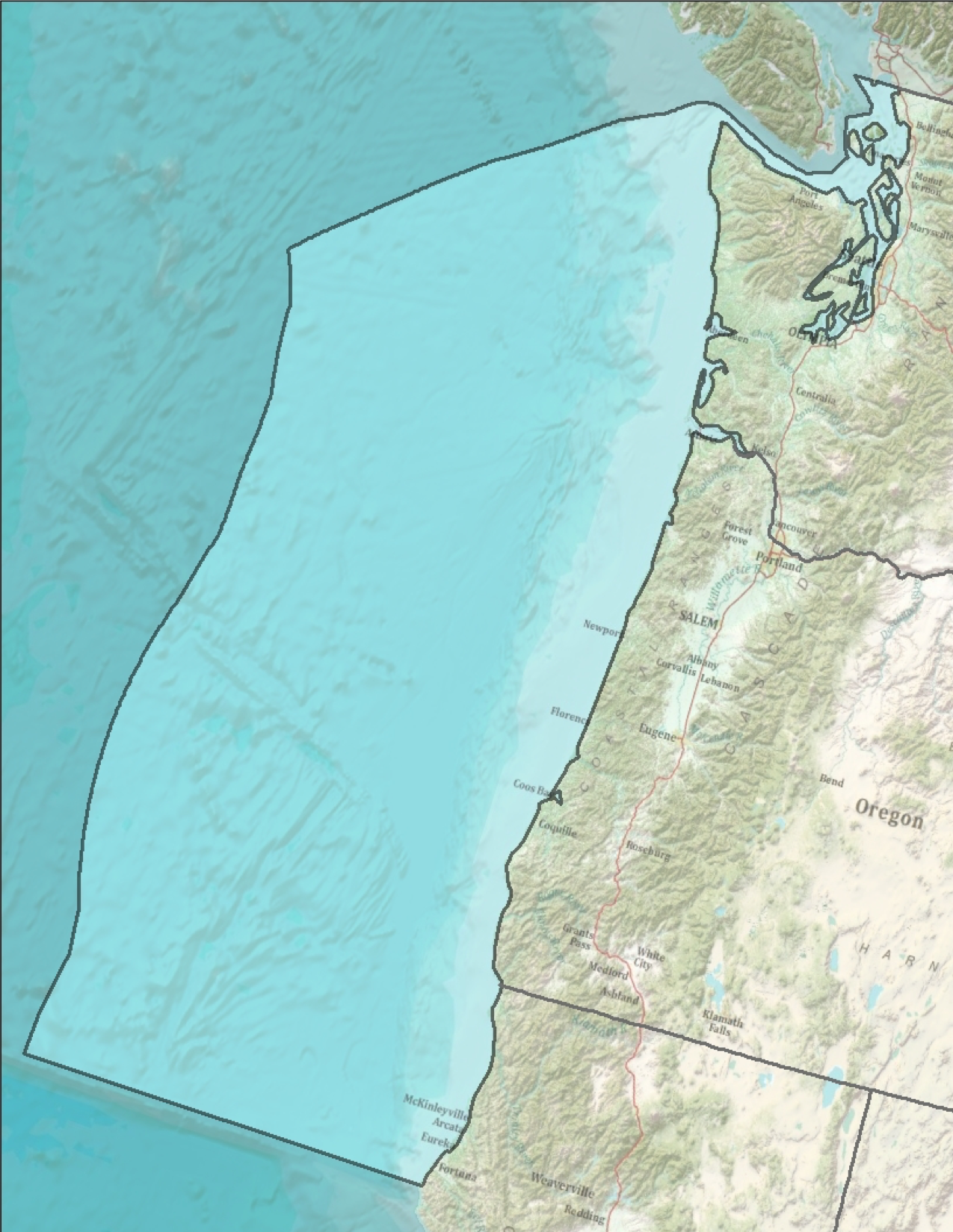 NANOOS is a partnership of over 50 entities, including industry, state agencies, local governments, tribes, non-government organizations, and educational institutions. Established in 2003, NANOOS has built regional partnerships in the Pacific Northwest (PNW) and to identified high priority user needs and requirements.
NANOOS places a priority on sustaining leveraged coastal observations and on developing the most informative and useful products for regional users. NANOOS provides links to a number of their products through its NANOOS Visualization System (NVS), which gathers data across a wide range of assets such as buoys, shore stations, and coastal land-based stations. These products are searchable by user category such as, boaters, emergency responders, and shellfish growers.
NANOOS has also developed a wide variety of user products and educational materials centered on its regional priorities. Examples include on-line tsunami evacuation/inundation maps, forecast information products developed for commercial and recreational albacore tuna fishers, real-time water quality information optimized for shellfish growers, blended tide, current, weather conditions forecasts for mariners, and on-line “theme pages” for issues of regional interest, such as ocean acidification and hypoxia, with direct links to data, educational content, and regional activities. A variety of lesson plans, some using real-time data, and learning resources are available and being used and evaluated by teachers at various levels.
Activities NANOOS undertakes are as follows:
- Maintains existing HF-radar capability to support the critical national capacity and continue the investment in wave mapping at critical ports.
- Sustains existing buoys and gliders in the Pacific Northwest coastal ocean, in coordination with national programs, These buoys and gliders provide regional observations that support hypoxia, Harmful Algal Bloom (HAB), ocean acidification, climate change detection and modeling input.
- Maintains observation capabilities in Pacific Northwest estuaries, in coordination with local and regional programs, to aid sustainable resource management, water quality assessment and sub-regional climate change evaluation.
- Maintains core elements of beach and shoreline observing programs by providing essential observations and better decision support tools for coastal managers, planners and engineers.
- Maintains NANOOS’ Data Management and Communications (DMAC) system for routine operational distribution of data and information.
- Contributes to a community of complementary numerical regional models, including the operation of regional models, and the tools and products they support, covering the head of tide of estuaries to the outer edges of the EEZ in both OR and WA.
- Continues to deliver user-defined products and services for PNW stakeholders.
- Sustains NANOOS education and outreach efforts to foster ocean literacy and facilitate use of NANOOS products for IOOS objectives.