Home > NCEP Quarterly Newsletter
NCEP Quarterly Newsletter - FY18Q1
Story image
Click image to zoomClick image to zoom
Meteorologists from the Civil Aviation Administration of China (CAAC), hosted by IMSG as part of the Aviation Weather and ATM Decision Making Integration Training class of 2017, visited NWS facilities in Kansas City from October 23-27th. They visited and toured the AWC, CWSU Olathe, and WFO Pleasant Hill During their visit the AWC. Senior Meteorologist Amy Harless provided the group with a presentation on the TCF.
Aviation Weather Center Visit
Class of 2017

Story image
Click image to zoomClick image to zoom
The Climate Prediction Center (CPC) implemented a new, simpler display for the seasonal probability of exceedance (POE) tool. The probability of exceedance is the chance that a particular temperature or precipitation value will be exceeded. The POE provides the entire distribution instead of only the most likely tercile as is typically shown on CPC sub-seasonal and seasonal outlooks. With access to the entire distribution, users may select any threshold or category that is of particular interest to the, and are not limited to pre-established tercile categories. The tool consists of a large map on the left, and a selection panel on the right.  The map is used to select the specific region the user would like a forecast for. Options in the right panel include selecting between average temperature or total precipitation and also the specific season of interest. One can also toggle between selecting a particular value and finding out the probability of exceeding that value or by selecting the probability and determining the value associated with it. Values can be obtained for the following percentages: 10, 20, 30, 40, 50, 60, 70, 80, and 90. The percent chance can also be obtained for a large variety of input values encompassing the range from the 10th to the 90th probability. This product is updated once per month on the 3rd Thursday in conjunction with the updated seasonal outlooks. Probability of Exceedance tool (POE)
Probability of Exceedance tool (POE)

Story image
Click image to zoomClick image to zoom
November 30, 2017 marks the official end of the 2017 Atlantic hurricane season, which matched NOAA’s seasonal predictions for being extremely active. The season produced 17 named storms of which 10 became hurricanes including six major hurricanes (Category 3, 4 or 5) – including the first two major hurricanes to hit the continental U.S. in 12 years. “Throughout this devastating hurricane season, NOAA provided vital forecasts and data that helped save many lives,” said U.S. Secretary of Commerce Wilbur Ross. “I commend the scientists and forecasters who worked long hours tracking every storm and guiding federal and local officials’ efforts to prepare and respond.” Based on the Accumulated Cyclone Energy index, which measures the combined intensity and duration of the storms during the season and is used to classify the strength of the entire hurricane season, 2017 was the seventh most active season in the historical record dating to 1851 and was the most active season since 2005. Though it was a furious season, NOAA issued early and reliable forecasts to communities in the path of this year’s storms. NOAA's preliminary data show that the National Hurricane Center issued forecasts with record-setting accuracy. And track forecasts for the three most damaging hurricanes were about 25 percent more accurate than average.
Extremely Active 2017 Atlantic Hurricane

2017 Atlantic Hurricane Season Year-End Summary

This year, three devastating major hurricanes made landfall (Harvey in Texas; Irma in the Caribbean and southeastern U.S.; and Maria in the Caribbean and Puerto Rico). Harvey was also the first major hurricane to hit the U.S. since Wilma struck Florida in October 2005. Additionally, four other storms hit the U.S., including Cindy in Texas, Emily and Phillipe in Florida, and Nate in Mississippi. “This was a hurricane season that wouldn’t quit,” said retired Navy Rear Adm. Timothy Gallaudet, Ph.D., acting NOAA administrator. “The season started early with a storm in April and the peak of the season featured an onslaught of ten successive hurricanes. NOAA forecasters rose to this challenge to keep emergency officials and the public aware of anticipated hazards.”
Extremely Active 2017 Atlantic Hurricane

Story image
Click image to zoomClick image to zoom
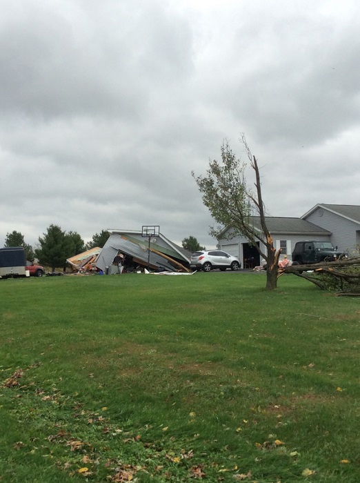
On December 13th, a production crew with The Weather Channel visited the SPC to interview Forecast Operations Chief Bill Bunting for an upcoming special on survivors of recent deadly tornadoes. Much of the interview focused on the destructive potential of tornadoes and safety precautions before and during severe storms. The crew also filmed SPC forecasters at work and observed some of the tools used to monitor and predict severe thunderstorms. The interview will likely air in April.
Picture of Satellite Images

Storm Damage

Picture of Satellite Images

Story image
Click image to zoomClick image to zoom
On Tuesday, December 12, NOAA’s National Hurricane Center (NHC) and Ocean Prediction Center (OPC) began delivering High Seas Gridded Forecasts from NHC, and Offshore Gridded Forecasts from OPC, for the first time operationally in the Atlantic basin for the National Digital Forecast Database (NDFD). These products provide new ways for maritime users to ingest open ocean weather forecasts for parameters such as wind speed and direction, and significant wave heights, as well as hazardous marine weather warnings.

Transitioning these products into operations is a significant milestone as OPC works to deliver authoritative weather forecasts to the maritime community. In the future, currently experimental versions of these products in the Pacific basin will become operational.

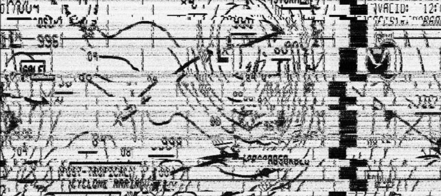
Image of NDFD grids for marine wind speed (knots)

Story image
Click image to zoomClick image to zoom
Kaitlyn Kalua josnedrter of FY18, through December 8, NCEP’s NCO and OPC coordinated with NWS Headquarters and the U.S. Coast Guard to restore the quality of radiofax transmissions. During the summer, there began chronic reports of garbled radiofax charts, with an example shown below, making critical weather information hard to interpret particularly where the lines shift. This was especially troublesome during an active tropical cyclone season, with many vessels still relying on radiofax to get authoritative, critical weather information from the OPC, TAFB, and WFO Honolulu.
Badly garbled OPC radiofax chart as received in September 2017

After several attempts to correct the problem failed, routine conference calls between NCEP’s NCO and OPC, NWS Headquarters, and the U.S. Coast

Guard began to develop a solution to the issue. A coordinated solution eventually resulted in a repairs to the chart transmission which concluded December 8. Among the fixes were NCO installing new servers at the U.S. Coast Guard’s Communications Command (COMMCOM) in Chesapeake, VA, a more frequent server patching cycle by the U.S. Coast Guard, and an agreement on a long-term solution to set up proper communications paths between NCWCP, COMMCOM, and Boulder. Feedback received from customers as far away as Germany have noted improvement while tuned into the 9110 kHz signal originating from a transmitter in Boston, MA.
Improved radiofax chart issued 1258UTC November 3 while coordinated repair efforts were underway.

Story image
Click image to zoomClick image to zoom
In late October, representatives from 48 countries met in Geneva, Switzerland, for the fifth quadrennial meeting of the Joint World Meteorological Organization (WMO) – Intergovernmental Oceanographic Commission (IOC) Technical Commission for Oceanography and Marine Meteorology (JCOMM). JCOMM is an intergovernmental body of technical experts that coordinate oceanographic and marine meteorological observing, data management, and forecast and warning services in support of safety of life and property at sea. NWS joined representatives from OAR, NESDIS, and Scripps Institution of Oceanography on the U.S. Delegation. During the proceedings, Darin Figurskey, OPC Ocean Forecast Branch Chief, was elected as the Chairman on the International Ship Observations Team. The team sets international standards for weather and ocean observations from ships at sea. OPC Director Tom Cuff was elected to the JCOMM management team as the Chairman of the Services and Forecast Systems Coordination Group. These positions reflect NWS’s global leadership in marine weather forecasting and will help set a course to modernize weather services to the maritime community.
US Delegation to JCOMM-5 (left to right): Luca Centurioni (Scripps), Emily Smail (NESDIS), 
                                   Jennifer Lewis (NWS), Brittany Croll (OAR), David Legler (OAR), Tom Cuff (NWS), Shelby Brunner (OAR), and Sid Thurston (OAR)
US Delegation to JCOMM-5 (left to right): Luca Centurioni (Scripps), Emily Smail (NESDIS), Jennifer Lewis (NWS), Brittany Croll (OAR), David Legler (OAR), Tom Cuff (NWS), Shelby Brunner (OAR), and Sid Thurston (OAR)

Story image
Click image to zoomClick image to zoom
On Tuesday, December 12, NOAA’s National Hurricane Center (NHC) and Ocean Prediction Center (OPC) began delivering High Seas Gridded Forecasts from NHC, and Offshore Gridded Forecasts from OPC, for the first time operationally in the Atlantic basin for the National Digital Forecast Database (NDFD). These products provide new ways for maritime users to ingest open ocean weather forecasts for parameters such as wind speed and direction, and significant wave heights, as well as hazardous marine weather warnings.
Image of NDFD grids for marine wind speed (knots)

Transitioning these products into operations is a significant milestone as OPC works to deliver authoritative weather forecasts to the maritime community. In the future, currently experimental versions of these products in the Pacific basin will become operational.

Ocean Prediction Center Employees Elected to International Leadership Roles

In late October, representatives from 48 countries met in Geneva, Switzerland, for the fifth quadrennial meeting of the Joint World Meteorological Organization (WMO) – Intergovernmental Oceanographic Commission (IOC) Technical Commission for Oceanography and Marine Meteorology (JCOMM). JCOMM is an intergovernmental body of technical experts that coordinate oceanographic and marine meteorological observing, data management, and forecast and warning services in support of safety of life and property at sea.

NWS joined representatives from OAR, NESDIS, and Scripps Institution of Oceanography on the U.S. Delegation. During the proceedings, Darin Figurskey, OPC Ocean Forecast Branch Chief, was elected as the Chairman on the International Ship Observations Team. The team sets international standards for weather and ocean observations from ships at sea. OPC Director Tom Cuff was elected to the JCOMM management team as the Chairman of the Services and Forecast Systems Coordination Group. These positions reflect NWS’s global leadership in marine weather forecasting and will help set a course to modernize weather services to the maritime community.
US Delegation to JCOMM-5
US Delegation to JCOMM-5 (left to right): Luca Centurioni (Scripps), Emily Smail (NESDIS), Jennifer Lewis (NWS), Brittany Croll (OAR), David Legler (OAR), Tom Cuff (NWS), Shelby Brunner (OAR), and Sid Thurston (OAR)

Collaborative Effort Restored Radiofax Broadcast Quality

During the first quarter of FY18, through December 8, NCEP’s NCO and OPC coordinated with NWS Headquarters and the U.S. Coast Guard to restore the quality of radiofax transmissions. During the summer, there began chronic reports of garbled radiofax charts, with an example shown below, making critical weather information hard to interpret particularly where the lines shift. This was especially troublesome during an active tropical cyclone season, with many vessels still relying on radiofax to get authoritative, critical weather information from the OPC, TAFB, and WFO Honolulu.

Badly garbled OPC radiofax chart as received in September 2017.

After several attempts to correct the problem failed, routine conference calls between NCEP’s NCO and OPC, NWS Headquarters, and the U.S. Coast Guard began to develop a solution to the issue. A coordinated solution eventually resulted in a repairs to the chart transmission which concluded December 8. Among the fixes were NCO installing new servers at the U.S. Coast Guard’s Communications Command (COMMCOM) in Chesapeake, VA, a more frequent server patching cycle by the U.S. Coast Guard, and an agreement on a long-term solution to set up proper communications paths between NCWCP, COMMCOM, and Boulder. Feedback received from customers as far away as Germany have noted improvement while tuned into the 9110 kHz signal originating from a transmitter in Boston, MA.

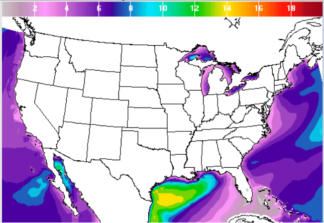
Improved radiofax chart issued 1258UTC November 3 while coordinated repair efforts were underway.
Image of NDFD grids for marine wind speed (knots)

Story image
Click image to zoomClick image to zoom
For 75 years, NOAA’s Weather Prediction Center, in College Park, Maryland, has delivered lifesaving weather forecasts for significant events that involve precipitation -- such as rain, sleet, and hail and that produce flash floods, tropical cyclones and extreme snowfall. We sat down with Greg Carbin, chief of the CFor 75 years, NOAA’s Weather Prediction Center, in College Park, Maryland, has delivered lifesaving weather enter’s forecast operations branch, to talk about how meteorologists across NOAA work with WPC to produce accurate, timely predictions for the larger U.S. and down to your own Zip Code.
Greg Carbin, chief of the Center’s forecast operations branch
Q. So, first off: How do you forecast a winter storm?

GC: Forecasting winter precipitation is interesting from many perspectives. Our ability to forecast a winter storm depends on properties in the atmosphere. Think about a snow forecast like a recipe. If ingredients like cold air, moisture, and rising air come together in the right way, they will result in wintry weather.

Our forecasters, who are scientists, understand well the required ingredients to be confident in a snow forecast. Like any weather forecast, there is greater uncertainty many days in advance, but as we get closer, the picture usually becomes clearer. It is our forecasters’ job to recognize those atmospheric patterns that trigger heavy precipitation.

Q. What is the role of the Weather Prediction Center in developing winter weather forecasts?

GC: The Weather Prediction Center collaborates with our colleagues across NOAA’s National Weather Service to provide detailed forecasts of snowstorms and other high-impact precipitation events.  

For example, if we notice a significant winter-weather pattern developing across a large portion of the country, we have the experts here in Maryland to understand the dynamics of that weather and we share our analyses with local forecasting offices.

Q. What’s the relationship between forecasters at the Weather Prediction Center and those at the 122 weather forecast offices around the country?

GC: We have a lot of interaction and collaboration. Forecasters across National Weather Service forecast offices share expertise and information. WPC offers “big picture” national-level forecasts that weather forecasts offices can then tailor for their local communities. We like to say, “One National Weather Service, one forecast.” What this means is that we work together to deliver the best possible forecast for your neighborhood.

Q. Greg, what do you enjoy most about forecasting winter weather?
Greg Carbin, chief of the Center’s forecast operations branch

GC: Snow is the best. I love snow! I wouldn’t be a meteorologist without my love for winter weather. While winter storm forecasts can be tricky due to significant uncertainty about where rain/snow boundaries will set up, we appreciate the challenge and strive to ensure that citizens and businesses are well prepared for the impacts a winter storm may bring. With that preparedness under our belts, we can all relax in a safe place and enjoy the awesome power and beauty of a good snow storm.

More: Head on over to NOAA’s Weather Prediction Center for national weather forecasts and to NOAA’s weather.gov for the latest local forecasts, watches and warnings for your Zip Code.

FINAL Draft: As of 1/17/18 Gaches/Contey

Greg Carbin, chief of the Center’s forecast operations branch

Story image
Click image to zoomClick image to zoom
November 2-3, 2017, Bill Murtagh joined US State Department representatives at the United States–Canada Bilateral Meetings on Space Weather Services in Ottawa, Canada. Canada is considering developing a national strategy to address space weather. They are interested in learning what the United States is doing at national policy levels to address risks associated with space weather so that they might enhance their national space-weather preparedness.

The Executive Office of the President Office of Science and Technology (OSTP) and State Department wish to strengthen and formalize ties between the United States and Canada in our efforts to enhance the resilience of critical infrastructure in North America to the adverse effects of space weather. The very productive discussions yielded several outcomes. Both Nations expressed interest in developing a broad framework for inter-governmental (bilateral) participation on space weather. Whether this should be a broader effort that would include the preparedness community, or just limited to services and research, remains to be determined. One potential mechanism for this is to develop a high-level joint Canada/US strategy developed through a White House-led effort. OSTP will work with State Department to explore potential options for this strategy. It was also agreed that a formal implementing arrangement on data sharing between the United States and Canada is necessary. Both Nations agreed that NOAA and NRCan should explore a collaborative effort to create a joint E-field product, which covers all of the United States and Canada. Both countries agreed that an annual meeting to continue the dialogue is appropriate.

Space Weather Services in Ottawa, Canada

Story image
Click image to zoomClick image to zoom
The National Hurricane Center’s (NHC) Tropical Analysis and Forecast Branch (TAFB) led a team to create and develop a new High Seas Forecast Tool and Text Formatter within the Graphical Forecast Editor (GFE), which is part of CAVE/AWIPS2. Representatives from NHC and WFO HFO/CPHC worked with Tom LeFebvre of Global Systems Division (GSD) in Miami, FL from November 13 through 17.

This was the final scheduled meeting on the project following previous sessions which began in 2012 at the onset of the development. The goal of this particular meeting was a final technical development sprint, to fix outstanding software bugs from previous development, additional testing of the developed software, and addressing requirements for any future development. A request to baseline the software in AWIPS following this development has also been made. To summarize the overall project, the new High Seas Forecast Tool and Text Formatter greatly benefits the NHC/TAFB, Ocean Prediction Center, and WFO HFO/Central Pacific Hurricane Center, which are the three NOAA/NWS offices responsible for issuing High Seas Forecast products, per the World Meteorological Organization (WMO). The new Tool and Text Formatter allows forecasters to spend more time on the meteorology, and less time typing the forecast. The Tool and Text Formatter reads and samples the GFE gridded database, ensuring consistency across all products issued by each office. The Text Formatter also provides the High Seas Forecast in a new polygon based format, which will allow for users to easily plot areas of interest.

High Seas Forecast Tool and Text Formatter within the Graphical Forecast Editor (GFE)

Story image
Click image to zoomClick image to zoom
1, 2017, at 00 GMT, NCEP Environmental Modeling Center upgraded the HREF and HIRESW systems. The upgrade includes changes to HREF model membership; HIRESW model runs, including changes to initialization and earlier product availability; and output products. HREF membership changes for CONUS include the addition of a second WRF-ARW member (the run from 12 hours ago); the reduction of NAM 3 km CONUS nest members in HREF down to two (the current cycle plus the six hour old run); a reduction of NMMB members from HIRESW down to two (the current cycle plus the 12 hour old run). For Alaska, Hawaii, and Puerto Rico new HREF products are generated from a six-member ensemble (two cycles each of HIRESW NMMB, HIRESW ARW, and HIRESW ARW mem2).

HIRESW model changes include unification of the horizontal grid spacing at 3 km for both the ARW and NMMB models (3.2 km for both over CONUS); new horizontal grid spacing of 3.2km for CONUS and 3.0 for Alaska, Hawaii, Guam and Puerto Rico, and of 3.2km for the CONUS NMMB. A second (40-level, different physics/PBL) ARW member is added for all domains (except Guam). The two ARW members for Puerto Rico are initialized off the RAP and NAM. The runs initialized from GFS now use 0.25 degree GFS data from the previous cycle for initial and lateral boundary conditions, since the HIRESW/HREF now runs earlier in the production cycle. The NMMB run increases the call frequency for PBL/surface physics and microphysics to every other time-step. The vertical level structure has changed within the primary 50 level ARW runs for all domains except Alaska (which was changed in an earlier model upgrade).

HREF and HIRESW systems

In This Issue...
  Back to top

NOAA/ National Weather Service
National Centers for Environmental Prediction
5830 University Research Court
College Park, MD 20740
NCEP Internet Services Team
Disclaimer
Help
Glossary
Privacy Policy
About Us
Career Opportunities
Page last modified: Thursday, 09-Mar-2017 17:59:27 UTC