
National Cooperative Geologic Mapping Program
Home
The National Cooperative Geologic Mapping Program (NCGMP) is the primary source of funds for the production of geologic maps in the United States and provides accurate geologic maps and three-dimensional framework models that help to sustain and improve the quality of life and economic vitality of the Nation and to mitigate natural hazards.
The National Geologic Map Database
The National Geologic Map Database serves as the authoritative, comprehensive resource for information about paper and digital geoscience maps and reports on the Nation's geology and stratigraphy, by all publishers.
Search the NGMDBNews

From Volcanoes to Vineyards - New Geologic Map Reveals Portland's Deep History
A new digital geologic map of the greater Portland-Vancouver-Hillsboro metropolitan area of Oregon and Washington being released today will support emergency response, conservation, agriculture and recreation.

Earth MRI Funds Critical Minerals Projects in Colorado
A total of $171,555 will fund new research and preserve important data across the Centennial State

Earth MRI Funds Critical Minerals Projects in Indiana
A total of $160,000 will fund new research and preserve important data across the Hoosier State
Publications

GeMS (Geologic Map Schema)—A standard format for the digital publication of geologic maps
IntroductionThis report describes and defines GeMS (for Geologic Map Schema), a new standardized database schema—that is, a database design—for the digital publication of geologic maps. It originally was intended for geologic mapping funded by the National Cooperative Geologic Mapping Program of the U.S. Geological Survey, but its use can be...
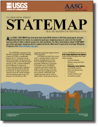
U.S. Geological Survey STATEMAP Program—Geologic mapping for the public good
As of 2020, STATEMAP has invested more than $150 million in 48 State geological surveys, matched dollar for dollar, to complete geologic mapping projects crucial to the health and security of State natural resources and residents. For more information about STATEMAP and other geologic mapping efforts supported by the National Cooperative Geologic...
Ackerman, Abby; McPhee, Darcy K.
Deep Learning as a tool to forecast hydrologic response for landslide-prone hillslopes
Empirical thresholds for landslide warning systems have benefitted from the incorporation of soil‐hydrologic monitoring data, but the mechanistic basis for their predictive capabilities is limited. Although physically based hydrologic models can accurately simulate changes in soil moisture and pore pressure that promote landslides, their utility...
Orland, Elijah; Roering, Joshua J.; Thomas, Matthew A.; Mirus, Benjamin B.