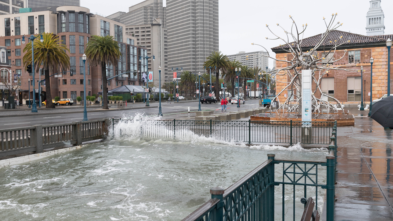
New NASA research is helping the City of San Francisco plan measures to adapt to sea level rise. (Image credit: Dave R/Flickr (CC BY-NC 2.0))
Full story ›
At this year's American Geophysical Union (AGU), researchers are highlighting how an ice-measuring mission is helping to understand aspects of our home planet far beyond what it was intended to do.
Full story ›
High-tide flooding is an increasing fact of life for U.S. coastal areas. A new tool developed with NASA funding projects its annual frequency for 97 U.S. cities and how it will change over time. (Image credit: B137, CC BY-SA 4.0, via Wikimedia Commons)
Full story ›
Sentinel-6 Michael Freilich, the world's latest sea level satellite, is safely in orbit and ready to begin critical ocean measurements for the next five-and-a-half years.
Full story ›
The Virtual Earth System Laboratory includes simulations related to glaciers, ice sheets, sea level and solid earth.
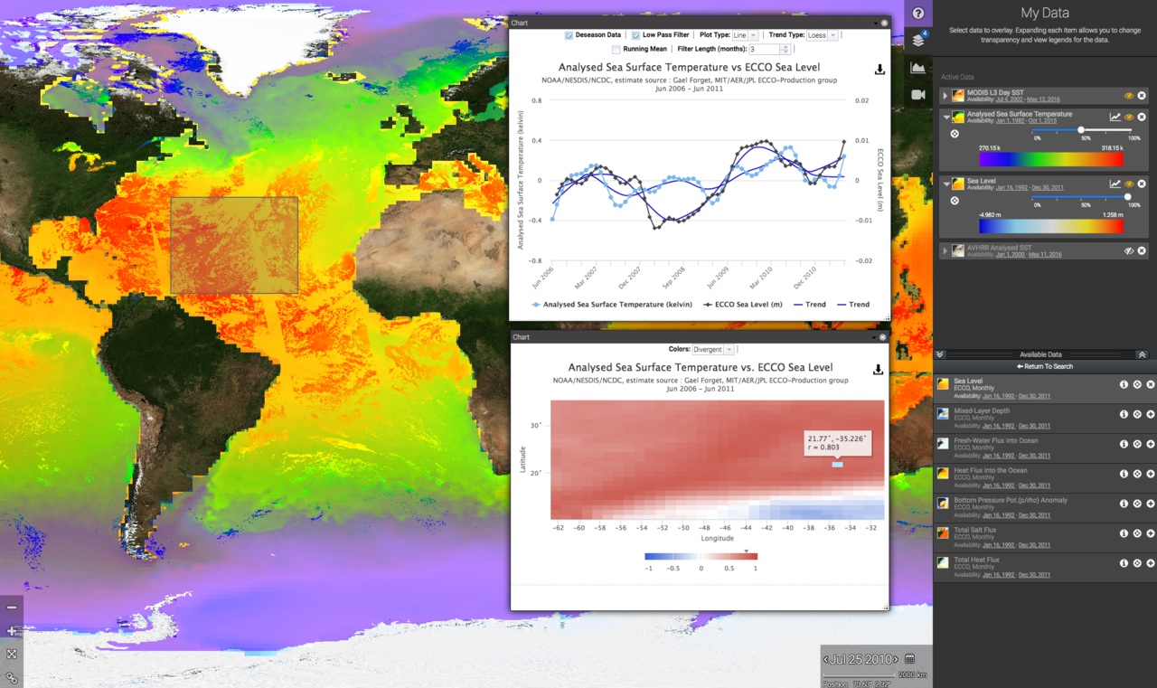
Understanding Sea Level
NASA keeps track of sea level change and its causes from space. Find out more about how NASA satellite observations help our understanding of this complex topic.
NASA keeps track of sea level change and its causes from space. Find out more about how NASA satellite observations help our understanding of this complex topic.
Global Sea Level
Explore the main causes: ice melt and heat-driven expansion of ocean water