


GEDI addresses its mission science questions by acquiring lidar waveform (i.e., vertical profile) observations between 51.6° N and S latitudes. By precisely recording the return timing of laser energy pulses shot at the Earth’s surface, each GEDI observation contains information about the vegetation canopy and the topography underneath. Scientists use this information to quantify canopy height, canopy vertical structure, and ground elevation.
The GEDI instrument includes three identical near-infrared lasers. Two are used at full power, while the other one is split into two beams, for a total of 4 beams. Each of the beams is optically dithered across-track to create a total of 8 ground tracks, with between-track spacing of ~600 m (~1969 ft), and a total across-track width of 4.2 km (~2.6 mi). The average along-track distance between the footprints is 60 m (~197 ft) and footprint size averages 25 m (~82 ft), resulting in almost continuous along-track coverage.
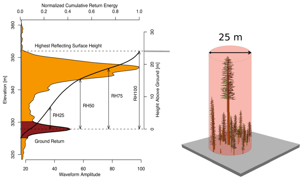
Shown here is sample GEDI lidar waveform [left]. The light brown area under the curve represents return energy from the canopy, while the dark brown area signifies the return from the underlying topography. The black line is the cumulative return energy, starting from the bottom of the ground return (normalized to 0) to the top of the canopy (normalized to 1). Relative Height (RH) metrics give the height at which a certain quantile returned energy is reached relative to the ground (the center of the ground return). The diagram on the right shows the distribution of trees that produced the waveform on the left.
