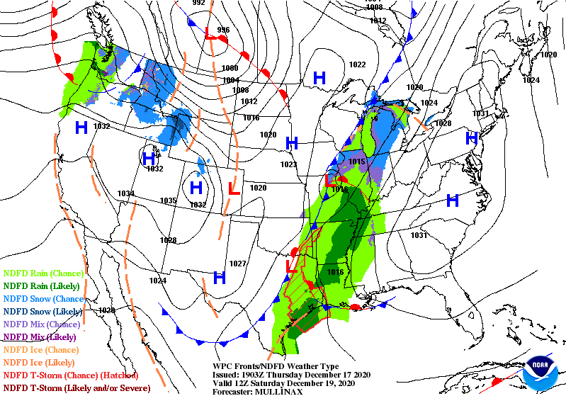
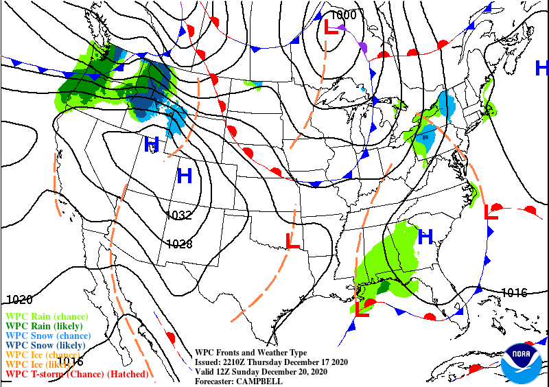
Valid Thu Dec 17, 2020
![Day 9 image not available](https://webarchive.library.unt.edu/web/20201218003308im_/https://www.wpc.ncep.noaa.gov/sfc/namussfc21wbg.gif)
![Day 1 image not available](https://webarchive.library.unt.edu/web/20201218003308im_/https://www.wpc.ncep.noaa.gov/sfc/usfntsfc21wbg.gif)
![Day 1 image not available](https://webarchive.library.unt.edu/web/20201218003308im_/https://www.wpc.ncep.noaa.gov/qpf/fill_94qwbg.gif)
![Day 1 image not available](https://webarchive.library.unt.edu/web/20201218003308im_/https://www.wpc.ncep.noaa.gov/qpf/94ewbg.gif)
![Day 1 image not available](https://webarchive.library.unt.edu/web/20201218003308im_/https://www.wpc.ncep.noaa.gov/wwd/day1_psnow_gt_04.gif)
![Day 1 image not available](https://webarchive.library.unt.edu/web/20201218003308im_/https://www.wpc.ncep.noaa.gov/medr/9jhwbg_conus.gif)
![1/3/4/24-hr Changes](https://webarchive.library.unt.edu/web/20201218003308im_/https://www.wpc.ncep.noaa.gov/exper/change/tmpf_latest_24_us.gif)
Change in weather parameters (temperature, dewpoint, surface pressure, etc) over the last 1/3/6/24 hours. Data is provided from the Real-Time Mesoscale Analysis (RTMA) or the Rapid Refresh (RAP).
![GEFS Probs](https://webarchive.library.unt.edu/web/20201218003308im_/https://www.wpc.ncep.noaa.gov/para/para_includes/collaboration/gefsprobs.png)
Plots of GEFS probabilistic forecast of precipitation, temperature, and sea-level pressure exceeding various thresholds.
![Local Storm Reports](https://webarchive.library.unt.edu/web/20201218003308im_/https://www.wpc.ncep.noaa.gov/para/para_images/lsr.png)
Custom plots of Local Storm Reports across the Contiguous United States. Reports include rain, snow, ice, and severe weather, as well as other significant information from storm spotters.
![Experimental Extreme Precipitation Monitor](https://webarchive.library.unt.edu/web/20201218003308im_/https://www.wpc.ncep.noaa.gov/para/para_images/epm_exper_staticimage.png)
Displays the climatological significance of precipitation forecast by WPC. The climatological significance is represented by Average Recurrence Intervals (ARIs) of precipitation estimates from NOAA Atlas-14 and Atlas2.
![ESAT](https://webarchive.library.unt.edu/web/20201218003308im_/https://www.wpc.ncep.noaa.gov/para/para_images/esat.png)
An interactive situational awareness table that displays anomalies, percentiles, and return intervals from the GEFS, NAEFS, and ECMWF Ensembles (login required to view ECMWF data).
*Please note that there is currently an issue where only users on a NOAA network can access this page. We are actively working to resolve this problem.
![NDFD Records](https://webarchive.library.unt.edu/web/20201218003308im_/https://www.wpc.ncep.noaa.gov/para/para_images/ndfdrecords_example.png)
Interactive display of where temperatures could approach or exceed records within the contiguous U.S. (based on NDFD temperature forecasts)
![NWS NDFD Max/Min Temperatures and Departure from Normal](https://webarchive.library.unt.edu/web/20201218003308im_/https://www.wpc.ncep.noaa.gov/para/para_images/ndfd_maxmin_departure.gif)
Displays Days 1-7 NDFD maximum and minimum temperatures, along with their respective departures from climatology.
![Prototype Snowband Probability Forecasts](https://webarchive.library.unt.edu/web/20201218003308im_/https://www.wpc.ncep.noaa.gov/para/para_images/MTD_example.png)
An interactive tool that depicts areas of heavy snowfall from individual members of high-resolution short range ensemble forecasts.
![CIPS Guidance](https://webarchive.library.unt.edu/web/20201218003308im_/https://www.wpc.ncep.noaa.gov/para/para_includes/collaboration/cips.png)
Analog guidance that uses an objective approach to find historical events that are similar to the upcoming forecast.
![National Blend](https://webarchive.library.unt.edu/web/20201218003308im_/https://www.wpc.ncep.noaa.gov/para/para_includes/collaboration/nblend.png)
Nationally consistent and skillful suite of calibrated forecast guidance based on a blend of both NWS and non-NWS numerical weather prediction model data and post-processed model guidance.
![AR Portal](https://webarchive.library.unt.edu/web/20201218003308im_/https://www.wpc.ncep.noaa.gov/para/para_includes/collaboration/arportal.png)
A portal for atmospheric river forecasts and diagnostics from the GEFS.
![GEFS Plumes](https://webarchive.library.unt.edu/web/20201218003308im_/https://www.wpc.ncep.noaa.gov/para/para_includes/collaboration/gefs.png)
An interactive display of time series plots from GEFS ensemble members at a point.
![SPC Tools](https://webarchive.library.unt.edu/web/20201218003308im_/https://www.wpc.ncep.noaa.gov/para/para_images/spctools.png)
A variety of useful tools generated at The Storm Prediction Center (SPC).
![ECMWF](https://webarchive.library.unt.edu/web/20201218003308im_/https://www.wpc.ncep.noaa.gov/para/para_includes/collaboration/ecmwf.png)
Output from the ECMWF 'Ensemble Prediction System' (ENS) for four parameters: mean sea level pressure, 850 hPa temperature, 850 hPa wind speed, and 500 hPa geopotential height.