Tool

DWMAPs: Showing the Way to Cleaner Water

By Mary Schollhamer

Growing up, I have always been a big fan of outdoor activities and enjoyedA family dog enjoys the beach. 
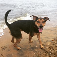
spending time at the beach with my family. The ocean was a big part of our lives, whether we were fishing, swimming, or on my grandfather’s boat. Now that I have a family of my own, we pack the car and the dog and head to the Outer Banks on the coast of North Carolina.

This summer, as my family was playing in the shallow tide and my dog was chasing crabs, I asked myself, “Is my family safe?”

Last month, EPA released a new tool to answer my question: the Drinking Water Mapping Application to Protect Source Waters (DWMAPS). DWMAPs is an online mapping tool to help you find information about drinking water and surface water in your community. I zoomed the map into the beach near Kitty Hawk, NC and added a layer of data to tell me if there were any existing Total Maximum Daily Loads (TMDLs) for these waters. A TMDL is a calculation of the maximum A screenshot of the DWMAPs tool.amount of a pollutant that can occur in a water body and serves as a potential starting point for restoration and maintaining water quality standards. The map provided links to location-specific reports, one of which told me the only problem I should be concerned about is the high-level of mercury in the fish caught in this area.  The DWMAPS tool is very informative and great for helping to protect your family and pets from harmful substances.

While DWMAPs is an easy way to find out about sources of pollution near your drinking water or how to get involved in protecting sources of drinking water in my community, it’s also a great tool for drinking water professionals. DWMAPs can be used to identify potential sources of contamination in specific locations, find data to support source water assessments, and help implement plans to manage potential sources of contamination. The new tool can also evaluate accidental spills and releases, identifying where emergency response resources for accidental releases must be readily available, and promote integration of drinking water protection activities with other environmental programs at the EPA, state, and local levels.

For information about what you can do to help, visit DWMAPs and click “What Can I Do About It?”

About the author:  Mary Schollhamer is the Acting Deputy Director of Communications in the Office of Water. She holds a Master’s Degree in English with a focus on ecofeminism from Stony Brook University and loves dogs.


Editor's Note: The opinions expressed herein are those of the author alone. EPA does not verify the accuracy or science of the contents of the blog, nor does EPA endorse the opinions or positions expressed. You may share this post. However, please do not change the title or the content. If you do make changes, please do not attribute the edited title or content to EPA or the author.

EPA's official web site is www.epa.gov. Some links on this page may redirect users from the EPA website to a non-EPA, third-party site. In doing so, EPA is directing you only to the specific content referenced at the time of publication, not to any other content that may appear on the same webpage or elsewhere on the third-party site, or be added at a later date.

EPA is providing this link for informational purposes only. EPA cannot attest to the accuracy of non-EPA information provided by any third-party sites or any other linked site. EPA does not endorse any non-government websites, companies, internet applications or any policies or information expressed therein.

Increasing Transparency through Improved Data Access

By Jessie Johnson

In college I worked with community groups to address local agriculture and food safety issues. During that time, I learned how many people in the community didn’t really understand these issues or what to do about them. I started to think about transparency and the importance of community involvement and education. I am thrilled to now be a part of the team working on the Enforcement and Compliance History Online tool, known as ECHO. This tool allows users to search facilities that are in non-compliance with environmental laws and helps make EPA enforcement efforts and companies’ actions more transparent for the general public.

Each year the ECHO team hears from users around the country about enhancements they would like to see. We have been working hard to create, promote, and improve the highlighted tools in the ECHO system and build new, useful tools. Some of our notable improvements include:

 2015 Highlights

  • Users now have a “Use My Location” feature on their mobile devices to find facilities within a three-mile radius.
  • When users search by case name, defendant name or facility name on the enforcement case search, they can choose to search for exact matches or names that begin with a search term.
  • An ECHO tool guide provides users with tips about tools for various analyses.
  • Pesticide Worker Protection dashboard provides a summary of enforcement and compliance aimed to reduce risk of pesticide poisoning and injury.
  • Online tutorials are available for clean water effluent charts, detailed facility reports, and the error reporting feature.

2016 Plans

I am also excited to share what’s in store for 2016. We will be focusing on improving ECHO tools and increasing public involvement. When I joined EPA, I came with a personal goal to help others get involved with knowing their environmental community and reporting on noncompliance of environmental laws. I am personally looking forward to seeing more public users and feedback so we can improve our enforcement efforts. But as a team, we have a lot of exciting projects for 2016 to help make ECHO more useful and informative for everyone.

  • Users will be able to search for criminal enforcement cases as well as the current opportunity to search civil enforcement cases.
  • Enhanced search results and mapping capabilities.
  • Water quality mapping.
  • Frequent tutorials and trainings for both public and government users.

After a great 2015 of modernizing ECHO I am looking forward to 2016!

Jessie Johnson is new to EPA as a program analyst with the Office of Enforcement and Compliance Assurance. She specializes in GIS technology and will be working to help improve the enforcement maps and training others in map analysis and has a particular interest in how GIS mapping can help improve enforcement and management efforts.

Editor's Note: The opinions expressed herein are those of the author alone. EPA does not verify the accuracy or science of the contents of the blog, nor does EPA endorse the opinions or positions expressed. You may share this post. However, please do not change the title or the content. If you do make changes, please do not attribute the edited title or content to EPA or the author.

EPA's official web site is www.epa.gov. Some links on this page may redirect users from the EPA website to a non-EPA, third-party site. In doing so, EPA is directing you only to the specific content referenced at the time of publication, not to any other content that may appear on the same webpage or elsewhere on the third-party site, or be added at a later date.

EPA is providing this link for informational purposes only. EPA cannot attest to the accuracy of non-EPA information provided by any third-party sites or any other linked site. EPA does not endorse any non-government websites, companies, internet applications or any policies or information expressed therein.