

Photos & videos

Natural Earth data at 100-meter resolution is out now in four regional GeoTIFFs. http://1.usa.gov/18xMX9F <> pic.twitter.com/YI3FWCKo52


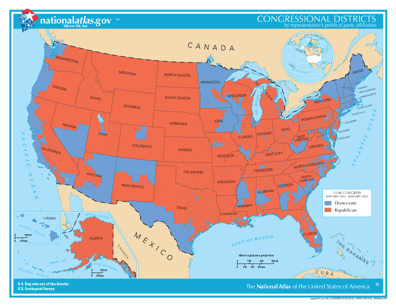
National map of Congressional Districts by Political Party Affiliation (page-sized PDF). http://1.usa.gov/bENjBH pic.twitter.com/9smZvc3XoQ
Printable Maps of current Congressional Districts boundaries for each state are out in PDF. http://1.usa.gov/bENjBH pic.twitter.com/CQ7RnqzaCp

@nationalatlas hasn't sent any Tweets with photos or videos yet.
Twitter may be over capacity or experiencing a momentary hiccup.
Visit Twitter Status for more information.