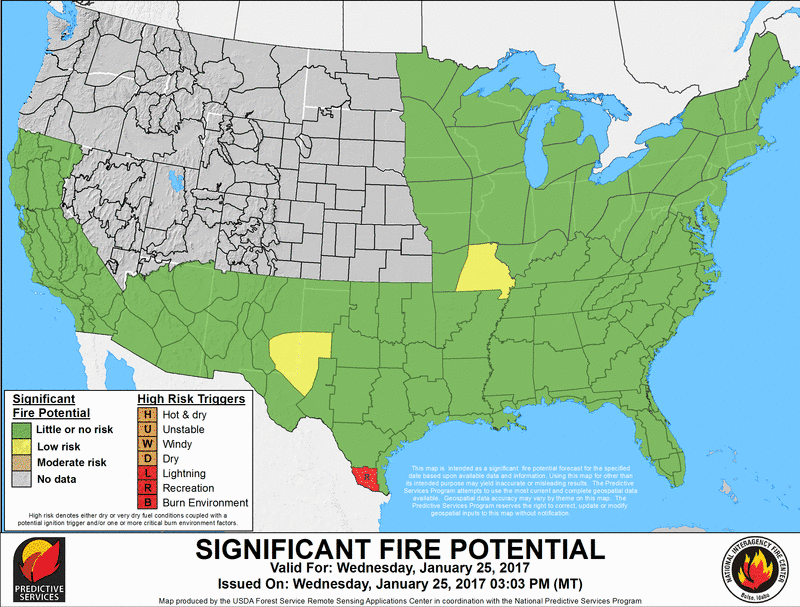
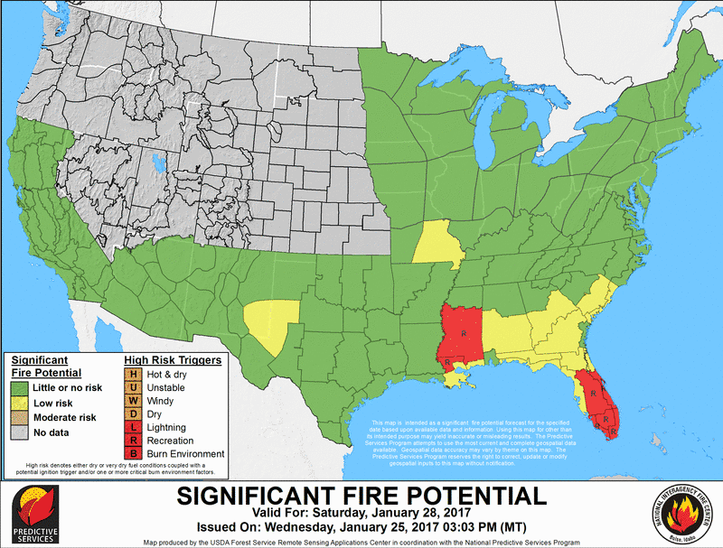
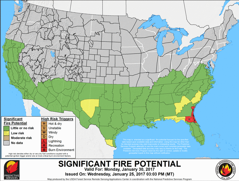
Incident Management Situation Report
  National Fire News
  All Hazard Incidents
 

PREDICTIVE SERVICES

 
  Weather
  Fuels/Fire Danger
  Outlooks
  National Predictive Services Subcommittee
  Links
  Aviation
  Crews
  Equipment/Supplies
  Overhead
  Reference Materials
   
ADMINISTRATIVE
  National Multi-Agency Coordinating Group
  Policy and Reports
  Incident Business Management
  Safety Management
  Training
  National Wildfire Coordinating Group
 
   
[graphic] Color Curve
 
OUTLOOKS
 
National Significant Wildland Fire Potential Outlook

This product provides outlooks for the current month, the month following and a seasonal look at the two months beyond that.

The main objectives of the National Significant Wildland Fire Potential Outlooks are to improve information available to fire management decision makers.  These assessments are designed to inform decision makers for proactive wildland fire management, thus better protecting lives and property, reducing firefighting costs and improving firefighting efficiency. 
The following maps represent the cumulative forecasts of the eleven Geographic Area Predictive Services Units and the National Predictive Services Unit. 
The entire text document can be found at the following link, National Wildland Significant Fire Potential Outlook.
This product is updated on the first of each month.
  Outlook Month 1 Outlook Month 2 Extended Outlook  
*Click on any graphic to access an enlarged version of the image
 
North American Significant Wildland Fire Potential Outlook.
 
National Significant Wildland Fire Potential Archive
 
These maps are a compilation of Geographic Area 7-Day Significant Fire Potential Outlooks. This product should be fully updated by 12:00 MDT daily.
Note: These outlooks are only posted when Geographic Areas are in fire season and Predictive Services staff are on duty..
Outlook Month 1 Outlook Month 1 Outlook Month 1 Outlook Month 1 Outlook Month 1 Outlook Month 1 Outlook Month 1
 
7-Day Significant Fire Potential National Viewer
Predictive Services Geospatial Products and Data - Including static and interactive map product
7-Day Significant Fire Potential Product Description
 
Each Geographic Area Predictive Services unit produces fire weather, fire danger, and fire potential reports. Predictive Services Outlooks for each Geographic Area can be found by clicking on the Area on the map below.
 
 
January February March April May June July August September October November December
 
*Graphics created from 1999 - 2010 FPA data
 
 
[Graphic] - Your First Click to the Federal Government Website

home | about | disclaimer | site map | contact us

National Interagency Coordination Center
National Interagency Fire Center
3833 S. Development Ave., Boise, Idaho, 83705