Shifting Without Datum Documentation
By Casey J. McLaughlin
Most of us take for granted that latitude and longitude always mean the same place on a map but is that true? I started thinking about GPS points and how a simple hand held (or my phone) may have an error of +/- several feet. Now I am wondering if the fuss I make about specifying Datum is worthwhile….
A Datum, defined by Webster’s is generally “something used as a basis for calculating or measuring.” Ah ha! I had never thought outside of the geographic usage of the word but I find understanding word roots can be quite helpful. What I really mean is what impact a Geodetic Datum has on latitude/longitude pairs. A Geodetic Datum is “the reference point for the various coordinate systems used in mapping the earth” (Geography.about.com). The Earth isn’t perfectly round and geodetic datums form the mathematical basis for modeling our home.
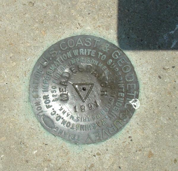
There are several datums which I see most frequently; NAD27, NAD83, and WGS1984. The NAD27 (North American Datum 1927) is interesting from a Region 7 perspective because its origin point is a survey point in Kansas – Meades Ranch (approx. 39.224087, -98.542152). Just for reference, the geometric center of the contiguous U.S. is also in Kansas! Once we began using high precision remote sensing technology, we needed a new datum – NAD83 (North American Datum 1983) was born. NAD83 has its origin defined by the Earth’s center of mass. The two systems are different enough that a given latitude/longitude could be several meters off – depending on the distance from the datum! Today, the World Geodetic System (WGS) 1984 Web Mercator is commonly used – I believe most major web platforms use it.
The main point I’m getting at here is that documenting the coordinate system information of geospatial data IS important. I have seen more than one dataset come in without proper documentation. To map it, I have to assume what datum is used – it wasn’t recorded. Please, if you’re collecting spatial data, don’t complicate it with incomplete information! Documenting our data collections is vital for using data with confidence and ensuring future data reuse.
For more information on Geodesy and such, check out:
Casey McLaughlin is a first generation Geospatial Enthusiast who has worked with EPA since 2003 as a contractor and now as the Regional GIS Lead. He currently holds the rank of #1 GISer in EPA Region 7′s Environmental Services Division.


Feb 12, 2013 @ 08:22:18
Very interesting article with useful information.