
- 12201 Sunrise Valley Drive
- Reston, VA 20192, USA
- 703-648-5953
- 1-888-ASK-USGS
- Employee Directory
- Web Chat
The U.S. Geological Survey (USGS) Core Science Systems (CSS) Mission Area builds on the core strengths of the USGS in characterizing and understanding complex Earth and biological systems through research, modeling, mapping, and the production of high-quality data. CSS delivers natural science information to the Nation in support of smart decisionmaking.
Read The Mission Overview
The National Geospatial Program is the Federal civilian mapping agency and provides the digital geospatial foundation for the Nation. It engages partners and communities of use to collaboratively produce consistent and accurate topographic map data.
Learn More
The USGS Science Data Catalog, supported by CSAS&L, provides seamless access to USGS research and monitoring data from across the nation. Users have the ability to search, browse, or use a map-based interface to discover data.
Learn More
USGS has many partnerships, both foreign and domestic, that enhance our science capabilities, provide needed support to others, and expand our ability to serve the global community. One little-known partnership that serves both foreign and domestic needs is the USGS science support to the U.S. Department of Defense (DOD) - U.S. Northern Command (USNORTHCOM).

New study investigates groundwater from the air

As part of The National Map transition to cloud hosting, several of the National Map NAIP Orthoimagery Services will be provided under new URLs.

The term “resilience” is ubiquitous in technical literature; it appears in numerous forms, such as resilience, resiliency, or resilient, and each use may have a different definition depending on the interpretation of the writer. This creates difficulties in understanding what is meant by ‘resilience’ in any given use case, especially in...
Context Remotely sensed differenced normalized burn ratios (DNBR) provide an index of fire severity across the footprint of a fire. We asked whether this index was useful for explaining patterns of bird occurrence within fire adapted xeric pine-oak forests of the southern Appalachian Mountains. Objectives We evaluated the use of DNBR indices for...
One method for working with large, dense sets of spatial point data is to aggregate the measure of the data into polygonal containers, such as political boundaries, or into regular spatial bins such as triangles, squares, or hexagons. When mapping these aggregations, the map projection must inevitably distort relationships. This distortion can...

Beginning in 2012, the USGS collaborated with the USDA to assess the effectiveness of pollinator plantings and how alteration of landscapes has affected native pollinators and potentially contributed to their decline. The 2008 Farm Bill recognized contributions made by pollinators and made conservation of pollinator habitat a priority. The USGS is assessing native bee habitat,...

The USGS Core Science Analytics and Synthesis and Library (CSAS&L) program coordinates multiple observation and measurement projects that generate multiple terabytes of publishable data. The Information Science Branch is collaborating with CSAS&L to design and build a dynamic data assembly pipeline for data collected by these projects. The pipeline includes numerous data transformation...

Working with the Northern Rockies Science Center, the Information Science Branch designed and developed ScienceCache, a scientific geocaching mobile application framework. Initially developed for citizen science data collection, the application was extended to work for any field data collection effort. The lead researcher controls the data collection route, collection forms, and data...

The Information Science Branch developed a set of performance, security, and resiliency models to evaluate information architectures optimized for cloud hosting solutions.

The Information Science Branch provides Agile project management, technical oversight, software research and development, and architectural support to the USGS ScienceBase project. ScienceBase provides a number of features that scientists can use to build data collections, share data through web services, and ensure these data are preserved for use by future researchers. The project involves...

The USIEI is a comprehensive, nationwide listing of known high-accuracy topographic and bathymetric data for the United States and its territories. The project is a collaborative effort of the USGS and NOAA with contributions from other federal agencies. The inventory supports the 3D Elevation Program and the Integrated Ocean and Coastal Mapping effort. This resource is updated in Spring and...

High quality 3D elevation data are critical to flood risk management, resource management, conservation, alternative energy, agriculture, infrastructure management, and a broad range of other nationally significant applications. 3DEP is a cooperative program, managed by the USGS on behalf of the community, with the goal to complete national coverage of 3D elevation data in 8 years.

The Alaska Mapping Executive Committee (AMEC) meets regularly to coordinate on critical Alaska topographic mapping activities. Executives from 15 Federal agencies and the State of Alaska are combining efforts to acquire new digital elevation, hydrography, transportation, shoreline and geopositional data for Alaska, and create a new digital topographic map series for the State.

The USGS Science Data Catalog serves as a single access point for public USGS scientific datasets and as a conduit to external catalogs in response to Federal Open Data requirements. The SDC allows the public to access USGS datasets through text and GIS-based search; topical browse, and keyword, mission area, data source, and scientist faceting.

The Alaska Mapping Initiative is a U.S. Geological Survey effort to generate new topographic maps of Alaska. The USGS is coordinating with the State of Alaska and multiple Federal agencies to acquire updated digital map layers such as elevation, surface water, roads, and boundaries, and to create a modern series of digital maps for Alaska using these updated layers.

OBIS-USA is the US Node of the Ocean Biogeographic Information System, providing the collection and distribution point to OBIS of marine biogeographic records in U.S. waters or collected with U.S. funding. Using the Darwin Core standard, OBIS-USA integrates and makes accessible data on marine species presence, absence, and abundance to aid scientists, resource managers, and decisions makers.

Biodiversity Information Serving Our Nation (BISON) is a web-based resource for species occurrence data in the U.S. and its Territories. BISON holds over 250 million species occurrence records, encompassing most living species found in the United States, from a broad array of sources, including museums, monitoring programs, research studies, citizen science projects and peer-reviewed...
 Screenshot")
The Dam Removal Information Portal is a Web site that serves information about the scientific studies associated with dam-removal projects. It is a visualization tool, including a map and interactive charts, of a dam-removal literature review designed and developed by a working group at the USGS John Wesley Powell Center for Analysis and Synthesis (Bellmore and others, 2015).

Radar data is being collected statewide for Alaska under direction of the USGS 3D Elevation Program (3DEP). The new data is vastly improving the accuracy and resolution of elevation data for the state, and is being collected using an airborne Interferometric Synthetic Aperture Radar (IfSAR) sensor. USGS and the State of Alaska maintain web-based status maps and download services.

The transportation data theme consists of roads, airports, railroads, and features associated with the transport of people or commerce. The data includes the location, classification, name/route designator, for most roads, and address ranges. The data supports mapping and geographic analysis for applications for routing, traffic safety, congestion mitigation, and disaster planning and response.

USGS data portray selected structures data, including the location and characteristics of manmade facilities. Characteristics consist of a structure's physical form (footprint), function, name, location, and detailed information about the structure. The types of structures collected are largely determined by the needs of the disaster planning and response and homeland security organizations.

The National Land Cover Database (NLCD) serves as the definitive Landsat-based, 30-meter resolution, land cover database for the Nation.

Boundaries data or governmental units represent major civil areas including states, counties, Federal, and Native American lands, and incorporated places such as cities and towns.

The National Hydrography Dataset (NHD) and Watershed Boundary Dataset (WBD) are used to portray surface water on The National Map.
The USIEI is a comprehensive, nationwide listing of known high-accuracy topographic and bathymetric data for the United States and its territories. The project is a collaborative effort of the USGS and NOAA with contributions from other federal agencies. The inventory supports the 3D Elevation Program and the Integrated Ocean and Coastal Mapping effort. This resource is updated in Spring and Fall.

The 3DEP products and services available through The National Map consist of lidar point clouds (LPC), standard digital elevation models (DEMs) at various horizontal resolutions, elevation source and associated datasets, an elevation point query service and bulk point query service. All 3DEP products are available, free of charge and without use restrictions.
ITIS is the authoritative taxonomic information on plants, animals, fungi, and microbes of North America and the world. We are a partnership of U.S., Canadian, and Mexican agencies (ITIS-North America); other organizations; and taxonomic specialists. ITIS data is used in thousands of databases in industry, academia and government.

The GAP Species Viewer provides nation-wide range maps and distribution models for amphibians, birds, mammals, and reptiles occurring in the continental U.S., Alaska, Hawaii, Puerto Rico, and U.S. Virgin Islands. These kinds of maps and data are fundamental to assessing patterns of species richness and planning for the management of the nation's biological diversity.

The Biocomplexity Thesaurus is an online resource supporting terms in a 'broader than' and 'narrower than' structure in ecological and biological sciences.

The OBIS-USA biogeographic tool provides a summary of the biodiversity (either as lists of species or as certain common diversity indices) for defined biogeographic or jurisdictional regions.

A web-based map viewer allowing users to search, view and download species occurrence data from BISON.

The GAP Protected Areas Database of the United States (PAD-US) Viewer provides a spatially explicit inventory that lets any user – from the general public to professional land managers – explore the protected areas network anywhere in the United States and allows them to easily use this inventory in conservation, land management, planning, recreation and other uses.
The OBIS-USA Data Dashboard offers multiple ways to discover, determine suitability for use, and obtain marine biological occurrence data, collected primarily from U.S. Waters or with U.S. funding. It assists users with maps, graphs, tables, and links to metadata while searching. Users can explore the data by geography, taxon, or individual dataset.

The GAP National Land Cover Data Viewer provides detailed, consistent maps of vegetation and land-use patterns for the continental United States, Alaska, Hawaii, and Puerto Rico. Knowledge about which types of vegetation occur across the country helps facilitate the planning and management of biological diversity on a regional and national scale.
The GAP Species Viewer provides nation-wide range maps and distribution models for amphibians, birds, mammals, and reptiles occurring in the continental U.S., Alaska, Hawaii, Puerto Rico, and U.S. Virgin Islands. These kinds of maps and data are fundamental to assessing patterns of species richness and planning for the management of the nation's biological diversity.

The viewer allows exploring the condition of stream and coastal habitats across the country at various spatial scales, reported in Through a Fish's Eye: The Status of Fish Habitats in the United States 2010. It offers a variety of base maps and provides one-click access to more detailed information on landscape disturbances and habitat scores for individual stream catchments.
The 3DEP products and services available through The National Map consist of standard digital elevation models (DEMs) at various horizontal resolutions, elevation source and associated datasets, an elevation point query service and bulk point query service. All 3DEP products are available, free of charge and without use restrictions.

The National Map offers a collection of small-scale datasets, most of which are at 1:1,000,000. The National Map publishes two data collections at one million-scale: one for Global Map users and one for National Map users. In terms of vector geometry, the lines, points, and areas in these data collections are identical. The difference is in the attributes assigned to these features.

US Topo maps are modeled on the familiar 7.5-minute, 1:24,000-scale quadrangle maps of the period 1947-1992, but are mass-produced from national GIS databases on a 3-year cycle.The maps are layered PDF documents with geospatial extensions. They are downloadable free of charge through several interfaces.

This is the primary search and download application for USGS topographic maps and base-layer GIS data. The same topographic maps are also downloadable through other interfaces.

USGS topographic maps originally published on paper in the period 1884-2006 have been scanned and published as PDF documents. This collection is of topographic quadrangle maps with scales between 1:10,000 and 1:250,000. These historic documents are downloadable free of charge through several interfaces.
The term “resilience” is ubiquitous in technical literature; it appears in numerous forms, such as resilience, resiliency, or resilient, and each use may have a different definition depending on the interpretation of the writer. This creates difficulties in understanding what is meant by ‘resilience’ in any given use case, especially in...
Wilt, Bonnie; Long, Suzanna K.; Shoberg, Thomas G.One method for working with large, dense sets of spatial point data is to aggregate the measure of the data into polygonal containers, such as political boundaries, or into regular spatial bins such as triangles, squares, or hexagons. When mapping these aggregations, the map projection must inevitably distort relationships. This distortion can...
Battersby, Sarah E.; Strebe, Daniel “daan”; Finn, Michael P.The isotopic composition of lead (Pb) in fugitive dust suspended by a vehicle from 13 unsurfaced roads in Missouri was measured to identify the source of Pb within an established long-term mining area. A three end-member model using 207Pb/206Pb and concentration as tracers resulted in fugitive dust samples plotting in the mixing field of well...
Witt, Emitt C.; Pribil, Michael; Hogan, John P; Wronkiewicz, DavidContext Remotely sensed differenced normalized burn ratios (DNBR) provide an index of fire severity across the footprint of a fire. We asked whether this index was useful for explaining patterns of bird occurrence within fire adapted xeric pine-oak forests of the southern Appalachian Mountains. Objectives We evaluated the use of DNBR indices for...
Rose, E.T., T. R. Simons, R. Klein, A. J. McKerrowThe majority of restoration strategies in the wake of large-scale disasters have focused on short-term emergency response solutions. Few consider medium- to long-term restoration strategies to reconnect urban areas to national supply chain interdependent critical infrastructure systems (SCICI). These SCICI promote the effective flow of goods,...
Ramachandran, Varun; Long, Suzanna K.; Shoberg, Thomas G.; Corns, Steven; Carlo, Hector J.Old, archived geologic maps are often available with little or no associated metadata. This creates special problems in terms of extracting their data to use with a modern database. This research focuses on some problems and uncertainties associated with conflating older geologic maps in regions where modern geologic maps are, as yet, non-existent...
Shoberg, Thomas G.We linked state-and-transition simulation models (STSMs) with an economics-based timber supply model to examine landscape dynamics in North Carolina through 2050 for three scenarios of forest biomass production. Forest biomass could be an important source of renewable energy in the future, but there is currently much uncertainty about how biomass...
Costanza, J.K., R. C. Abt, A. J. McKerrow, J.A. Collazo
Managing ecosystems for resilience and sustainability requires understanding how they will respond to future anthropogenic drivers such as climate change and urbanization. In fire-dependent ecosystems, predicting this response requires a focus on how these drivers will impact fire regimes. Here, we use scenarios of climate change, urbanization and...
Costanza, J. K., A.J. Terando, A. J. McKerrow, J. A. CollazoGrowing use of two-dimensional (2-D) hydraulic models has created a need for high resolution data to support flood volume estimates, floodplain specific engineering data, and accurate flood inundation scenarios. Elevation data are a critical input to these models that guide the flood-wave across the landscape allowing the computation of valuable...
Witt, Emitt C.Geospatial data are a key component of investigating, interpreting, and communicating the geological sciences. Locating geospatial data can be time-consuming, which detracts from time spent on a study because these data are not obviously placed in central locations or are served from many disparate databases. The National Map of the US Geological...
Witt, Emitt C.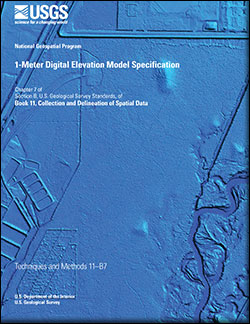
In January 2015, the U.S. Geological Survey National Geospatial Technical Operations Center began producing the 1-Meter Digital Elevation Model data product. This new product was developed to provide high resolution bare-earth digital elevation models from light detection and ranging (lidar) elevation data and other elevation data collected over...
Arundel, Samantha T.; Archuleta, Christy-Ann M.; Phillips, Lori A.; Roche, Brittany L.; Constance, Eric W.Hydrographic networks form an important data foundation for cartographic base mapping and for hydrologic analysis. Drainage density patterns for these networks can be derived to characterize local landscape, bedrock and climate conditions, and further inform hydrologic and geomorphological analysis by indicating areas where too few headwater...
Stanislawski, Larry V.; Falgout, Jeff T.; Buttenfield, Barbara P.


USGS has many partnerships, both foreign and domestic, that enhance our science capabilities, provide needed support to others, and expand our ability to serve the global community. One little-known partnership that serves both foreign and domestic needs is the USGS science support to the U.S. Department of Defense (DOD) - U.S. Northern Command (USNORTHCOM).
New study investigates groundwater from the air
As part of The National Map transition to cloud hosting, several of the National Map NAIP Orthoimagery Services will be provided under new URLs.

Calling all Earth Science professors conducting research or teaching geologic mapping. The USGS EDMAP Program is accepting funding proposals focusing on geologic mapping to support upper-level undergraduate and graduate students at their colleges or universities.

Congratulations to the winners of the 4th Annual Best Student Geologic Map Competition, held at the Geological Society of America's recent Annual Meeting in Denver, Colo.

Results of the Pennsylvania and New York Law Enforcement Mapping Challenges Released

Newly released US Topo maps are now available and for the first time, the maps covering Great Smoky Mountains National Park display trails, campgrounds, visitor centers, boundaries and other visitor information in a national park.

It’s not a radar for liars, it’s this week’s Earthword...

Effective September 6, 2016, walk-in sales and services at the California Geological Survey map sales office (located in the U.S. Geological Survey offices) on Middlefield Road in Menlo Park will be discontinued.

Calvin Meyer, of the USGS National Geospatial Technical Operations Center, receives Interior Department‘s Customer Service Award

The USGS National Geospatial Program has released an interactive Story Map giving viewers an overview of the US Topo map program

Kari Craun honored by USGS peers with Henry Gannett award for exceptional contributions to topographic mapping


