
- 12201 Sunrise Valley Drive
- Reston, VA 20192, USA
- 703-648-5953
- 1-888-ASK-USGS
- Employee Directory
- Web Chat
We conduct impartial, multi- and interdisciplinary research and monitoring on a large range of natural-resource issues that impact the quality of life of citizens and wildlife throughout the New England and Mid-Atlantic states of Connecticut, Delaware, Maine, Maryland, Massachusetts, New Hampshire, New Jersey, New York, Pennsylvania, Rhode Island, West Virginia, Vermont and Virginia.

Eastern Geology Paleoclimate; Leetown Aquatic; MD/DC/DE Water; National Minerals; New England Water- VT/NH/MA/ME/RI/CT; NJ Water; NY Water; Patuxent Wildlife; PA Water; VA/WV Water; Woods Hole Coastal Marine
Northeast Centers
If coastal salt marshes are like savings accounts, with sediment as the principal, all eight Atlantic and Pacific coast salt marshes studied are "in the red," researchers found.

A regional assessment of untreated groundwater in the Northern Atlantic Coastal Plain aquifer system in the eastern United States is now available from the U.S. Geological Survey.
A regional assessment of untreated groundwater in the combined Valley and Ridge and Piedmont and Blue Ridge aquifers in the eastern United States is now available from the U.S. Geological Survey.
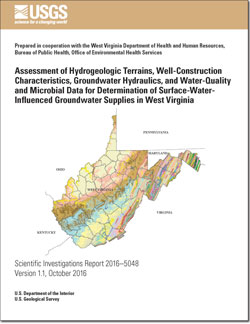
In January 2014, a storage tank leaked, spilling a large quantity of 4-methylcyclohexane methanol into the Elk River in West Virginia and contaminating the water supply for more than 300,000 people. In response, the West Virginia Legislature passed Senate Bill 373, which requires the West Virginia Department of Health and Human Resources (WVDHHR)...


Digital geospatial datasets of the extents and top elevations of the regional hydrogeologic units of the Northern Atlantic Coastal Plain aquifer system from Long Island, New York, to northeastern North Carolina were developed to provide an updated hydrogeologic framework to support analysis of groundwater resources.
One of the major strengths of the Northeast Area is the enthusiasm and commitment of our scientists to produce the type of high quality science that the USGS is known for. Working together with our partners across the nation, we have the ability to provide complete, integrated and holistic environmental information that will produce the best results that we can achieve.
USGS scientists have determined that high-salinity groundwater found more than 1,000 meters (0.6 mi.) deep under the Chesapeake Bay is actually remnant water from the Early Cretaceous North Atlantic Sea and is probably 100-145 million years old.
This is the oldest sizeable body of seawater to be identified worldwide.
Twice as salty as modern seawater, the ancient seawater was...
The purpose of the Designing Sustainable Coastal Habitats workshop and the approach the workshop steering committee used to bring together scientists, habitat restoration partners, and policy makers to address three goals. The three workshop goals or themes were to:
1. Assess the current status and trending condition of coastal ecosystems in the Chesapeake Bay watershed;...
Pollution-reducing practices can improve water quality in the Chesapeake Bay and its rivers and streams, according to new research from the Chesapeake Bay Program partnership. In a report released today, a number of case studies show that “best management practices”—including upgrading wastewater treatment plants, lowering vehicle and power plant emissions and reducing runoff...
The Challenge: Ancient Egyptians mummified animals for a variety of reasons, not the least of which was as votive offerings to certain deities. Among the six species of shrews that have been identified as mummies, one is now extinct, one is no longer occurs in Egypt, and the remaining four have more restricted distributions in the country. One of the latter species also exhibits...
The Challenge: The postcranial skeletons of mammals exhibit tremendous variation in form that partly relates to phylogeny (who a particular species is related to) and partly to locomotory function (how that species moves through its environment). Understanding the contributions of these two factors is important because phylogenetic characters assist in working out evolutionary...
The Challenge: Achieving conservation objectives in protected natural areas requires the ability to sustain visitation while avoiding or minimizing adverse environmental impacts. Trails are an essential infrastructure component that limits resource impacts by concentrating use on hardened treads designed and maintained to sustain traffic. This is particularly challenging...
The Challenge: The Potomac River Gorge, managed by the National Park Service in Virginia and Maryland, is a highly accessible protected natural area bordered by the intensively developed Washington metro region. The Gorge is biologically rich, with more than 400 occurrences of over 200 rare species. Potomac Gorge receives exceptionally heavy visitation, with nearly two...
The Challenge: The proliferation and degradation of visitor-created “informal” trails in protected areas can be a vexing management issue for land managers. Formal trail systems never provide access to all locations required by visitors seeking to engage in a variety of appropriate recreational activities. Traveling off-trail may be necessary to engage in...
The Challange: In eastern North America there is a viral disease called Eastern Equine Encephalitis, or EEE. This virus is transmitted among native bird species by the mosquito, Culiseta melanura, but does not cause disease in these passerine species. However, the virus is capable of causing severe disease or death in horses, some game bird species, humans and whooping...
The Challange: Whooping cranes have been successfully introduced using costume rearing techniques in either a direct autumn release or in an ultralight led migration from Wisconsin to Florida. In Florida, we have also released parent-reared whooping cranes. Not much is known about the learning that takes place in this K-selected species over the almost one year that...
The Challenge: Many critical wildlife surveys, such as the North American Breeding Bird Survey (BBS), are analyzed using complex hierarchical models. These models are generally multi-scale and contain random effects; the standard approaches to model selection and assessment of model fit are often inappropriate and no simple way exists to compare alternative models....
About data and tools used by USGS...
Hydrologic Conditions Mapper (NYWSC)
The survey was conducted in summer 2002 to assess the presence of terrapins in the Maryland portion of the Chesapeake Bay. Results are spatial locations of evidence related to nesting.

NWIS Maps all sites with links to all available water data for individual sites. These pages provide access to water-resources data collected at approximately 1.5 million sites in all 50 States, the District of Columbia, Puerto Rico, the Virgin Islands, Guam, American Samoa and the Commonwealth of the Northern Mariana Islands.

The 3DEP products and services available through The National Map consist of lidar point clouds (LPC), standard digital elevation models (DEMs) at various horizontal resolutions, elevation source and associated datasets, an elevation point query service and bulk point query service. All 3DEP products are available, free of charge and without use restrictions.

USGS 04295000 Richelieu River (Lake Champlain) at Rouses Point NY View of the River. Webcam updated 4 times daily.

USGS 04294413 Lake Champlain at Port Henry NY View of the Lake. Webcam updated 4 times daily.

USGS 01357500 Mohawk River at Cohoes NY View of the Falls. Webcam updated 4 times daily.

USGS 01357500 Mohawk River at Cohoes NY View of the Falls. Webcam updated 4 times daily.

USGS 01304200 Orient Harbor at Orient NY --Water elevation, astronomical-tide elevation, and residual water level. Graph updated every 15 minutes.

The Clinch-Powell River Basins Spanning Virginia and Tennessee
The 3DEP products and services available through The National Map consist of standard digital elevation models (DEMs) at various horizontal resolutions, elevation source and associated datasets, an elevation point query service and bulk point query service. All 3DEP products are available, free of charge and without use restrictions.

USGS topographic maps originally published on paper in the period 1884-2006 have been scanned and published as PDF documents. This collection is of topographic quadrangle maps with scales between 1:10,000 and 1:250,000. These historic documents are downloadable free of charge through several interfaces.

The National Geospatial Program satisfies the needs of customers by providing geospatial products and services that customers incorporate into their decisionmaking and operational activities.

The USGS Storm Tide Mapper is a tool for viewing, analyzing, and accessing storm tide data collected during and after hurricanes and Nor’easters. The USGS Storm Tide Mapper will continue to provide a unified and consistent source of real-time and archived storm-tide data.

This portal is a “go to” source for maps related to ocean and coastal mapping. Information is organized by geography or region, by theme, and by the year data was published.


fatalityCMR - capture-recapture software to correct raw counts of wildlife fatalities using trial experiments for carcass detecition probability and persistence time. Version 3.0


If coastal salt marshes are like savings accounts, with sediment as the principal, all eight Atlantic and Pacific coast salt marshes studied are "in the red," researchers found.
A regional assessment of untreated groundwater in the Northern Atlantic Coastal Plain aquifer system in the eastern United States is now available from the U.S. Geological Survey.
A regional assessment of untreated groundwater in the combined Valley and Ridge and Piedmont and Blue Ridge aquifers in the eastern United States is now available from the U.S. Geological Survey.

Hundreds of articles have been written about the largest volcanic eruption in recorded history, at Indonesia’s Mt. Tambora just over 200 years ago. But for a small group of New England-based researchers, one more Tambora story needed to be told, one related to its catastrophic effects in the Gulf of Maine that may carry lessons for intertwined human-natural systems facing climate change today.

Richard Batiuk got to know the Chesapeake Bay in the early 1970s. During visits with his friends and family, they would swim and boat, and fish would practically jump aboard. He was young but knew he wanted to live and work on the bay.

Water users around the country can now view the past and simulated future of hydrologic processes.

The Interior Department’s Climate Science Centers, managed by USGS, are helping the National Park Service pinpoint the specific impacts of climate change on parks and their cultural and natural resources. Doing so will help managers answer a critical question: which resources will require human intervention to ensure their continued existence?

USGS researchers ground-truthed Hurricane Sandy's October 2012 storm tides in New Jersey and found northern coastal communities had significantly higher storm tides than southern ones did, though flood damage was widespread in both areas. The findings suggest that some southern New Jersey communities may be underestimating their future flood risks.

")
Online sites will provide the first real-time, user-friendly Inner Harbor water information

A recent study looks at the impact of climate change on certain fish in Wisconsin lakes.

saterrac@usgs.gov
Phone: (631) 736-0783
Fax: (631) 736-4283

information@usgs.gov
Phone: 443-498-5500
Fax: 442-498-5510
Phone: 443-498-5552
Fax: 443-498-5510

sfortier@usgs.gov
Phone: 703-648-4920
Fax: 703-648-4995

Phone: 860-291-6740
Fax: 860-291-6799
Phone: (717) 730-6900
Fax: (717) 730-6997
Phone: (609) 771-3900
Fax: (609) 771-3915

Phone: (603) 226-7800
Fax: (603) 226-7894

Phone: (804) 261-2600
Fax: (804) 261-2657

Phone: (304) 347-5130
Fax: (304) 347-5133
Phone: (508) 490-5000
Fax: (508) 490-5068

Phone: (508) 548-8700
Fax: (508) 457-2310

Phone: 304 724-4400

Phone: 301 497-5000

Phone: 703-648-5953

Phone: 207 622-8201
Phone: (706) 542-1227

Phone: (315) 265-4410 / (518) 285-5602
Fax: (315) 265-2166
Phone: (276) 783-6191
Fax: (276) 782-9525
Phone: (304) 724-4509


