Mission Specification

Multichannel sea surface temperature (SST) products have been constructed operationally from the five and six channel Advanced Very High Resolution Radiometer (AVHRR) by NOAA's National Environmental Satellite, Data, and Information Service (NESDIS) since late 1981.
This Pathfinder SST time series represents the longest continual global ocean physical measurement from space. Development of the Pathfinder dataset (including all Version 5.0 and above data sets) is sponsored by the NOAA National Oceanographic Data Center (NODC) in collaboration with the University of Miami Rosensteil School of Marine and Atmospheric Science (RSMAS) while distribution is a collaborative effort between the NASA Physical Oceanography Distributed Active Archive Center (PO.DAAC) and the NODC. From a historical perspective, the Pathfinder program was originally initiated in the 1990s as a joint NOAA/NASA research activity for reprocessing of satellite based data sets including SST.
This research quality data consists of daily, 5 day, 8 day, monthly and yearly level 3 products on a 4km global grid. As of January 2011 it includes data from August 24, 1985 through December 31, 2009. Pathfinder AVHRR data comes from NOAA -9 (1/4/1985 – 11/07/88 & 9/14/94 – 01/21/95), NOAA – 11 (11/8/88 – 9/13/94), NOAA-14 (1/22/95 – 10/11/2000), NOAA-16 (10/12/00 -12/31/02), NOAA-17 (01/01/03 – 06/04/05), and NOAA-18 (06/05/05 – 12/31/09) satellites.
In 2009 NODC released Pathfinder version 5.1 from October of 1981 through January of 1985. This previously un-released data was from the NOAA -7 satellite. Version 5.1 uses higher resolution reference data than 5.0 for the purpose of achieving better resolution in the coastal and high gradient SST regions.
In September of 2011 the Pathfinder Version 5.2 (PFV5.2) was released. Several significant changes and improvements occurred with the release of PFV52. The following description may be found at the NOAA/NODC web site (http://www.nodc.noaa.gov/SatelliteData/pathfinder4km/).
"PFV52" was computed using an entirely modernized system, based on SeaDAS and incorporating several key changes over the older Pathfinder V5.0 and V5.1 datasets. PFV52 is viewed as a significant step forward in preparation for the future Version 6 (PFV6) data set (no release has yet been established for PFV6). Changes in PFV52 include the use of an entirely new land mask, a modified grid, and the inclusion of sea ice and wind speed ancillary data to support the use of the SST data. Importantly, the new PFV52 data are provided in netCDF-4 (classic model, with internal compression and chunking) and are nearly 100% compliant with the GHRSST Data Specification Version 2.0 (GDS2.0,http://data.nodc.noaa.gov/pathfinder/Version5.2/GDS_TechSpecs_v2.0.pdf) for L3C products. These data deviate from that standard only in that the Single Sensor Error Statistics (SSES) which include the sses_bias, sses_standard_deviation are empty. Additionally the sst_dtime variable is empty. Data for 1981-2010 are available. All of the PFV52 data are available through NODC's ftp, http, OPeNDAP, and THREDDS access systems.” More information on data gaps, processing may be found at: http://www.nodc.noaa.gov/SatelliteData/pathfinder4km/ .
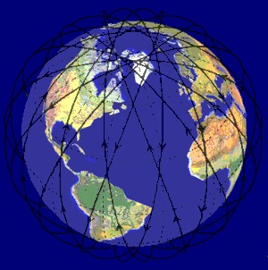
All the orbits are sun synchronous and have an ascending node of between 13:30 and 14:20 local time with the exception of NOAA-17 that has a daytime descending node of approximately 10:00.
 The orientation of the scan lines are perpendicular to the spacecraft orbit track and the speed of rotation of the scan mirror is selected so that adjacent scan lines are contiguous at the subsatellite (nadir) position. A total of 2048 samples will be obtained per channel per Earth scan, which will span an angle of 55.4 degrees from the nadir (subpoint view). All 6 spectral channels of the AVHRR/3 are registered so that they all measure energy from the same spot on the earth at the same time. All 6 channels are also calibrated so that the signal amplitude in each channel is a measure of the scene radiance. The radiometers are designed to operate for a period of 3 years.